Credit: Bahls et al. 2009.
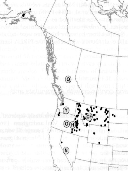
Distribution of Aulacoseira canadensis in western North America. "Q" marks the type locality at Quesnel, British Columbia. Other letters represent known fossil deposits.
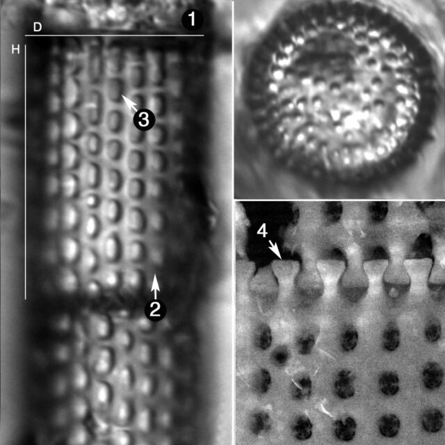
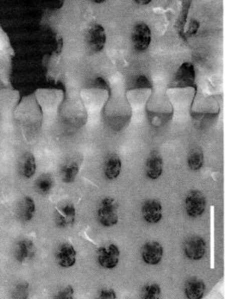
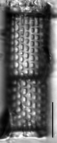
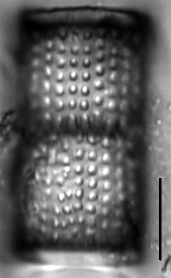
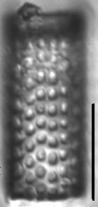
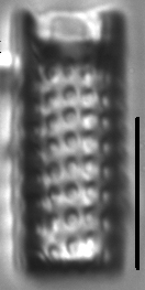
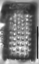
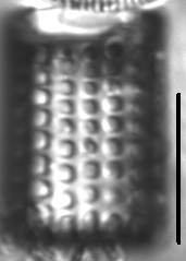
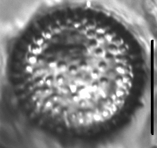
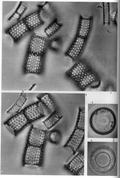
Frustules are cylindrical and form colonies. Valves are 5-16 µm in diameter, with a mantle height of 13-22 µm. The ratio of mantle height to valve diameter is >1. The mantle has straight sides, but sides may be curved in smaller diameter cells. Rows of mantle areolae are straight, 6-11 in 10 µm, with 5-10 very large blocky or oblong areolae in 10 µm. In smaller diameter cells areolae may be disorganized and more widely spaced. The height of the collum varies between 1/3 and 1/10 of the mantle height. The valve face is usually covered by areolae, but in some specimens there are areolae only at the periphery of the valve face. Linking spines are present. The ringleiste is solid and located on the border between the collum and the part of the mantle containing areolae.
When found in abundance, Aulacoseira canadensis is associated with freshwater lacustrine deposits of Miocene age, and none of the preserved material that we have examined contains protoplasm or plastids (Bahls et al. 2009). We therefore conclude that this taxon is probably extinct. Geological processes have redistributed fossil material throughout much of the interior Northwest (map), where occasional cells may appear in a wide variety of habitats.
Bahls, L. (2012). Aulacoseira canadensis. In Diatoms of North America. Retrieved April 19, 2024, from https://diatoms.org/species/aulacoseira_canadensis
The 15 response plots show an environmental variable (x axis) against the relative abundance (y axis) of Aulacoseira canadensis from all the stream reaches where it was present. Note that the relative abundance scale is the same on each plot. Explanation of each environmental variable and units are as follows:
ELEVATION = stream reach elevation (meters)
STRAHLER = distribution plot of the Strahler Stream Order
SLOPE = stream reach gradient (degrees)
W1_HALL = an index that is a measure of streamside (riparian) human activity that ranges from 0 - 10, with a value of 0 indicating of minimal disturbance to a value of 10 indicating severe disturbance.
PHSTVL = pH measured in a sealed syringe sample (pH units)
log_COND = log concentration of specific conductivity (µS/cm)
log_PTL = log concentration of total phosphorus (µg/L)
log_NO3 = log concentration of nitrate (µeq/L)
log_DOC = log concentration of dissolved organic carbon (mg/L)
log_SIO2 = log concentration of silicon (mg/L)
log_NA = log concentration of sodium (µeq/L)
log_HCO3 = log concentration of the bicarbonate ion (µeq/L)
EMBED = percent of the stream substrate that is embedded by sand and fine sediment
log_TURBIDITY = log of turbidity, a measure of cloudiness of water, in nephelometric turbidity units (NTU).
DISTOT = an index of total human disturbance in the watershed that ranges from 1 - 100, with a value of 0 indicating of minimal disturbance to a value of 100 indicating severe disturbance.