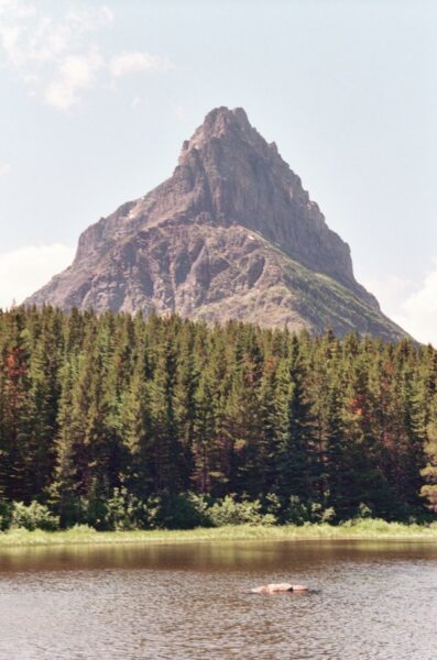
Credit: Loren Bahls
Governor Pond, Glacier National Park, Montana: home of Aneumastus tusculus.
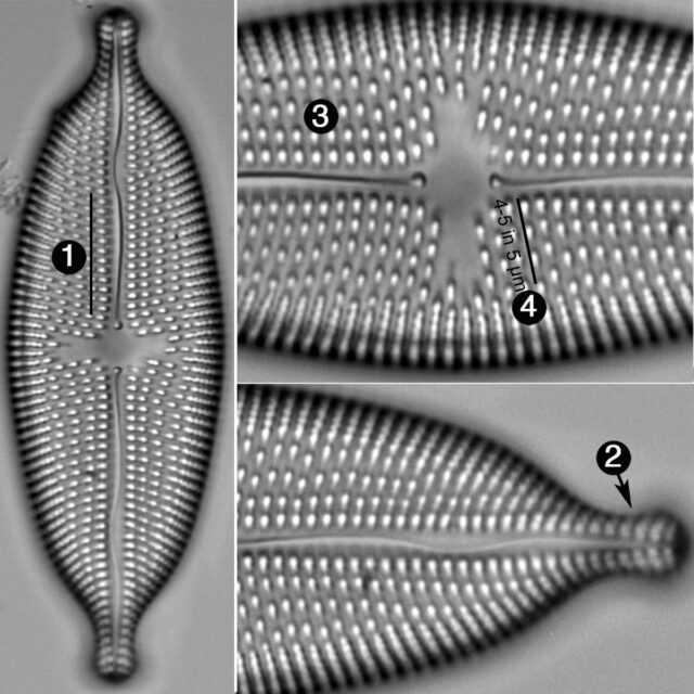
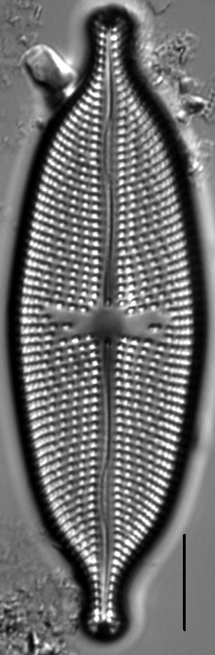
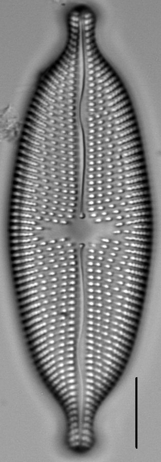
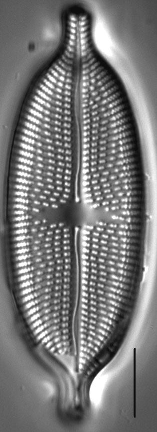
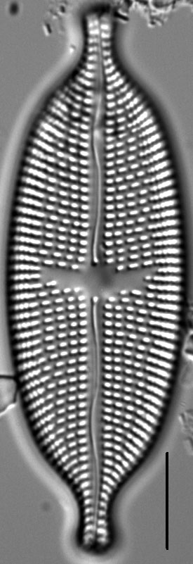
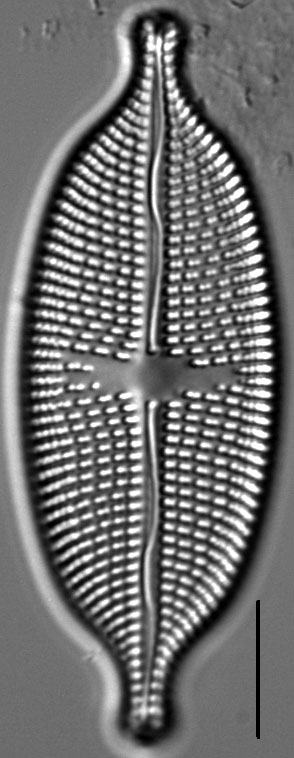
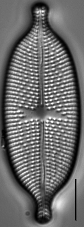
Valves are broadly linear-elliptic with abruptly protracted, long subcapitate apices. The axial area is relatively narrow. The central area is stauroid, delimited by 4-5 irregularly shortened striae on each side. The raphe is lateral and sinuous, distinguished by a pronounced wave in the area of the Voigt faults. Proximal raphe ends are dilated. Striae are weakly radiate near the central area, becoming strongly radiate near the poles. Striae composed of complex transapically elongated areolae near the valve center. Areolae are secondarily aligned in wavy longitudinal rows. Striae near the mantles are biseriate and composed of very small areolae arranged alternately. Areolae in the central part of the valve number 8-10 in 10 µm.
Aneumastus tusculus is common in lakes in the Northern Rocky Mountains. Specimens pictured here are from three small lakes in Glacier National Park, Montana. In these lakes the pH ranges from 6.80 to 8.20 and specific conductance ranges from 168 to 315 µS/cm. In Europe, Lange-Bertalot (2001) reports this species as widespread but becoming less abundant and less frequent due to increasing pollution. It is probably the most sensitive to pollution of all the U. S. species of Aneumastus.
Bahls, L. (2012). Aneumastus tusculus. In Diatoms of North America. Retrieved April 19, 2024, from https://diatoms.org/species/aneumastus_tusculus
The 15 response plots show an environmental variable (x axis) against the relative abundance (y axis) of Aneumastus tusculus from all the stream reaches where it was present. Note that the relative abundance scale is the same on each plot. Explanation of each environmental variable and units are as follows:
ELEVATION = stream reach elevation (meters)
STRAHLER = distribution plot of the Strahler Stream Order
SLOPE = stream reach gradient (degrees)
W1_HALL = an index that is a measure of streamside (riparian) human activity that ranges from 0 - 10, with a value of 0 indicating of minimal disturbance to a value of 10 indicating severe disturbance.
PHSTVL = pH measured in a sealed syringe sample (pH units)
log_COND = log concentration of specific conductivity (µS/cm)
log_PTL = log concentration of total phosphorus (µg/L)
log_NO3 = log concentration of nitrate (µeq/L)
log_DOC = log concentration of dissolved organic carbon (mg/L)
log_SIO2 = log concentration of silicon (mg/L)
log_NA = log concentration of sodium (µeq/L)
log_HCO3 = log concentration of the bicarbonate ion (µeq/L)
EMBED = percent of the stream substrate that is embedded by sand and fine sediment
log_TURBIDITY = log of turbidity, a measure of cloudiness of water, in nephelometric turbidity units (NTU).
DISTOT = an index of total human disturbance in the watershed that ranges from 1 - 100, with a value of 0 indicating of minimal disturbance to a value of 100 indicating severe disturbance.