Credit: USGS Biodata
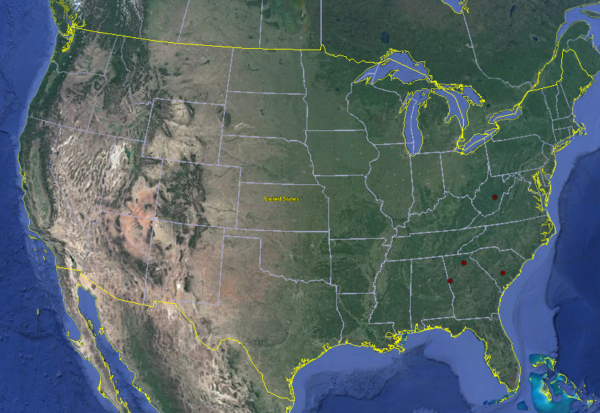
The distribution of Cavinula lacustris in streams of the United States. Accessed on July 5, 2017.
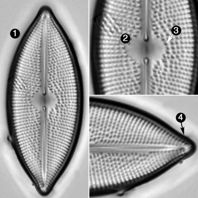
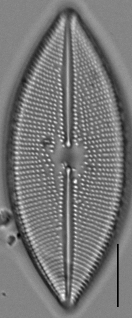
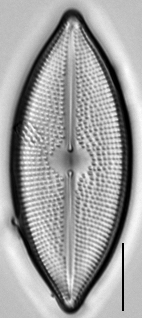
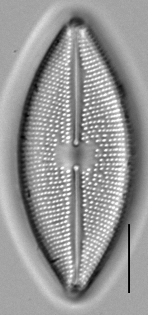
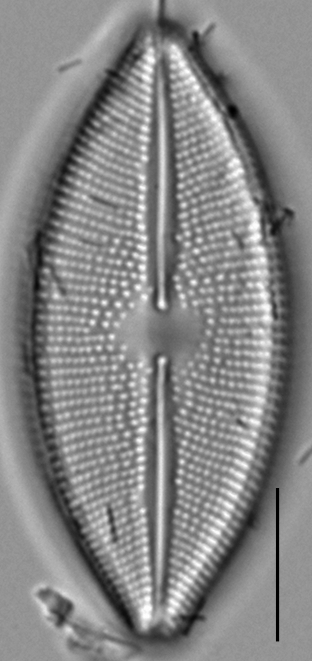
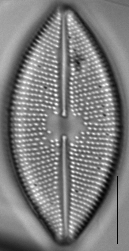
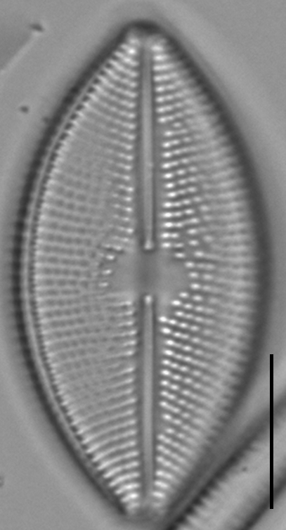
Valves lanceolate to linear-lanceolate. Apices small and protracted, ending bluntly rounded. The axial area is linear-lanceolate. The raphe is lateral with inflated proximal ends and the distal raphe ends deflect opposite each other continue on to the mantle. The central area is circular to elliptic. Striae parallel at the central area becoming curved radiate. Areolae round with highly variable spacing, occurring 13-21 in 10 µm. Areolae sometimes regularly spaced throughout and in other valves areolae are less densely spaced near the axial area becoming more densely spaced at the near the face mantle junction. The terminal areola on each stria is transapically elongated.
While this taxon was named for first being found in a lacustrine environment, it is also found in lotic environments of eastern and north central United States (Patrick and Reimer 1966), growing epilithic and epiphytic in stream habitats (Camburn et al. 1978). This taxon is common and prefers circumneutral water chemistry in Alaska (Foged 1981). Stoermer (1980) reported this taxon rare in shallow habitats of Lake Michigan, Lake Huron, and Lake Superior. Bahls (2017) reports it from a river in Nunavut, Canada.
Cavinula lacustris is distributed globally in lakes from Mongolia (Kulikovskiy et al. 2012) to the United Kingdom (Smith 1856).
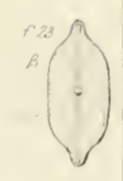
Navicula lacustris, W. G.—This fine species has only as yet occurred in the gathering from Lochleven, in which, though not abundant, it is yet far from scarce. It presents two well-marked varieties, a and ß, which pass into each other by intermediate forms: a, which is rather more abundant than the other, is elliptico-lanceolate, with acute apices. Nodule bright in the centre, but without definite outline. Median line double. Striae fine, but distinct, slightly inclined ; about 28 or 30 in. .001 ; length from .0016 to .0025 inch : ß agrees in every point with a, except in outline. It is broad, has straight sides, sometimes even a little incurvated, and suddenly contracted to narrow produced extremities. These two varieties are seen in fig's. 23 and 23 ß, and there exists an intermediate form. The only species with which this could in any way be confounded is N. firma var. ß. But the latter is longer and larger, always of a brown colour, and in N. firma not only are the striae much finer and less con-spicuous, but they are almost exactly parallel. It is not easy in a drawing to give certain peculiarities of aspect, but anyone who compares the two species, N. firma ß and N. lacustris, will perceive that the latter has an aspect entirely different from the former. Moreover the side lines, always seen in N. firma, never occur in N. lacustris.
Edlund, M., Burge, D. (2017). Lacustriella lacustris. In Diatoms of North America. Retrieved April 25, 2024, from https://diatoms.org/species/cavinula_lacustris
The 15 response plots show an environmental variable (x axis) against the relative abundance (y axis) of Lacustriella lacustris from all the stream reaches where it was present. Note that the relative abundance scale is the same on each plot. Explanation of each environmental variable and units are as follows:
ELEVATION = stream reach elevation (meters)
STRAHLER = distribution plot of the Strahler Stream Order
SLOPE = stream reach gradient (degrees)
W1_HALL = an index that is a measure of streamside (riparian) human activity that ranges from 0 - 10, with a value of 0 indicating of minimal disturbance to a value of 10 indicating severe disturbance.
PHSTVL = pH measured in a sealed syringe sample (pH units)
log_COND = log concentration of specific conductivity (µS/cm)
log_PTL = log concentration of total phosphorus (µg/L)
log_NO3 = log concentration of nitrate (µeq/L)
log_DOC = log concentration of dissolved organic carbon (mg/L)
log_SIO2 = log concentration of silicon (mg/L)
log_NA = log concentration of sodium (µeq/L)
log_HCO3 = log concentration of the bicarbonate ion (µeq/L)
EMBED = percent of the stream substrate that is embedded by sand and fine sediment
log_TURBIDITY = log of turbidity, a measure of cloudiness of water, in nephelometric turbidity units (NTU).
DISTOT = an index of total human disturbance in the watershed that ranges from 1 - 100, with a value of 0 indicating of minimal disturbance to a value of 100 indicating severe disturbance.