Credit: Loren Bahls
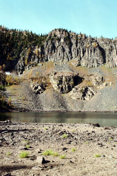
Upper Wolverine Lake, Ten Lakes Scenic Area, Kootenai National Forest, Lincoln County, Montana: home of Cavinula scutiformis.
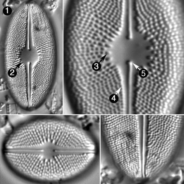
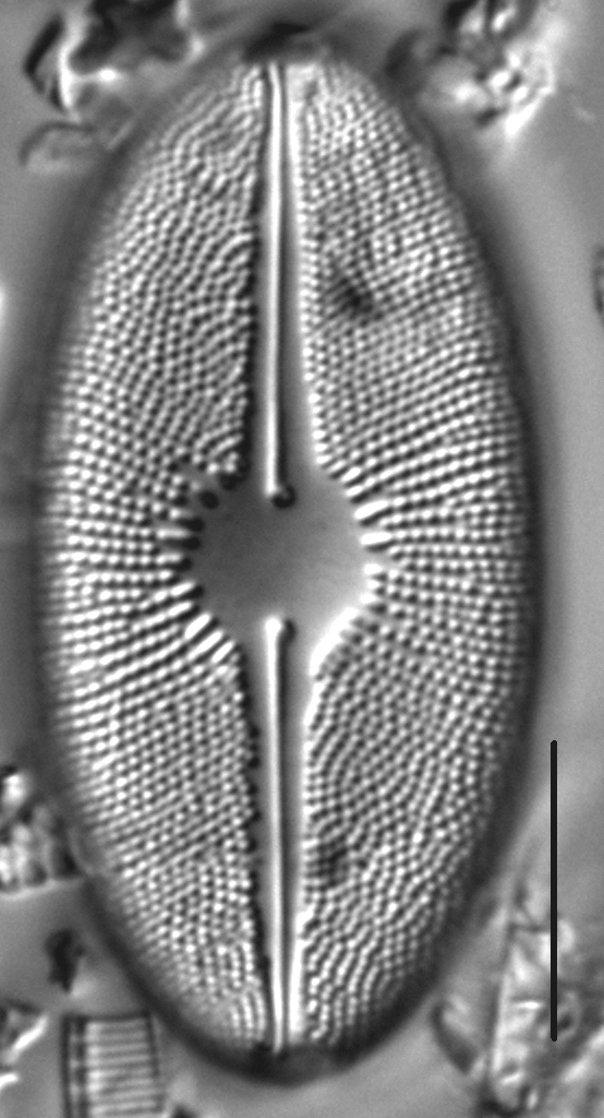
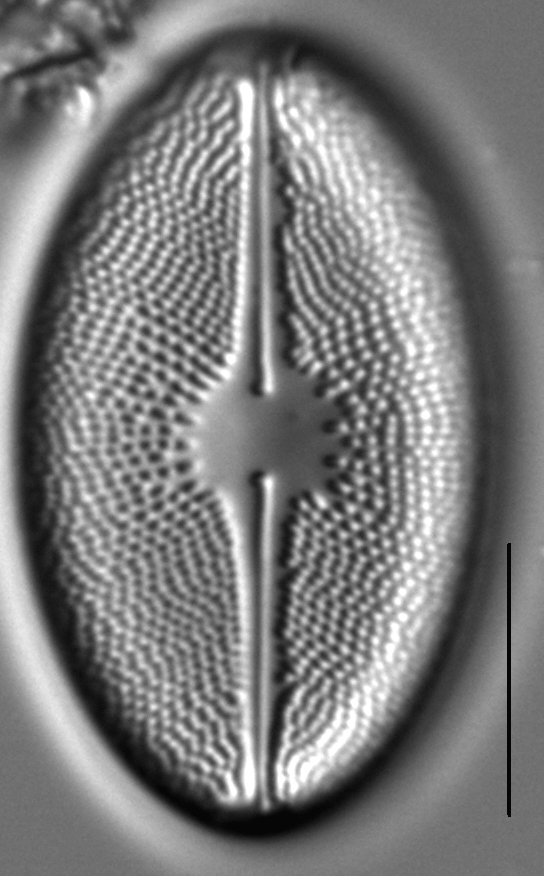
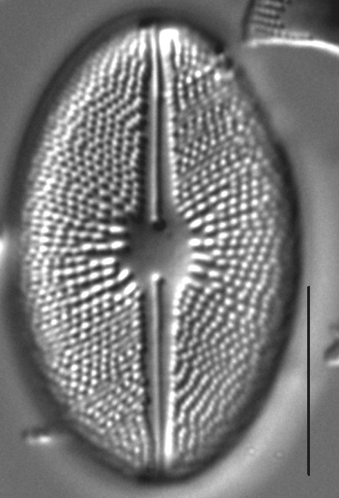
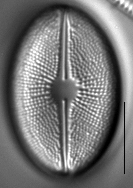
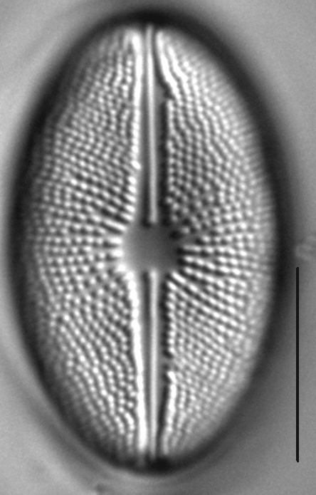
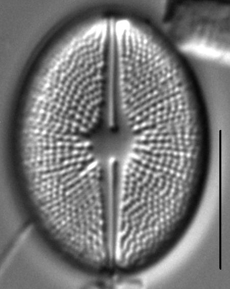
Valves are elliptic with broadly rounded apices. The axial area widens gradually toward the valve center to a large, orbicular central area. The raphe is filiform with distinctly expanded proximal ends. Distal raphe fissures are small. Striae are radiate throughout and more broadly spaced near the valve center. Areolae nearest the central area are larger and transapically elongate. Areolae number 16-20 in 10 µm near the valve center, 20-24 in 10 µm near the apices.
Cavinula scutiformis has been recorded from two lakes in northwestern Montana near the border with British Columbia. In one of these lakes (Upper Wolverine Lake, below), pH measured 8.83, specific conductance was 107 µS/cm, and temperature was 12.5 degrees C. Krammer and Lange-Bertalot (1986) report this species from electrolyte-poor waters in northern regions of Europe, Asia, and the Americas. Patrick and Reimer (1966) report C. scutiformis from the Middle Atlantic states and South Carolina. The type locality is Stavanger, Norway.
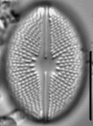
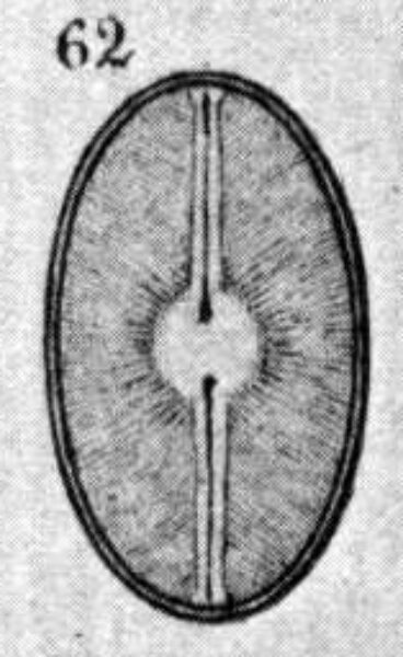
Image provided by Schmidt (1881) without description.
Bahls, L. (2012). Cavinula scutiformis. In Diatoms of North America. Retrieved April 25, 2024, from https://diatoms.org/species/cavinula_scutiformis
The 15 response plots show an environmental variable (x axis) against the relative abundance (y axis) of Cavinula scutiformis from all the stream reaches where it was present. Note that the relative abundance scale is the same on each plot. Explanation of each environmental variable and units are as follows:
ELEVATION = stream reach elevation (meters)
STRAHLER = distribution plot of the Strahler Stream Order
SLOPE = stream reach gradient (degrees)
W1_HALL = an index that is a measure of streamside (riparian) human activity that ranges from 0 - 10, with a value of 0 indicating of minimal disturbance to a value of 10 indicating severe disturbance.
PHSTVL = pH measured in a sealed syringe sample (pH units)
log_COND = log concentration of specific conductivity (µS/cm)
log_PTL = log concentration of total phosphorus (µg/L)
log_NO3 = log concentration of nitrate (µeq/L)
log_DOC = log concentration of dissolved organic carbon (mg/L)
log_SIO2 = log concentration of silicon (mg/L)
log_NA = log concentration of sodium (µeq/L)
log_HCO3 = log concentration of the bicarbonate ion (µeq/L)
EMBED = percent of the stream substrate that is embedded by sand and fine sediment
log_TURBIDITY = log of turbidity, a measure of cloudiness of water, in nephelometric turbidity units (NTU).
DISTOT = an index of total human disturbance in the watershed that ranges from 1 - 100, with a value of 0 indicating of minimal disturbance to a value of 100 indicating severe disturbance.