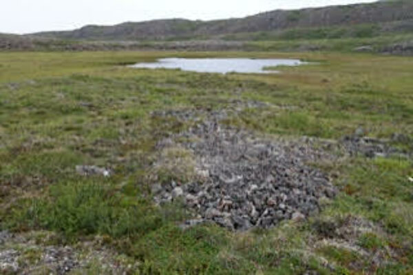
Credit: Beverly Boynton, Adventurers and Scientists for Conservation
Small Lake, Coppermine Mountains, Nunavut, Canada: home of Cymbopleura tynnii.
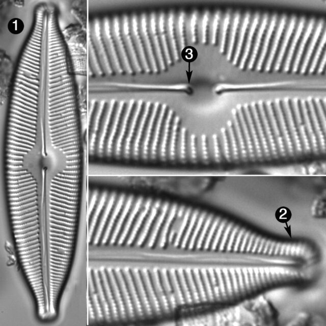
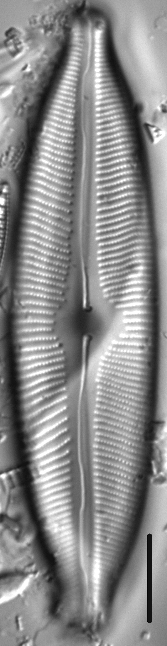
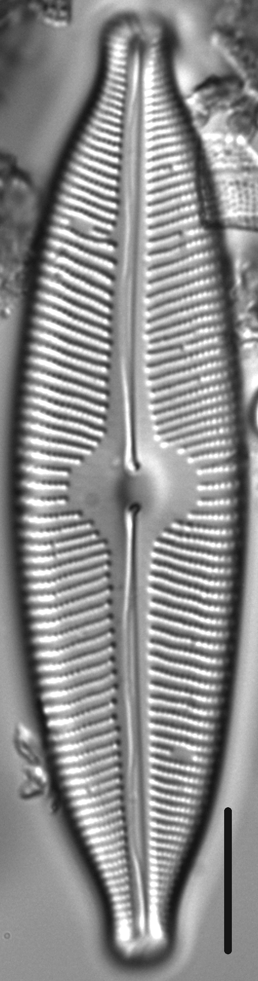
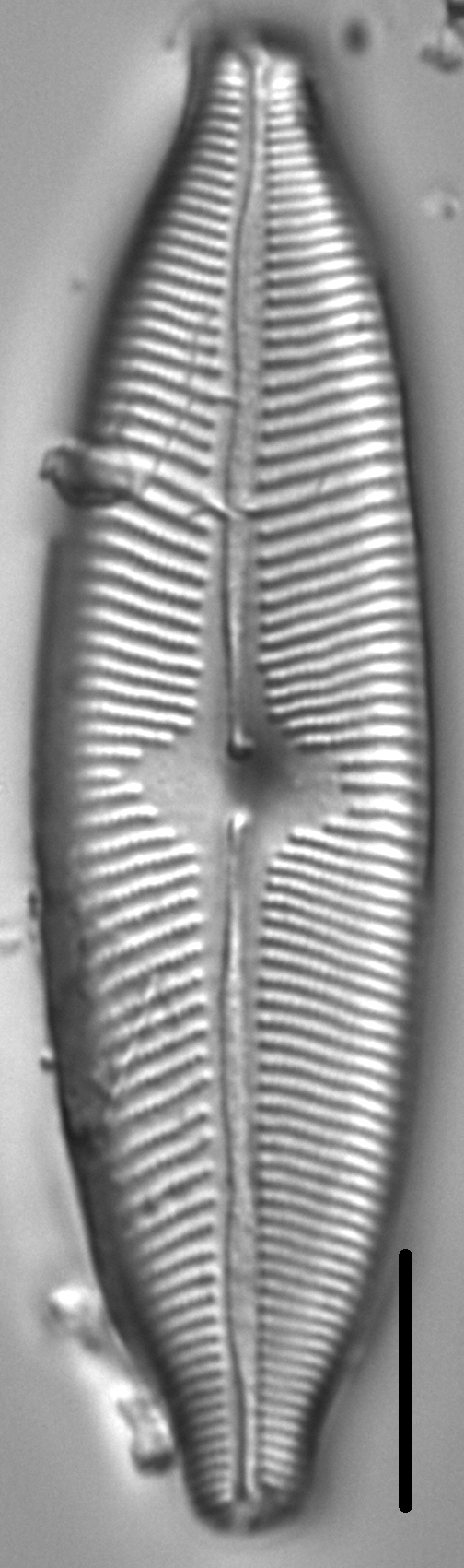
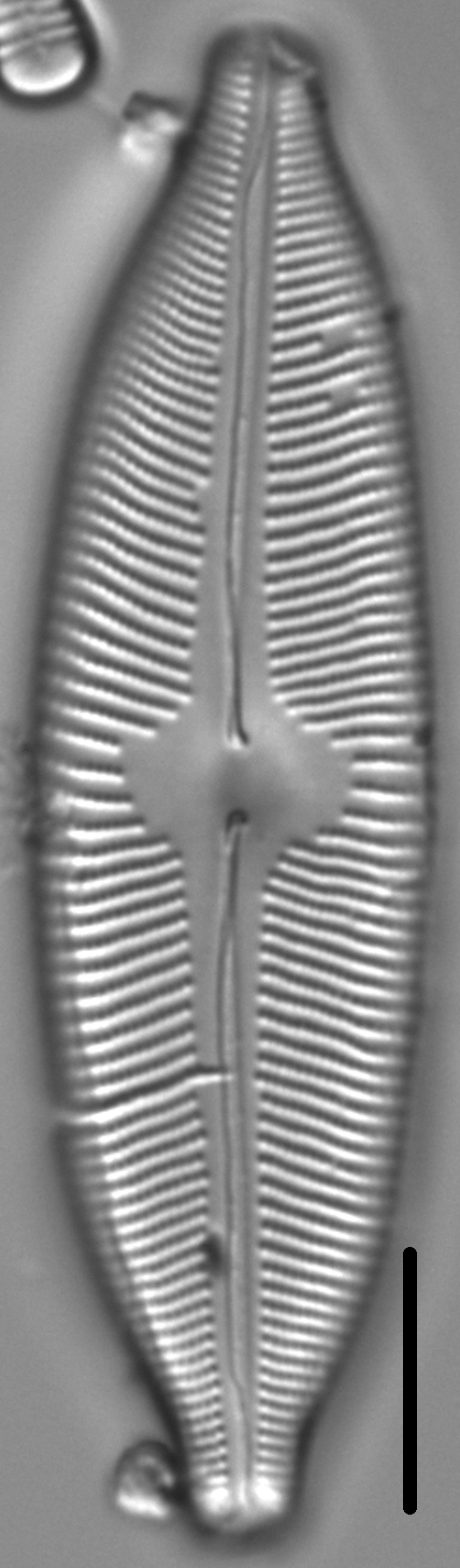
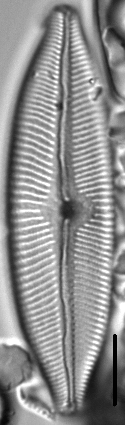
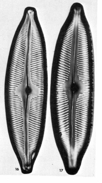
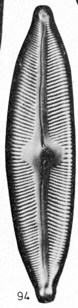
Valves are broadly elliptic-lanceolate, with wide subrostrate apices. The axial area is narrow and close to the valve midline. The central area is a transverse rhomboid, sometimes asymmetric, and about 1/2 the valve width. The raphe is lateral, becoming filiform near the proximal and distal ends. Proximal raphe ends are somewhat inflated and bent towards the ventral side. Distal raphe ends are comma-shaped and deflected dorsally. Striae are radiate throughout and indistinctly punctate. Areolae number 28-30 in 10 µm.
Krammer (2003) reports that this taxon prefers oligotrophic waters with low electrolyte content and lives as epiphytes on mosses. Its distribution is reported as from Alaska, Canada, Lapland, Spitsbergen and Siberia.
Bahls, L. (2015). Cymbopleura tynnii. In Diatoms of North America. Retrieved April 20, 2024, from https://diatoms.org/species/cymbopleura_tynnii
The 15 response plots show an environmental variable (x axis) against the relative abundance (y axis) of Cymbopleura tynnii from all the stream reaches where it was present. Note that the relative abundance scale is the same on each plot. Explanation of each environmental variable and units are as follows:
ELEVATION = stream reach elevation (meters)
STRAHLER = distribution plot of the Strahler Stream Order
SLOPE = stream reach gradient (degrees)
W1_HALL = an index that is a measure of streamside (riparian) human activity that ranges from 0 - 10, with a value of 0 indicating of minimal disturbance to a value of 10 indicating severe disturbance.
PHSTVL = pH measured in a sealed syringe sample (pH units)
log_COND = log concentration of specific conductivity (µS/cm)
log_PTL = log concentration of total phosphorus (µg/L)
log_NO3 = log concentration of nitrate (µeq/L)
log_DOC = log concentration of dissolved organic carbon (mg/L)
log_SIO2 = log concentration of silicon (mg/L)
log_NA = log concentration of sodium (µeq/L)
log_HCO3 = log concentration of the bicarbonate ion (µeq/L)
EMBED = percent of the stream substrate that is embedded by sand and fine sediment
log_TURBIDITY = log of turbidity, a measure of cloudiness of water, in nephelometric turbidity units (NTU).
DISTOT = an index of total human disturbance in the watershed that ranges from 1 - 100, with a value of 0 indicating of minimal disturbance to a value of 100 indicating severe disturbance.