Credit: Montana Diatom Database
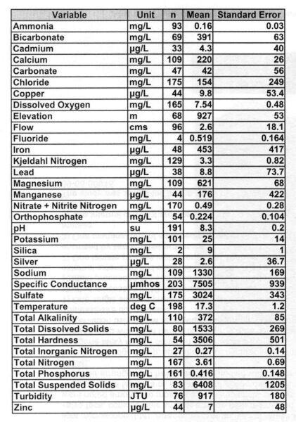
Abundance-weighted means for selected water quality variables measured concurrently with the collection of samples containing Navicula cincta.
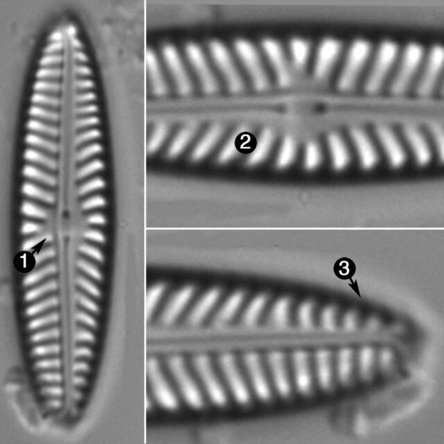
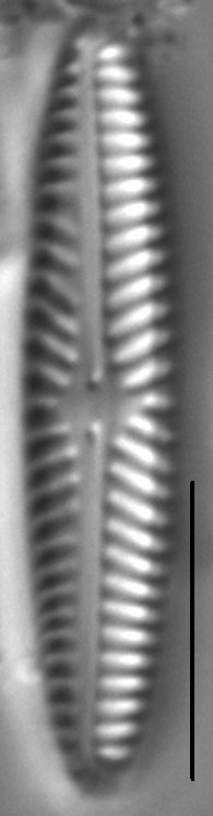
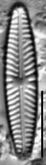
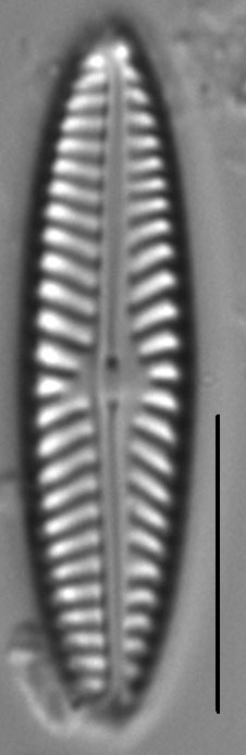
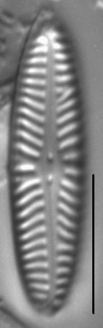
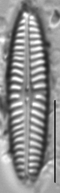
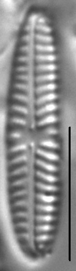
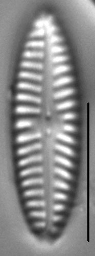
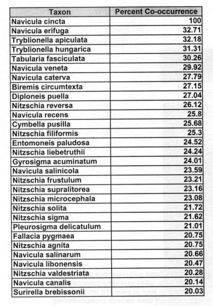
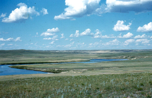
Valves are linear-lanceolate to elliptic-lanceolate with obtusely rounded, never protracted apices. The axial area is narrow and widens gradually into the central area, which is small and irregular in shape due to the variable length of the central striae. The raphe is filiform and straight with proximal ends that are slightly inflated and relatively close together. Striae are radiate and more widely spaced at valve center, abruptly becoming parallel and then convergent near the apices. Areolae in the striae are very fine and difficult to resolve in LM.
Navicula cincta is widespread and locally abundant in streams with moderate to high levels of conductivity. These waters tend to have elevated concentrations of chloride, sodium, and sulfate (see table below). Common diatom associates of N. cincta (see table below) share an affinity for brackish and nutrient-rich inland waters.
Bahls, L. (2012). Navicula cincta. In Diatoms of North America. Retrieved April 24, 2024, from https://diatoms.org/species/navicula_cincta
The 15 response plots show an environmental variable (x axis) against the relative abundance (y axis) of Navicula cincta from all the stream reaches where it was present. Note that the relative abundance scale is the same on each plot. Explanation of each environmental variable and units are as follows:
ELEVATION = stream reach elevation (meters)
STRAHLER = distribution plot of the Strahler Stream Order
SLOPE = stream reach gradient (degrees)
W1_HALL = an index that is a measure of streamside (riparian) human activity that ranges from 0 - 10, with a value of 0 indicating of minimal disturbance to a value of 10 indicating severe disturbance.
PHSTVL = pH measured in a sealed syringe sample (pH units)
log_COND = log concentration of specific conductivity (µS/cm)
log_PTL = log concentration of total phosphorus (µg/L)
log_NO3 = log concentration of nitrate (µeq/L)
log_DOC = log concentration of dissolved organic carbon (mg/L)
log_SIO2 = log concentration of silicon (mg/L)
log_NA = log concentration of sodium (µeq/L)
log_HCO3 = log concentration of the bicarbonate ion (µeq/L)
EMBED = percent of the stream substrate that is embedded by sand and fine sediment
log_TURBIDITY = log of turbidity, a measure of cloudiness of water, in nephelometric turbidity units (NTU).
DISTOT = an index of total human disturbance in the watershed that ranges from 1 - 100, with a value of 0 indicating of minimal disturbance to a value of 100 indicating severe disturbance.