Simonsenia delognei
-
Category
-
Length Range9.5-14.5 µm
-
Width Range2.5 µm
-
ContributorCarrie Graeff - Oct 2012
-
ReviewerSarah Spaulding - Oct 2012
Identification
Description
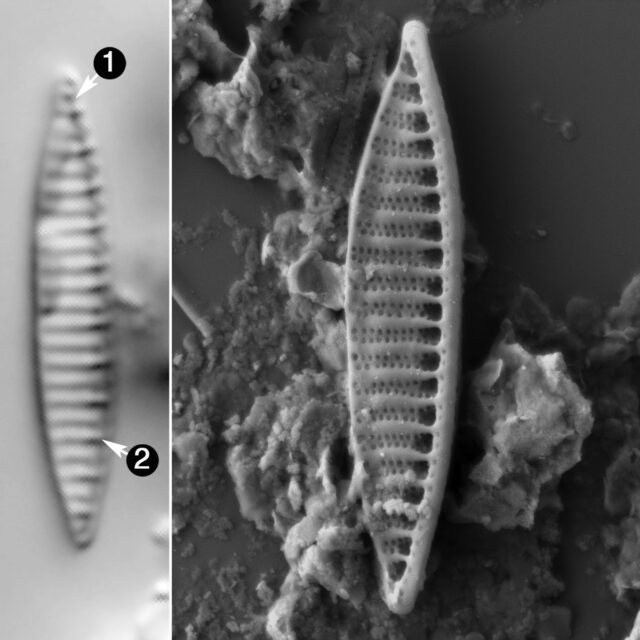
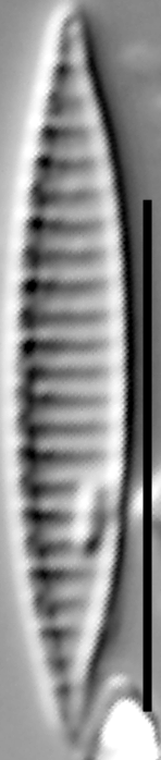
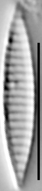
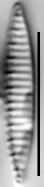
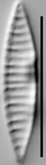
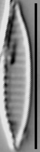
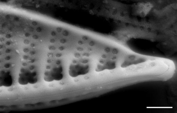
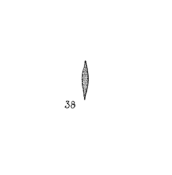
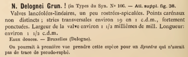
The valves are small and lanceolate or linear-lanceolate with apices that are extremely narrowly rounded and often protracted. The striae are generally biseriate but become multiseriate and disorganized near the raphe canal. The striae are not resolvable in the LM, but the presence of transapical costae gives the valves the appearance of having resolved striae. The costa density is 18 in 10 microns.
Original Description
-
BasionymNitzschia delognei
-
AuthorGrunow in Van Heurck 1885
Original Images
Citations & Links
Citations
-
Publication Link: 10.1038/srep17115
Links
-
Index Nominum Algarum
-
North American Diatom Ecological DatabaseNADED ID: 59001
Cite This Page
Graeff, C. (2012). Simonsenia delognei. In Diatoms of North America. Retrieved April 24, 2024, from https://diatoms.org/species/simonsenia_delognei
Responses
The 15 response plots show an environmental variable (x axis) against the relative abundance (y axis) of Simonsenia delognei from all the stream reaches where it was present. Note that the relative abundance scale is the same on each plot. Explanation of each environmental variable and units are as follows:
ELEVATION = stream reach elevation (meters)
STRAHLER = distribution plot of the Strahler Stream Order
SLOPE = stream reach gradient (degrees)
W1_HALL = an index that is a measure of streamside (riparian) human activity that ranges from 0 - 10, with a value of 0 indicating of minimal disturbance to a value of 10 indicating severe disturbance.
PHSTVL = pH measured in a sealed syringe sample (pH units)
log_COND = log concentration of specific conductivity (µS/cm)
log_PTL = log concentration of total phosphorus (µg/L)
log_NO3 = log concentration of nitrate (µeq/L)
log_DOC = log concentration of dissolved organic carbon (mg/L)
log_SIO2 = log concentration of silicon (mg/L)
log_NA = log concentration of sodium (µeq/L)
log_HCO3 = log concentration of the bicarbonate ion (µeq/L)
EMBED = percent of the stream substrate that is embedded by sand and fine sediment
log_TURBIDITY = log of turbidity, a measure of cloudiness of water, in nephelometric turbidity units (NTU).
DISTOT = an index of total human disturbance in the watershed that ranges from 1 - 100, with a value of 0 indicating of minimal disturbance to a value of 100 indicating severe disturbance.
Simonsenia delognei
- Valve apices extremely narrow, often protracted
- Costae 18 in 10 µm
The valves of S. delognei have extremely narrow apices that are often protracted. The costa density is 18 in 10 µm.