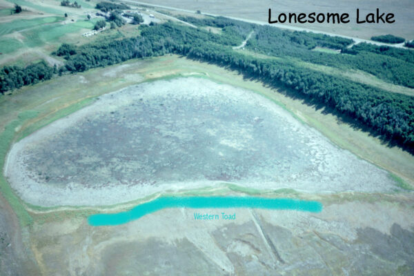
Credit: Barb Johnston, Parks Canada
Lonesome Lake, Waterton Lakes National Park, Alberta, Canada: home of Stauroneis acuta.
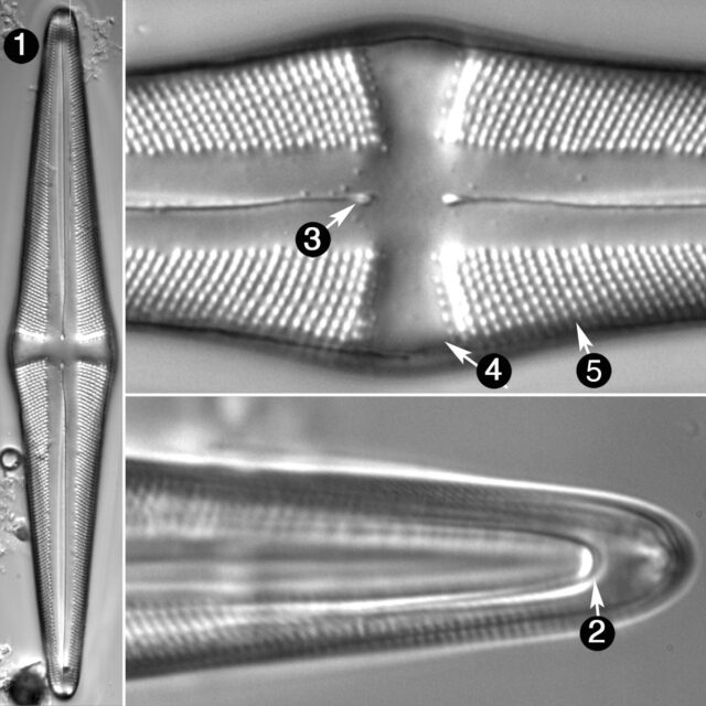
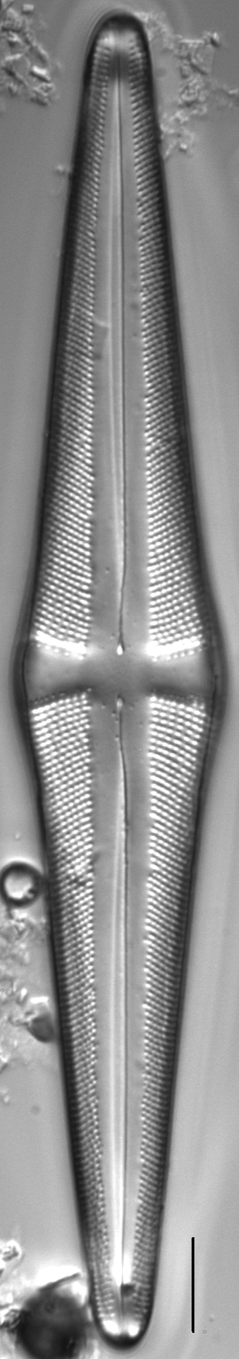
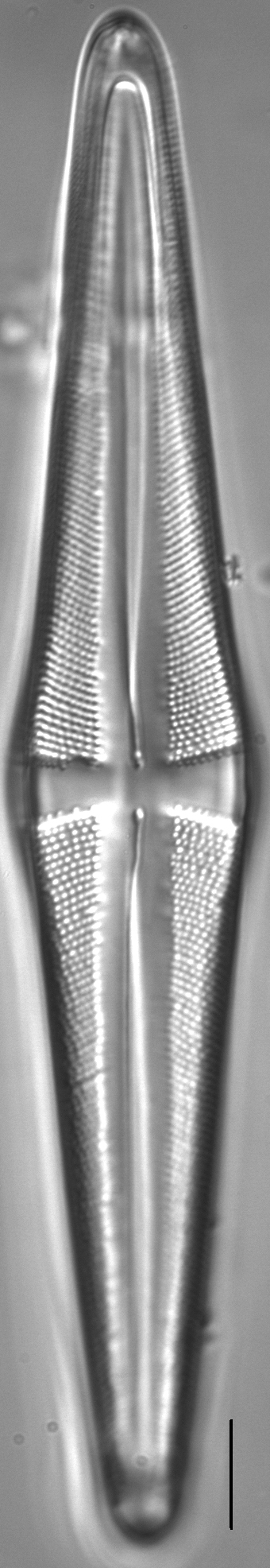
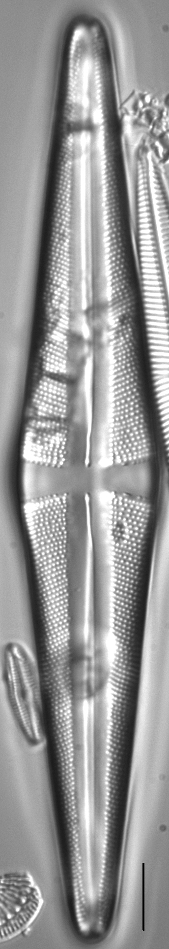
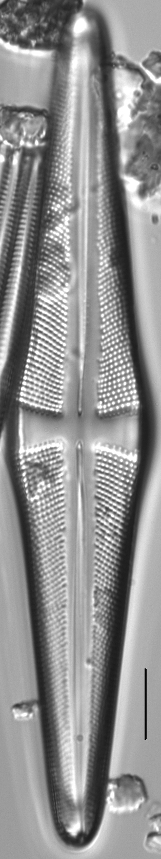
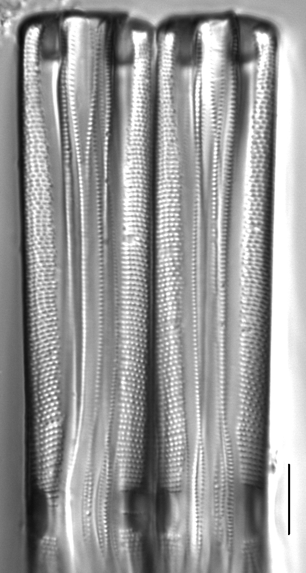
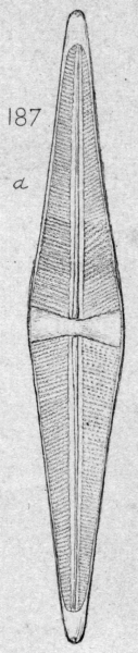
Valves are rhombic-lanceolate and somewhat gibbous at the center, with acutely rounded apices. Pseudosepta are very prominent at the apices. The axial area is narrow near the valve apices, becoming much wider toward the central area. The central area is a wide stauros, expanding in deltoid fashion toward the valve margins. External raphe fissures are lateral, becoming filiform at the distal and proximal ends. Proximal raphe ends are weakly expanded and nearly straight. Striae are strongly radiate throughout and continue onto the valve mantle. Areolae are coarse, 12-15 in 10 µm. Cells are commonly found adherent face-to-face in short colonies. Elements of the cingulum and pseudosepta are evident in girdle view.
Stauroneis acuta is one of two Stauroneis species in the Northern Rockies with frustules commonly found adherent face-to-face in coloneis. The other colony-forming species is Stauroneis kishinena. Stauroneis acuta is widely distributed in small lakes in both the northern and southern hemispheres (Patrick & Reimer 1966, Van de Vijver et al. 2004) and appears to prefer slightly alkaline waters with low to moderate levels of dissolved solids. It is rarely found in large numbers.
Bahls, L. (2011). Stauroneis acuta. In Diatoms of North America. Retrieved April 19, 2024, from https://diatoms.org/species/stauroneis_acuta
The 15 response plots show an environmental variable (x axis) against the relative abundance (y axis) of Stauroneis acuta from all the stream reaches where it was present. Note that the relative abundance scale is the same on each plot. Explanation of each environmental variable and units are as follows:
ELEVATION = stream reach elevation (meters)
STRAHLER = distribution plot of the Strahler Stream Order
SLOPE = stream reach gradient (degrees)
W1_HALL = an index that is a measure of streamside (riparian) human activity that ranges from 0 - 10, with a value of 0 indicating of minimal disturbance to a value of 10 indicating severe disturbance.
PHSTVL = pH measured in a sealed syringe sample (pH units)
log_COND = log concentration of specific conductivity (µS/cm)
log_PTL = log concentration of total phosphorus (µg/L)
log_NO3 = log concentration of nitrate (µeq/L)
log_DOC = log concentration of dissolved organic carbon (mg/L)
log_SIO2 = log concentration of silicon (mg/L)
log_NA = log concentration of sodium (µeq/L)
log_HCO3 = log concentration of the bicarbonate ion (µeq/L)
EMBED = percent of the stream substrate that is embedded by sand and fine sediment
log_TURBIDITY = log of turbidity, a measure of cloudiness of water, in nephelometric turbidity units (NTU).
DISTOT = an index of total human disturbance in the watershed that ranges from 1 - 100, with a value of 0 indicating of minimal disturbance to a value of 100 indicating severe disturbance.