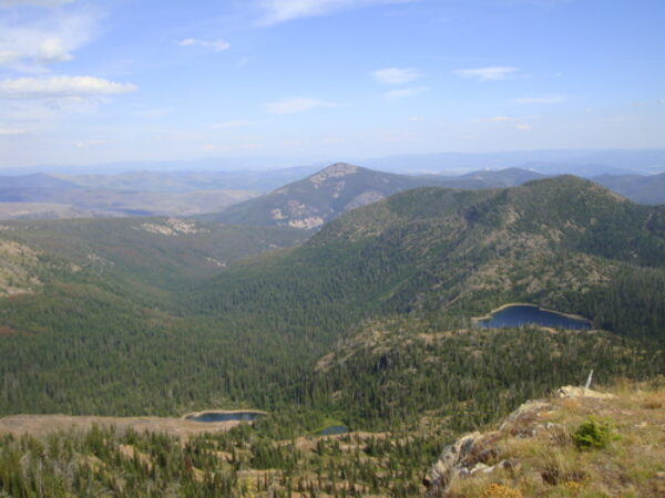
Credit: Google Earth
Beeskove Lake (right), Missoula County, Montana: home of Stauroneis neohyalina.
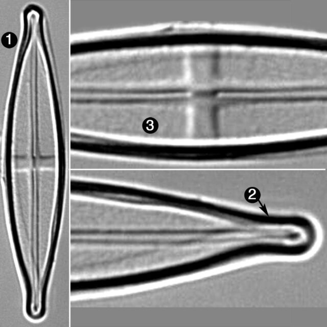
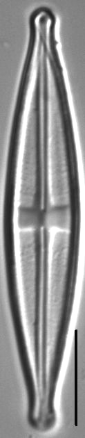
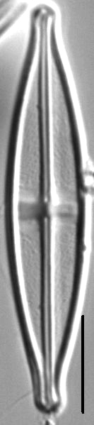
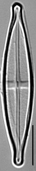
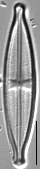
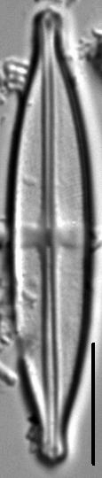
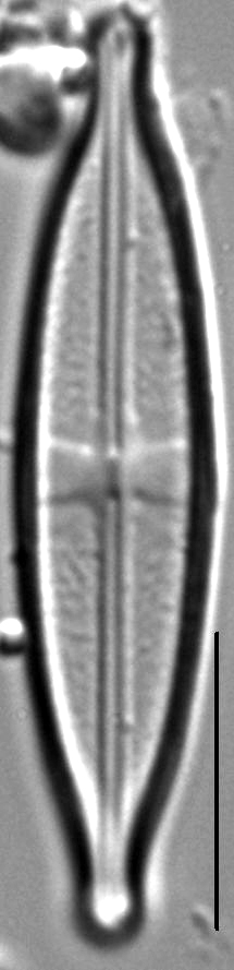
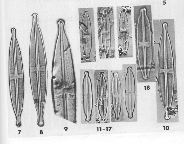
Valves are linear-lanceolate with protracted and narrowly rostrate to subcapitate apices. Raphe is weakly lateral, becoming filiform at the distal and proximal ends. Proximal raphe ends are small and straight, and not inflated. The axial area is narrow, barely wider than the raphe, flaring slightly at the stauros. The central area is a rectangular stauros, often asymmetric and slightly wider at the valve margins. Short striae are sometimes present at the margins of the stauros. Striae are radiate throughout. Areolae are irregularly spaced and difficult to resolve in LM.
Stauroneis neohyalina is widely distributed in small lakes and wetlands throughout the Northern Rockies. The pH of these waters ranges from 6.2 to 7.6 and specific conductance ranges from 8 to 109 µS/cm. Lange-Bertalot & Metzeltin (1996) reported this species from an electrolyte-poor, humic-rich lake in Finland. Siver et al. (2005) reported this species (as Stauroneis gracilior) from somewhat acidic ponds on Cape Cod, Massachusetts.
Bahls, L. (2011). Stauroneis neohyalina. In Diatoms of North America. Retrieved April 18, 2024, from https://diatoms.org/species/stauroneis_neohyalina
The 15 response plots show an environmental variable (x axis) against the relative abundance (y axis) of Stauroneis neohyalina from all the stream reaches where it was present. Note that the relative abundance scale is the same on each plot. Explanation of each environmental variable and units are as follows:
ELEVATION = stream reach elevation (meters)
STRAHLER = distribution plot of the Strahler Stream Order
SLOPE = stream reach gradient (degrees)
W1_HALL = an index that is a measure of streamside (riparian) human activity that ranges from 0 - 10, with a value of 0 indicating of minimal disturbance to a value of 10 indicating severe disturbance.
PHSTVL = pH measured in a sealed syringe sample (pH units)
log_COND = log concentration of specific conductivity (µS/cm)
log_PTL = log concentration of total phosphorus (µg/L)
log_NO3 = log concentration of nitrate (µeq/L)
log_DOC = log concentration of dissolved organic carbon (mg/L)
log_SIO2 = log concentration of silicon (mg/L)
log_NA = log concentration of sodium (µeq/L)
log_HCO3 = log concentration of the bicarbonate ion (µeq/L)
EMBED = percent of the stream substrate that is embedded by sand and fine sediment
log_TURBIDITY = log of turbidity, a measure of cloudiness of water, in nephelometric turbidity units (NTU).
DISTOT = an index of total human disturbance in the watershed that ranges from 1 - 100, with a value of 0 indicating of minimal disturbance to a value of 100 indicating severe disturbance.