Credit: Loren Bahls
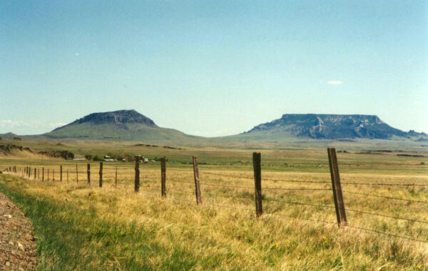
Round Butte (left) and Square Butte (right) near Geraldine in Chouteau County, Montana. A spring seep at the base of Square Butte is the type locality for Stauroneis sacajaweae.
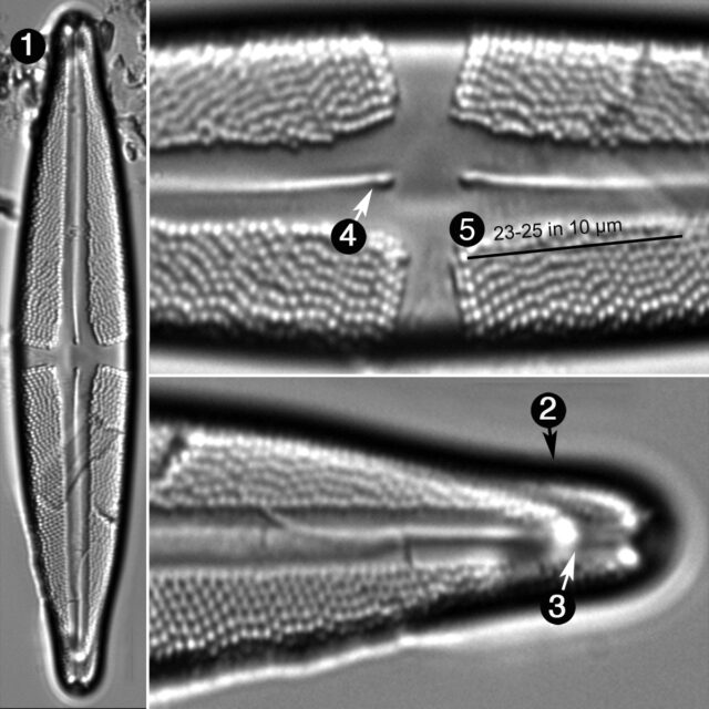
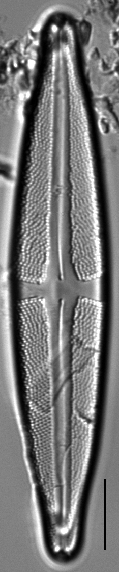
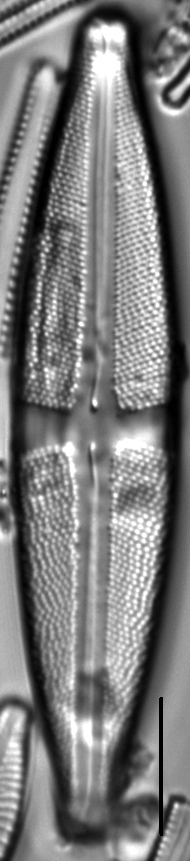
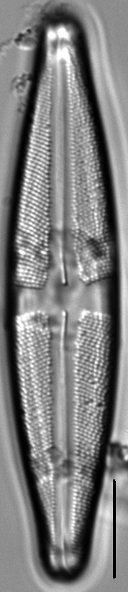
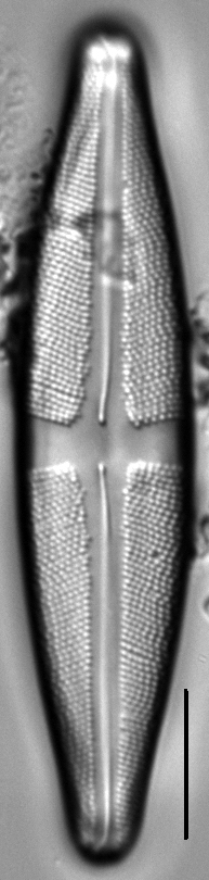
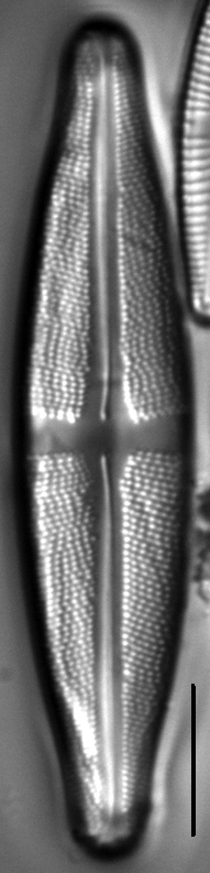
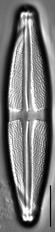
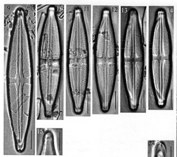
Valves are lanceolate with gradually attenuated subrostrate apices. A deep pseudoseptum occupies each apex. The raphe is lateral, becoming filiform towards proximal ends, which are bent to one side and tipped with weakly inflated pores. Distal raphe ends are hooked in a direction opposite that of proximal ends. The axial area is about 3 times wider than the raphe and widens gradually towards central area. The central stauros is broad and shaped like a bow tie. Striae are strongly radiate throughout. Areolae number 18–22 in 10 μm.
Stauroneis sacajaweae has been confirmed from only two localities, both headwater spring seeps at moderate elevations in the northern Rocky Mountains of Montana.
Valves lanceolate with gradually attenuated subrostrate apices. A deep pseudoseptum occupies each apex (Fig. 15). Valve length 54–80 μm; valve width 10.8–14.7 μm. Raphe lateral, becoming filiform towards proximal ends, which are bent to one side and tipped with weakly inflated pores. Distal raphe ends hooked in a direction opposite that of proximal ends. Axial area c 3 x wider than raphe and widens gradually towards central area. Central stauros broad, shaped like a bow tie. Striae strongly radiate throughout, 23–25 in 10 μm. Areolae in striae 18–22 in 10 μm.
Bahls, L. (2012). Stauroneis sacajaweae. In Diatoms of North America. Retrieved April 25, 2024, from https://diatoms.org/species/stauroneis_sacajaweae
The 15 response plots show an environmental variable (x axis) against the relative abundance (y axis) of Stauroneis sacajaweae from all the stream reaches where it was present. Note that the relative abundance scale is the same on each plot. Explanation of each environmental variable and units are as follows:
ELEVATION = stream reach elevation (meters)
STRAHLER = distribution plot of the Strahler Stream Order
SLOPE = stream reach gradient (degrees)
W1_HALL = an index that is a measure of streamside (riparian) human activity that ranges from 0 - 10, with a value of 0 indicating of minimal disturbance to a value of 10 indicating severe disturbance.
PHSTVL = pH measured in a sealed syringe sample (pH units)
log_COND = log concentration of specific conductivity (µS/cm)
log_PTL = log concentration of total phosphorus (µg/L)
log_NO3 = log concentration of nitrate (µeq/L)
log_DOC = log concentration of dissolved organic carbon (mg/L)
log_SIO2 = log concentration of silicon (mg/L)
log_NA = log concentration of sodium (µeq/L)
log_HCO3 = log concentration of the bicarbonate ion (µeq/L)
EMBED = percent of the stream substrate that is embedded by sand and fine sediment
log_TURBIDITY = log of turbidity, a measure of cloudiness of water, in nephelometric turbidity units (NTU).
DISTOT = an index of total human disturbance in the watershed that ranges from 1 - 100, with a value of 0 indicating of minimal disturbance to a value of 100 indicating severe disturbance.