
Credit: John Pierce
Loren Bahls at Drosera Pond, Indian Meadows Research Natural Area, Helena National Forest, Montana: type locality of Stauroneis submarginalis.
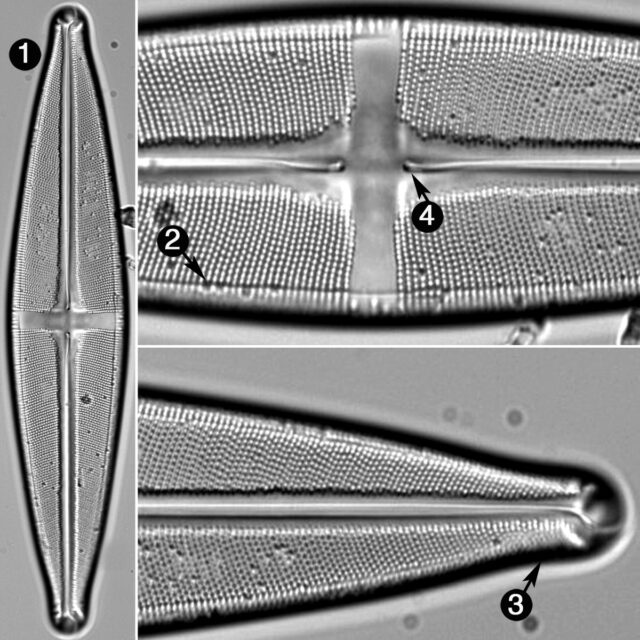
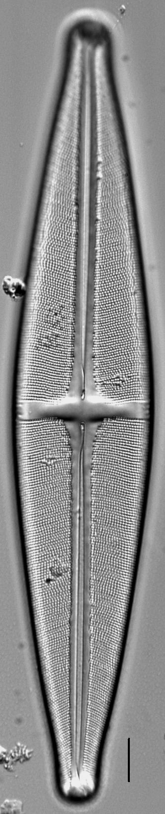
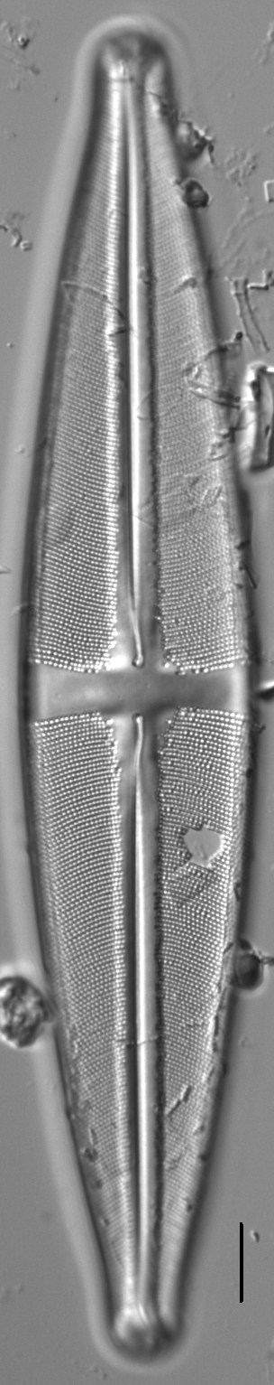
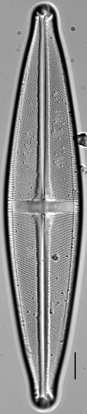
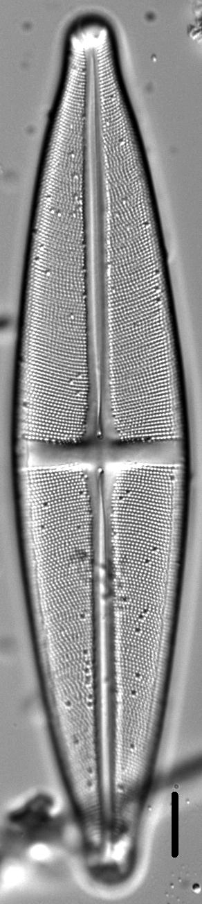
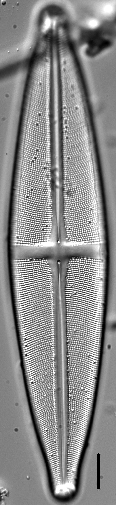
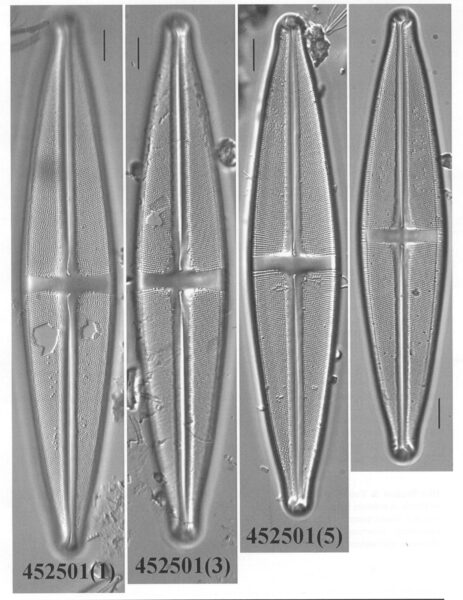
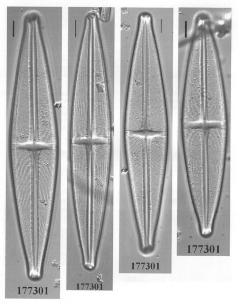
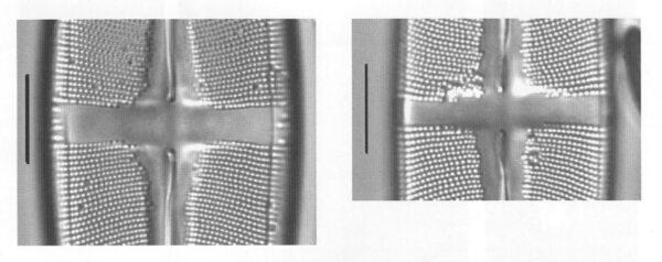
Valves are broadly lanceolate with slightly protracted and broadly rounded apices. A narrow longitudinal line, visible in LM, runs parallel to and 2–3 µm inside the valve/mantle margin. The axial area is narrow and widens slightly near the central area. The central area is s narrow, rectangular stauros, slightly expanded towards the valve margins where short striae are often present. Raphe branches are lateral with proximal ends inflated and curved. Terminal raphe fissures are hooked. Striae are radiate throughout. Areolae number 16–20 in 10 µm.
Stauroneis submarginalis has been found in several small lakes and wetlands in western Montana, northern Idaho, eastern Washington, and southern Alberta. The pH of these waters ranges from 6.2 to 8.6 and specific conductance ranges from 10 to 92 µS/cm.
(Differential diagnosis compared to Stauroneis rex): Valves are broadly lanceolate with slightly protracted, broadly rounded apices. Length 140–186 µm (not >225 µm), breadth 23–35 µm (not >35 µm). Length to width ratio: 5.0-6.4. A narrow longitudinal line, visible in LM, runs parallel to and 2–3 µm inside the valve margins. Axial area narrow, widening slightly near the central area. Transverse fascia narrow, rectangular, slightly expanded toward the valve margins. Fascia often with short striae. Raphe fissure lateral, proximal ends inflated and curved (not straight). Terminal raphe fissures hooked. Striae radiate throughout, 15–17 (not 12–14) in 10 µm. Striae puncta 16–20 (not 11–14) in 10 µm. For measurements, n = 22 valves.
Bahls, L. (2011). Stauroneis submarginalis. In Diatoms of North America. Retrieved April 25, 2024, from https://diatoms.org/species/stauroneis_submarginalis
The 15 response plots show an environmental variable (x axis) against the relative abundance (y axis) of Stauroneis submarginalis from all the stream reaches where it was present. Note that the relative abundance scale is the same on each plot. Explanation of each environmental variable and units are as follows:
ELEVATION = stream reach elevation (meters)
STRAHLER = distribution plot of the Strahler Stream Order
SLOPE = stream reach gradient (degrees)
W1_HALL = an index that is a measure of streamside (riparian) human activity that ranges from 0 - 10, with a value of 0 indicating of minimal disturbance to a value of 10 indicating severe disturbance.
PHSTVL = pH measured in a sealed syringe sample (pH units)
log_COND = log concentration of specific conductivity (µS/cm)
log_PTL = log concentration of total phosphorus (µg/L)
log_NO3 = log concentration of nitrate (µeq/L)
log_DOC = log concentration of dissolved organic carbon (mg/L)
log_SIO2 = log concentration of silicon (mg/L)
log_NA = log concentration of sodium (µeq/L)
log_HCO3 = log concentration of the bicarbonate ion (µeq/L)
EMBED = percent of the stream substrate that is embedded by sand and fine sediment
log_TURBIDITY = log of turbidity, a measure of cloudiness of water, in nephelometric turbidity units (NTU).
DISTOT = an index of total human disturbance in the watershed that ranges from 1 - 100, with a value of 0 indicating of minimal disturbance to a value of 100 indicating severe disturbance.