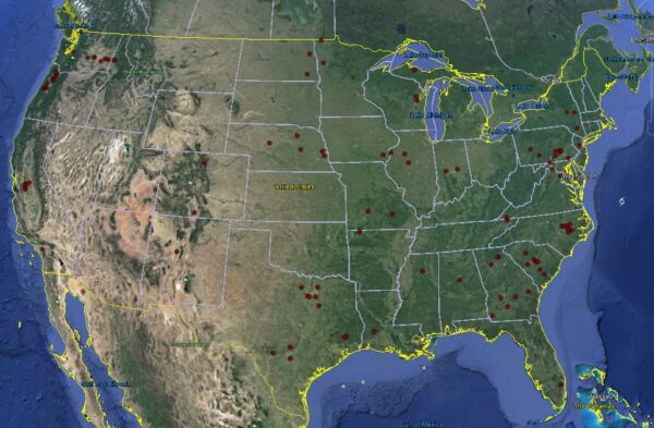
Credit: USGS BioData
Distribution of Surirella tenera in rivers of the continental U.S. based on the National Water Quality Assessment program. Retrieved 10 June 2016.
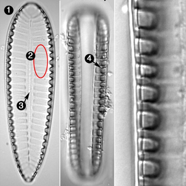
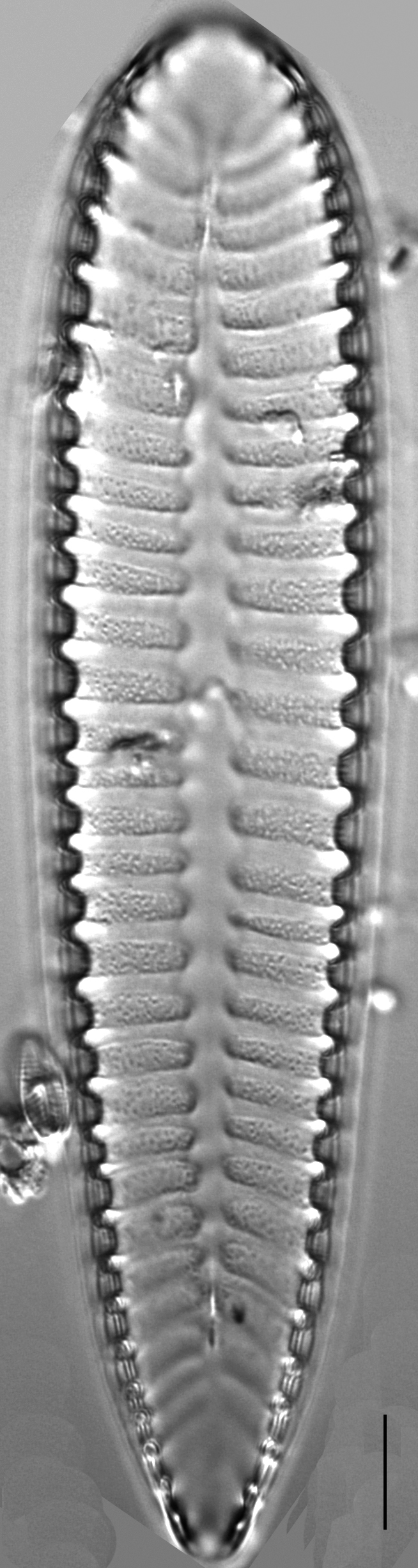
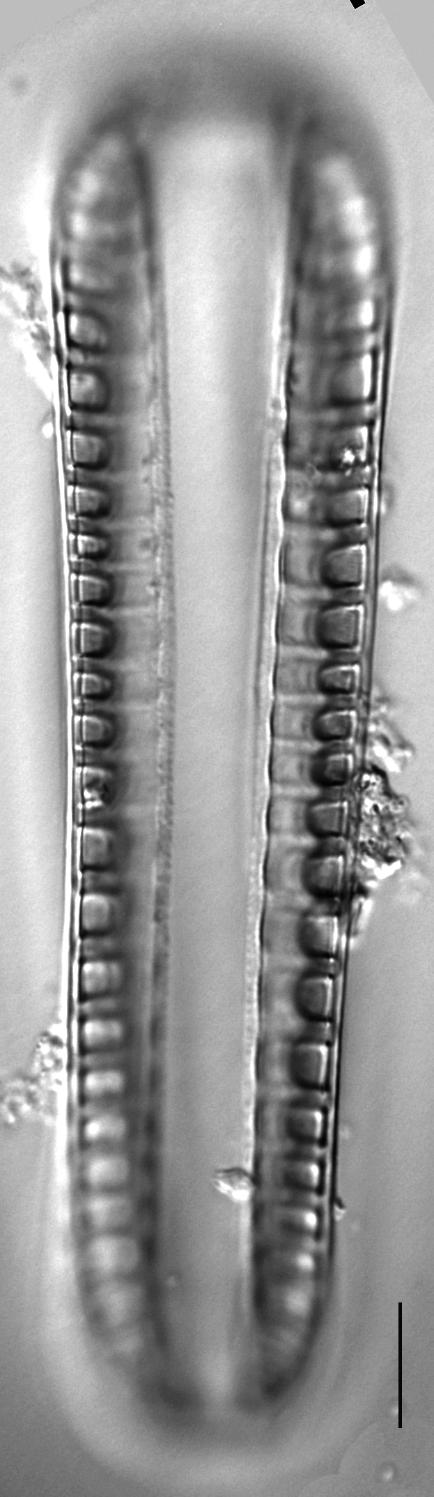
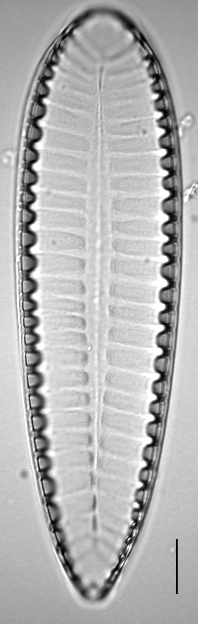
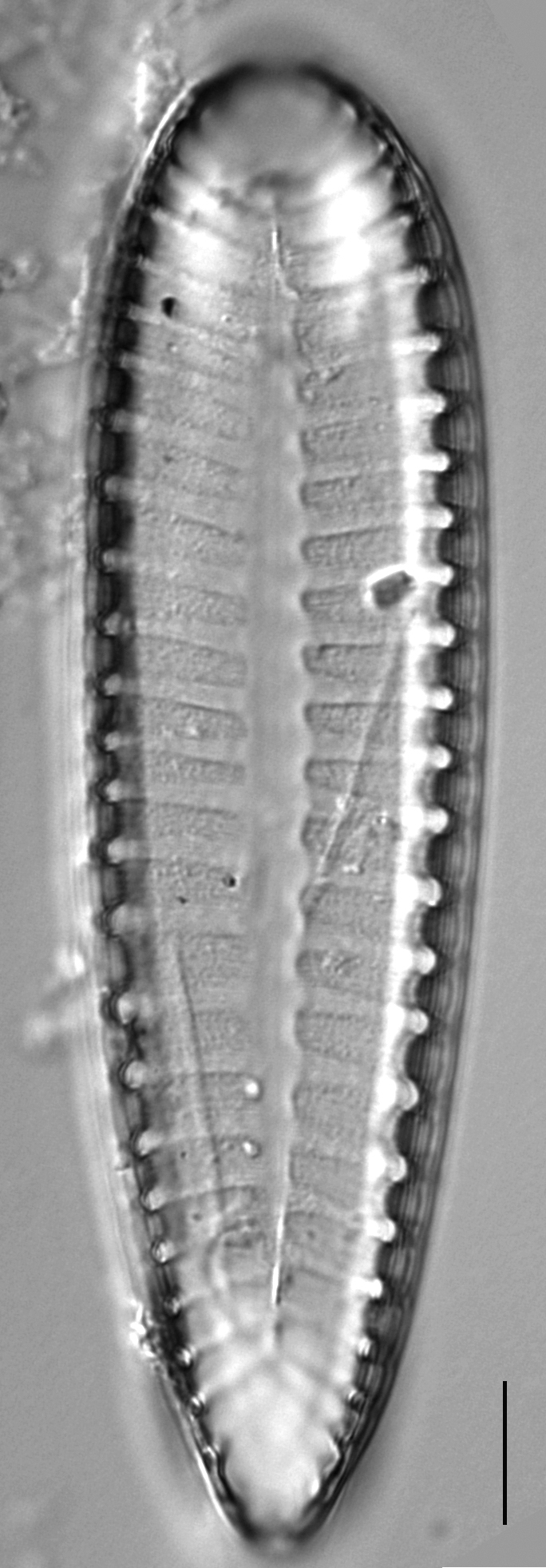
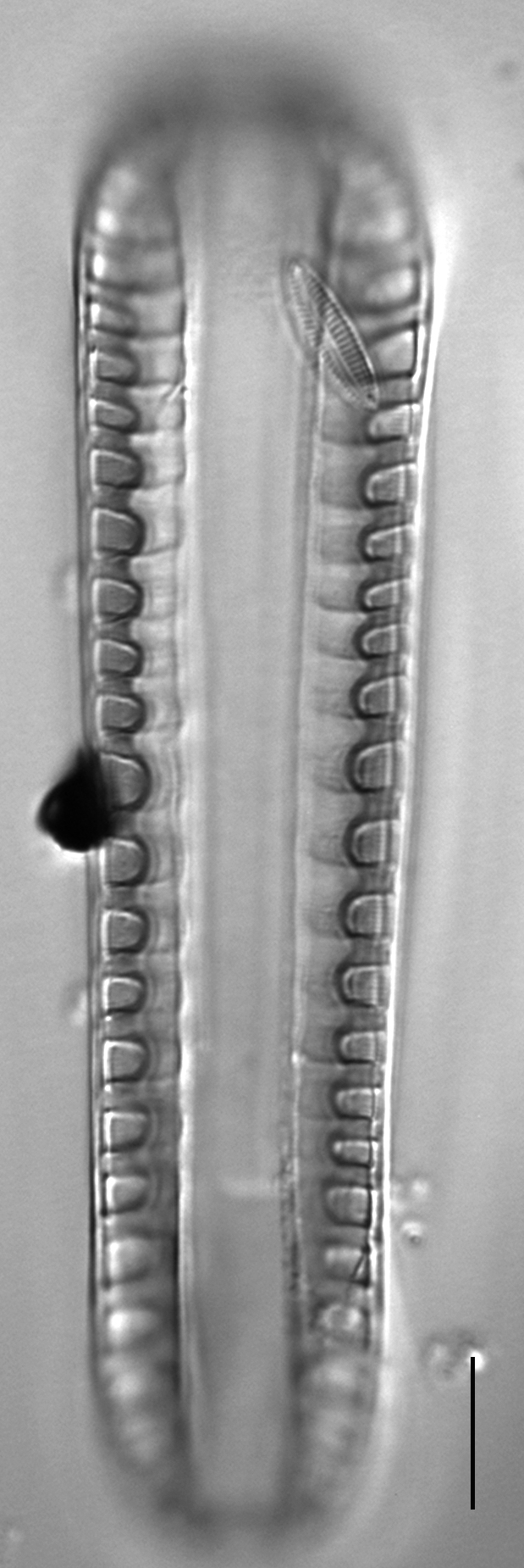
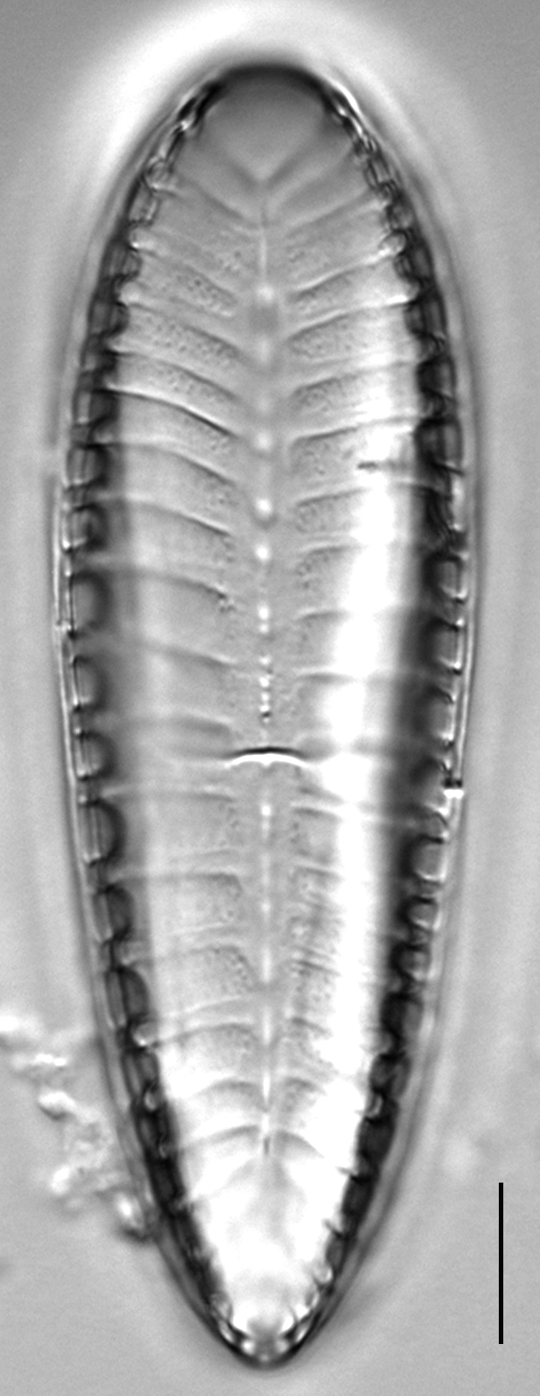
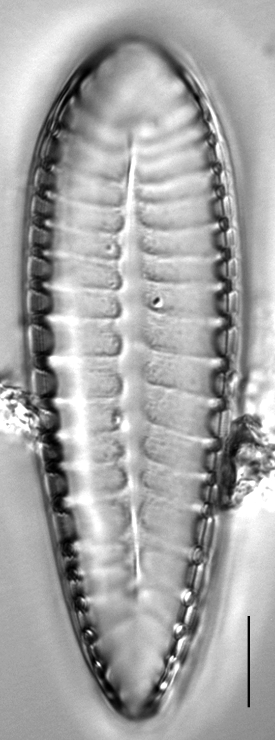
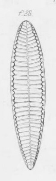
Valves are heteropolar, with a rounded headpole and cuneate footpole. Frustules may have a slight torsion about the apical axis. Length to width ratio is 3-4:1. A narrow-lanceolate hyaline axial area is present in the center of the valve, along the apical axis. Porcae, or transapical undulations, are usually positioned opposite each other, on either side of the apical axis. There are transapical depressions between porcae along the apical axis from headpole to footpole, forming a distinct corrugated pattern. Porcae are radiate at the apices. An alar wing is evident in girdle view. The raphe is placed in a raised canal and the canal appears about as wide as the fenestrae, which number 18-26 in 100 μm. The raphe is situated atop a raised keel, or alar wing, around the valve margin. Alar canals are visible as hollow openings associated with the porcae along the margin between the valve face and the advalvar side of the raphe system.
Surirella tenera was observed in Waller Creek, a small stream in an urban area of Austin, Texas, USA. It was unattached and fairly abundant in the benthos. Surirella tenera was also reported to be present in Alaska, where the taxon tended to be present in alkaline environments and was described as having a global geographic distribution range (Foged 1981). Surirella tenera is classified as an oligohalobous species (Foged 1981). Oligohalobous taxa include those that prefer slightly brackish waters, as well as taxa that prefer freshwater environments but can tolerate brackish waters (Pienitz et al. 1991).
The following are examples of reports of this taxon included in a species list but lacking verifiable images. This taxon was reported in oligotrophic lakes with acidic conditions in Florida (Whitmore 1989). Hemphill-Haley (1990) reported S. tenera in middle intertidal samples of Niawiakum River in northern Willapa Bay, Washington. Also, Ognjanova-Rumenova et al. (2011) reported the greatest relative abundance of this taxon in Bliznaka, Bubreka, Okoto (Sedemte Ez- era Cirque) and Dolno Marichino, Gorno Marichi- no (Marishki cirque) lakes, the alkaline cirques of the Rila Mts, southwest Bulgaria.
Rouzbahani, T. (2016). Surirella tenera. In Diatoms of North America. Retrieved April 24, 2024, from https://diatoms.org/species/surirella_tenera
The 15 response plots show an environmental variable (x axis) against the relative abundance (y axis) of Surirella tenera from all the stream reaches where it was present. Note that the relative abundance scale is the same on each plot. Explanation of each environmental variable and units are as follows:
ELEVATION = stream reach elevation (meters)
STRAHLER = distribution plot of the Strahler Stream Order
SLOPE = stream reach gradient (degrees)
W1_HALL = an index that is a measure of streamside (riparian) human activity that ranges from 0 - 10, with a value of 0 indicating of minimal disturbance to a value of 10 indicating severe disturbance.
PHSTVL = pH measured in a sealed syringe sample (pH units)
log_COND = log concentration of specific conductivity (µS/cm)
log_PTL = log concentration of total phosphorus (µg/L)
log_NO3 = log concentration of nitrate (µeq/L)
log_DOC = log concentration of dissolved organic carbon (mg/L)
log_SIO2 = log concentration of silicon (mg/L)
log_NA = log concentration of sodium (µeq/L)
log_HCO3 = log concentration of the bicarbonate ion (µeq/L)
EMBED = percent of the stream substrate that is embedded by sand and fine sediment
log_TURBIDITY = log of turbidity, a measure of cloudiness of water, in nephelometric turbidity units (NTU).
DISTOT = an index of total human disturbance in the watershed that ranges from 1 - 100, with a value of 0 indicating of minimal disturbance to a value of 100 indicating severe disturbance.