Credit: Loren Bahls
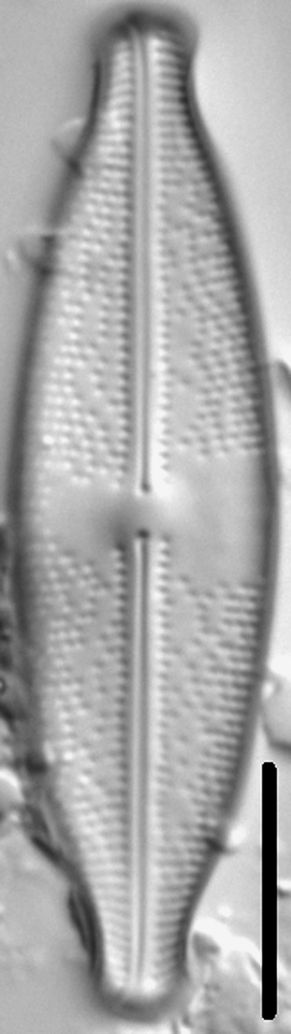
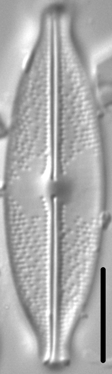
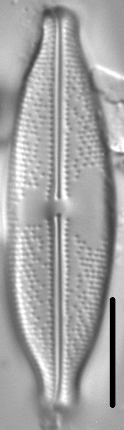
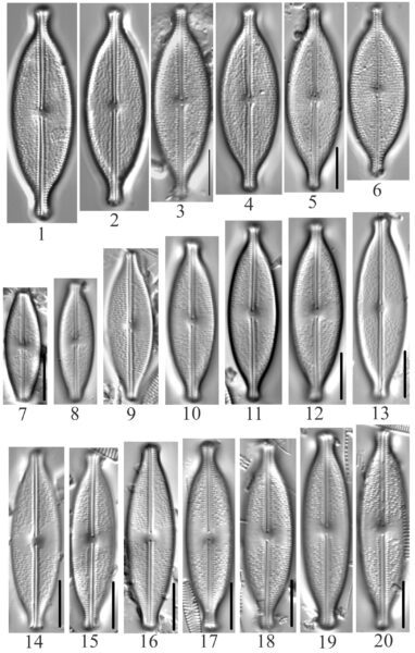
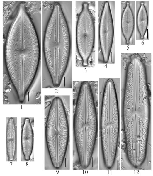
Anomoeoneis capitata (top row) compared to Anomoeoneis monoensis (bottom two rows).
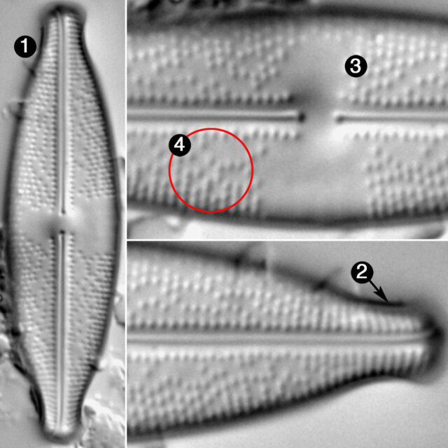
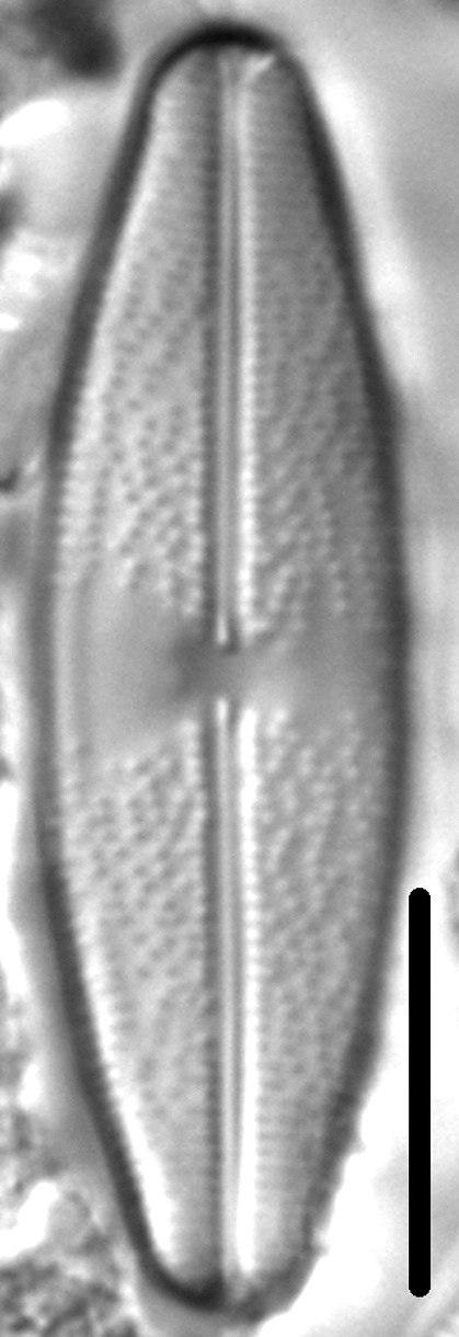
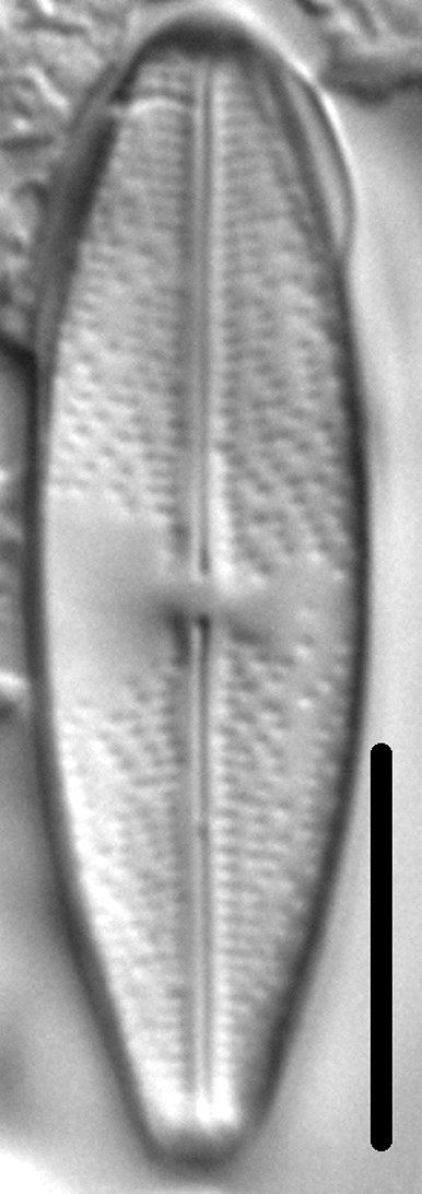
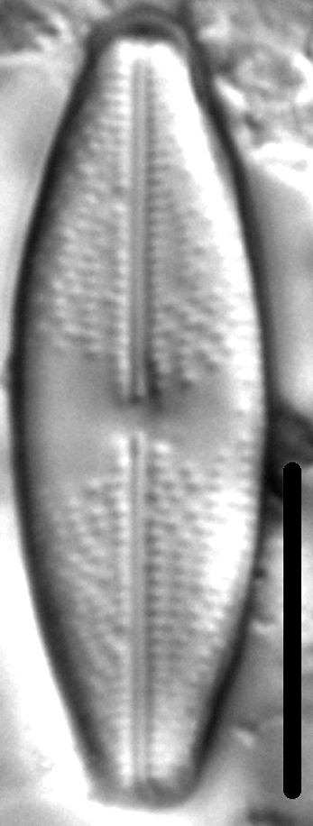
Valves are lanceolate. Apices are highly variable, ranging from broadly rounded to rostrate to capitate. The axial area and raphe are narrow and straight. The central area is asymmetric; the larger side is wedge shaped and extends to the valve margin; the smaller side is rounded and bordered along its outer margin by one to several very short striae. Ghost striae may be present in the central area. External proximal raphe ends are tear-drop shaped and deflected very slightly to one side. Terminal raphe fissures are deflected sharply in the same direction as the proximal raphe ends. Striae are radiate, becoming convergent towards the apices. Areolae are irregularly spaced; in uninterrupted series they number about 30 in 10 µm.
Anomoeoneis monoensis is locally common in brackish to hypersaline lakes and streams in eastern Montana. In waters that support Montana populations, specific conductance ranges from 4,850 to 87,000 µS/cm, pH from 8.70 to 10.0, and sodium and sulfate are the dominant cation and anion, respectively. Cumming et al. (1995) reported this species as Anomoeoneis sphaerophora forma 2 PISCES from saline lakes in southern British Columbia.
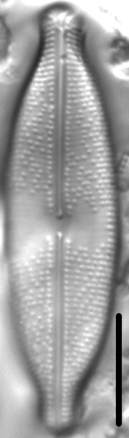
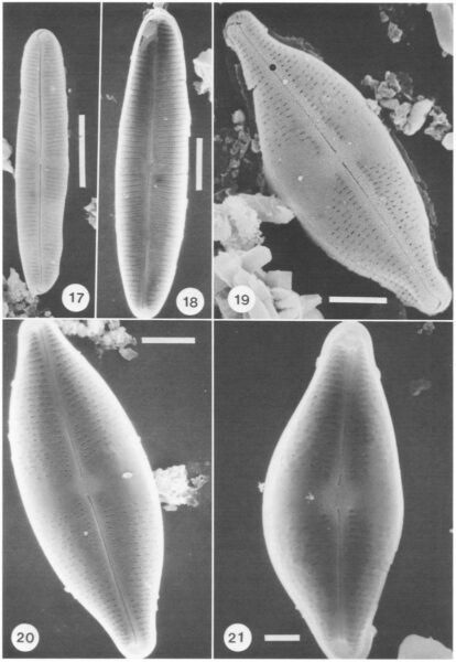
Anomoeoneis sphaerophora var. minor var. nov.
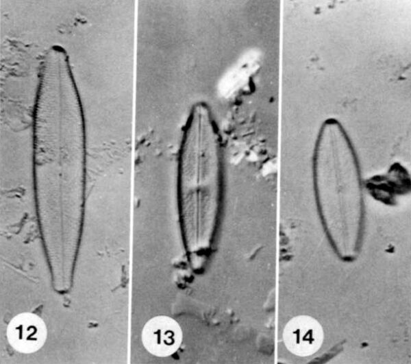
(Figs. 11-16, 19-21; Fig. 14 illustrates the holotype)
Descriptio. Ambitu variabilis, valvae var. sphaerophora parvior subtiliter
striatior. Longitudo 19-48 ,tm. Latitudo 6.5-10 ,tm. Striae 20-22 in 10 um.
Holotypus. CAS slide #216060.
Description. Valve outline variable, smaller and more finely striated thanvar. sphaerophora. Length 19-48 jim, breadth 6.5-10 ,um. Striae 20-22 in 10 um.
Holotype. CAS slide #216060.
Type locality. Mono Lake, Lee Vining tufa grove, 10-m depth, rock scrape.
Bahls, L. (2018). Anomoeoneis monoensis. In Diatoms of North America. Retrieved November 21, 2024, from https://diatoms.org/species/anomoeoneis-monoensis
The 15 response plots show an environmental variable (x axis) against the relative abundance (y axis) of Anomoeoneis monoensis from all the stream reaches where it was present. Note that the relative abundance scale is the same on each plot. Explanation of each environmental variable and units are as follows:
ELEVATION = stream reach elevation (meters)
STRAHLER = distribution plot of the Strahler Stream Order
SLOPE = stream reach gradient (degrees)
W1_HALL = an index that is a measure of streamside (riparian) human activity that ranges from 0 - 10, with a value of 0 indicating of minimal disturbance to a value of 10 indicating severe disturbance.
PHSTVL = pH measured in a sealed syringe sample (pH units)
log_COND = log concentration of specific conductivity (µS/cm)
log_PTL = log concentration of total phosphorus (µg/L)
log_NO3 = log concentration of nitrate (µeq/L)
log_DOC = log concentration of dissolved organic carbon (mg/L)
log_SIO2 = log concentration of silicon (mg/L)
log_NA = log concentration of sodium (µeq/L)
log_HCO3 = log concentration of the bicarbonate ion (µeq/L)
EMBED = percent of the stream substrate that is embedded by sand and fine sediment
log_TURBIDITY = log of turbidity, a measure of cloudiness of water, in nephelometric turbidity units (NTU).
DISTOT = an index of total human disturbance in the watershed that ranges from 1 - 100, with a value of 0 indicating of minimal disturbance to a value of 100 indicating severe disturbance.