Craticula halophila

-
Category
-
Length Range33-52 µm
-
Width Range8.7-12.4 µm
-
Striae in 10 µm17-19
-
Reported AsNavicula halophila (Patrick and Reimer 1966, p. 467, plate 44, fig. 4)
-
ContributorLoren Bahls - Oct 2012
-
ReviewerSarah Spaulding - Aug 2014
Identification
Description
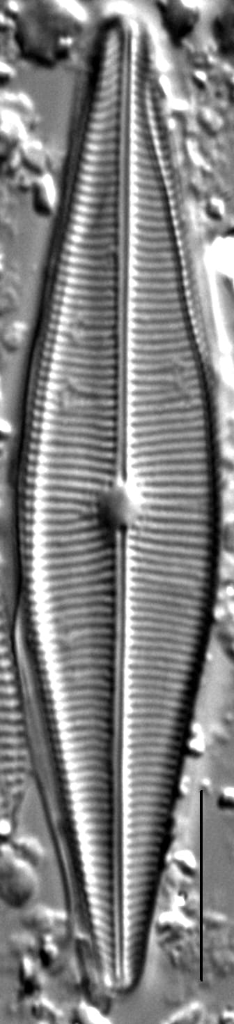
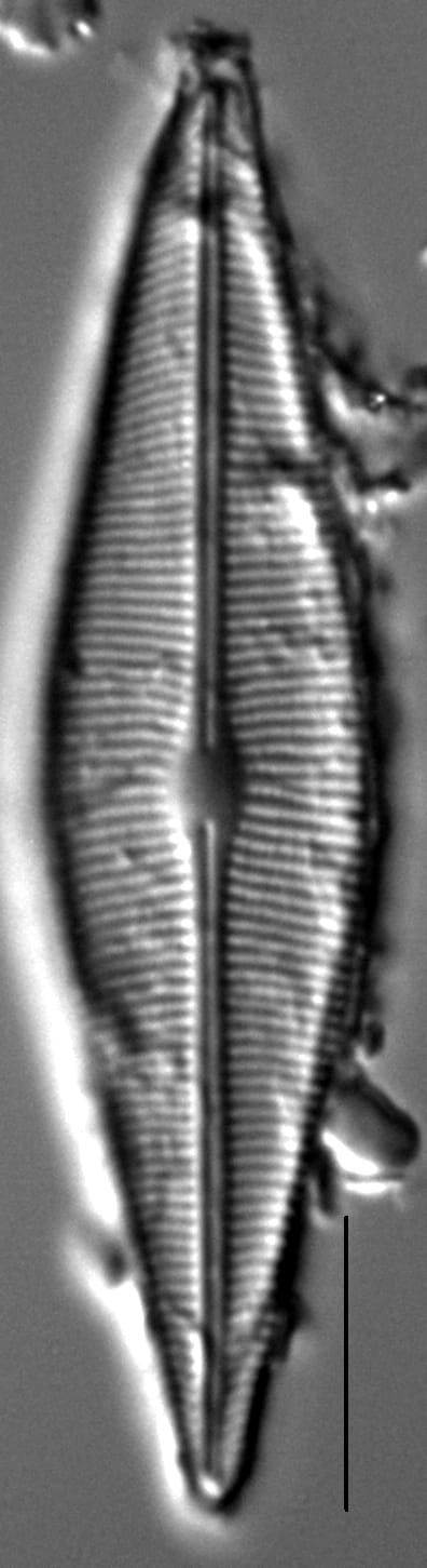
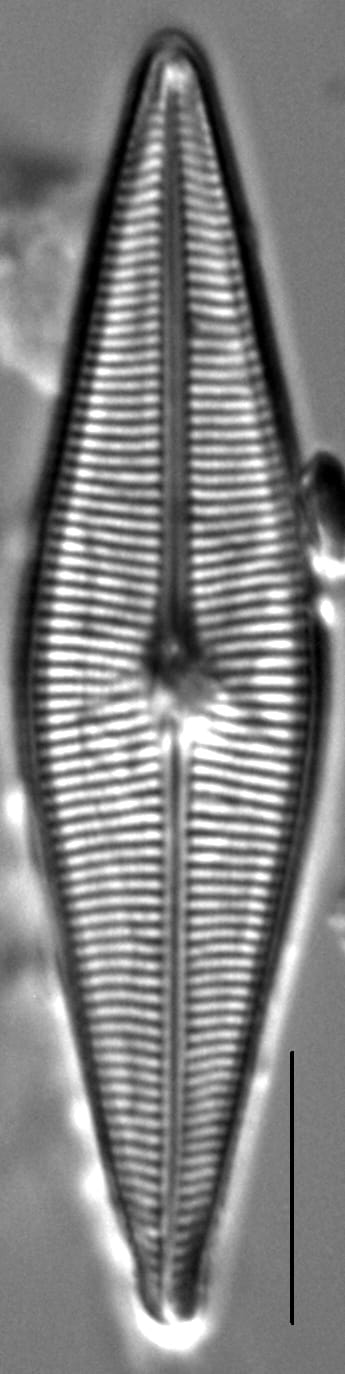
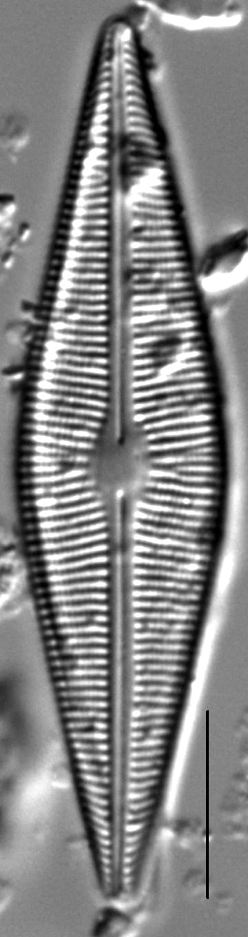
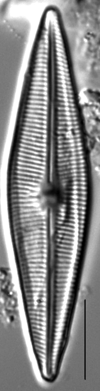
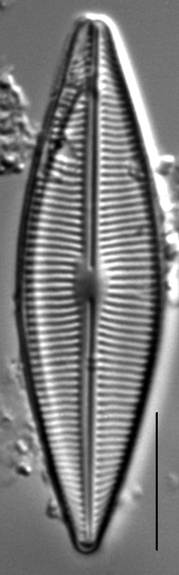
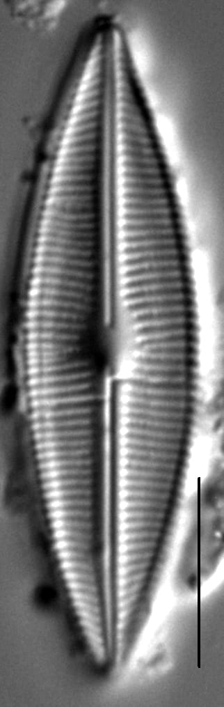
Valves are rhombic lanceolate with acute apices, or very subtly protracted apices in small specimens. The axial area is very narrow. The central area is small and elliptic in shape. The raphe is filiform with straight, weakly expanded proximal ends and distal ends that are hooked to the same side. Striae are parallel to weakly radiate at the valve center, becoming convergent towards the apices. Areolae are fine and difficult to resolve in LM.
Autecology
Craticula halophila is widely distributed in streams acros the Northwestern Great Plains, where it prefers waters with high levels of dissolved solids (Montana Diatom Collection). There are 50 confirmed records of this taxon in the Montana Diatom Collection.
-
Size Range, µm3
-
Motility
-
Attachment
-
Habitat
-
Colony
-
BCG
-
Waterbody
-
Distribution
- Learn more about this
Original Description
var. halophila Grun. (Atl. Suppl. fig. 30.— in Type Ν° 12.) Etroit, très-petit : environ 5 c.d.m. ; stries délicates, 16 environ en 1 c.d.m., radiantes vers la partie moyenne, convergentes aux extrémités. Saumâtre. — Blankenberghe.
-
BasionymNavicula cuspidata var. halophila
-
AuthorGrunow in Van Heurck 1885
Original Images


Citations & Links
Citations
Links
-
Index Nominum Algarum
-
GenBank
-
North American Diatom Ecological DatabaseNADED ID: 21005
Updates
Jun 26, 2026 - Note page for Craticula buderi
The name, Craticula halophila, was originally applied to the specimens currently shown on the page for C. buderi. That page was revised and this page was opened. - S. Spaulding
Cite This Page
Bahls, L. (2012). Craticula halophila. In Diatoms of North America. Retrieved June 26, 2026, from https://diatoms.org/species/48882/craticula_halophila_sensu_llb
Responses
The 15 response plots show an environmental variable (x axis) against the relative abundance (y axis) of Craticula halophila from all the stream reaches where it was present. Note that the relative abundance scale is the same on each plot. Explanation of each environmental variable and units are as follows:
ELEVATION = stream reach elevation (meters)
STRAHLER = distribution plot of the Strahler Stream Order
SLOPE = stream reach gradient (degrees)
W1_HALL = an index that is a measure of streamside (riparian) human activity that ranges from 0 - 10, with a value of 0 indicating of minimal disturbance to a value of 10 indicating severe disturbance.
PHSTVL = pH measured in a sealed syringe sample (pH units)
log_COND = log concentration of specific conductivity (µS/cm)
log_PTL = log concentration of total phosphorus (µg/L)
log_NO3 = log concentration of nitrate (µeq/L)
log_DOC = log concentration of dissolved organic carbon (mg/L)
log_SIO2 = log concentration of silicon (mg/L)
log_NA = log concentration of sodium (µeq/L)
log_HCO3 = log concentration of the bicarbonate ion (µeq/L)
EMBED = percent of the stream substrate that is embedded by sand and fine sediment
log_TURBIDITY = log of turbidity, a measure of cloudiness of water, in nephelometric turbidity units (NTU).
DISTOT = an index of total human disturbance in the watershed that ranges from 1 - 100, with a value of 0 indicating of minimal disturbance to a value of 100 indicating severe disturbance.
Craticula halophila
- Valves rhombic lanceolate
- Maximum width >10 µm
- Apices acute
Craticula halophila has rhombic lanceolate valves with acute apices. The maximum valve width is greater than 10 µm.