
Credit: Loren Bahls
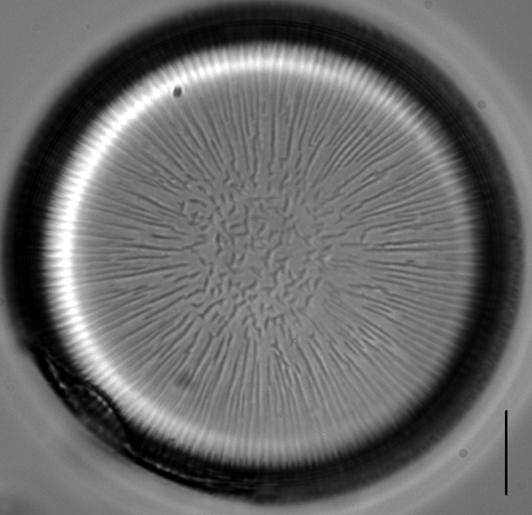
Live colony of Ellerbeckia arenaria showing cells with numerous discoid plastids. Scale bar = 10 µm.


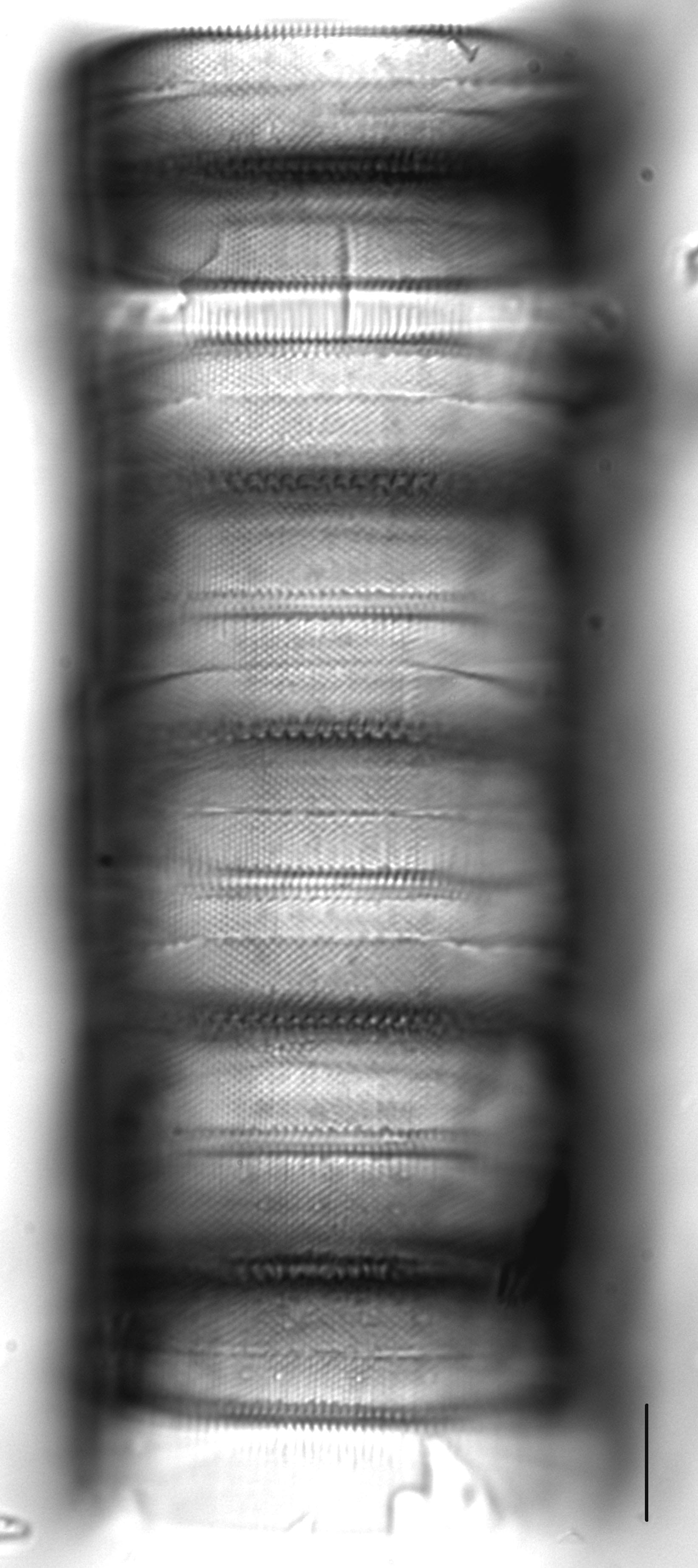
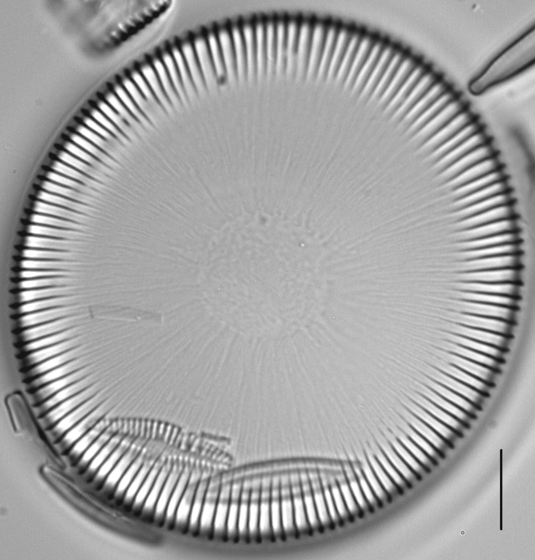
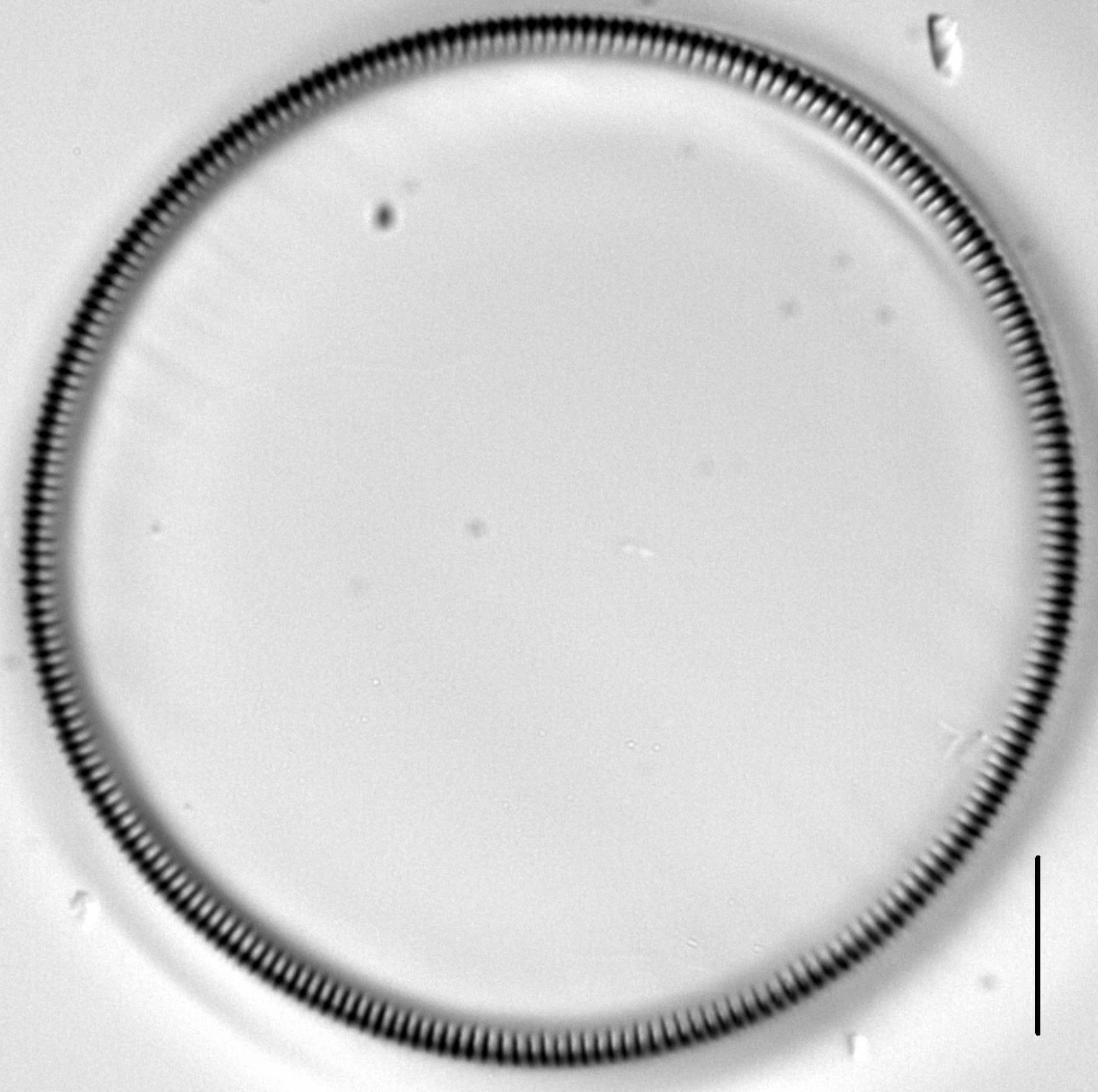
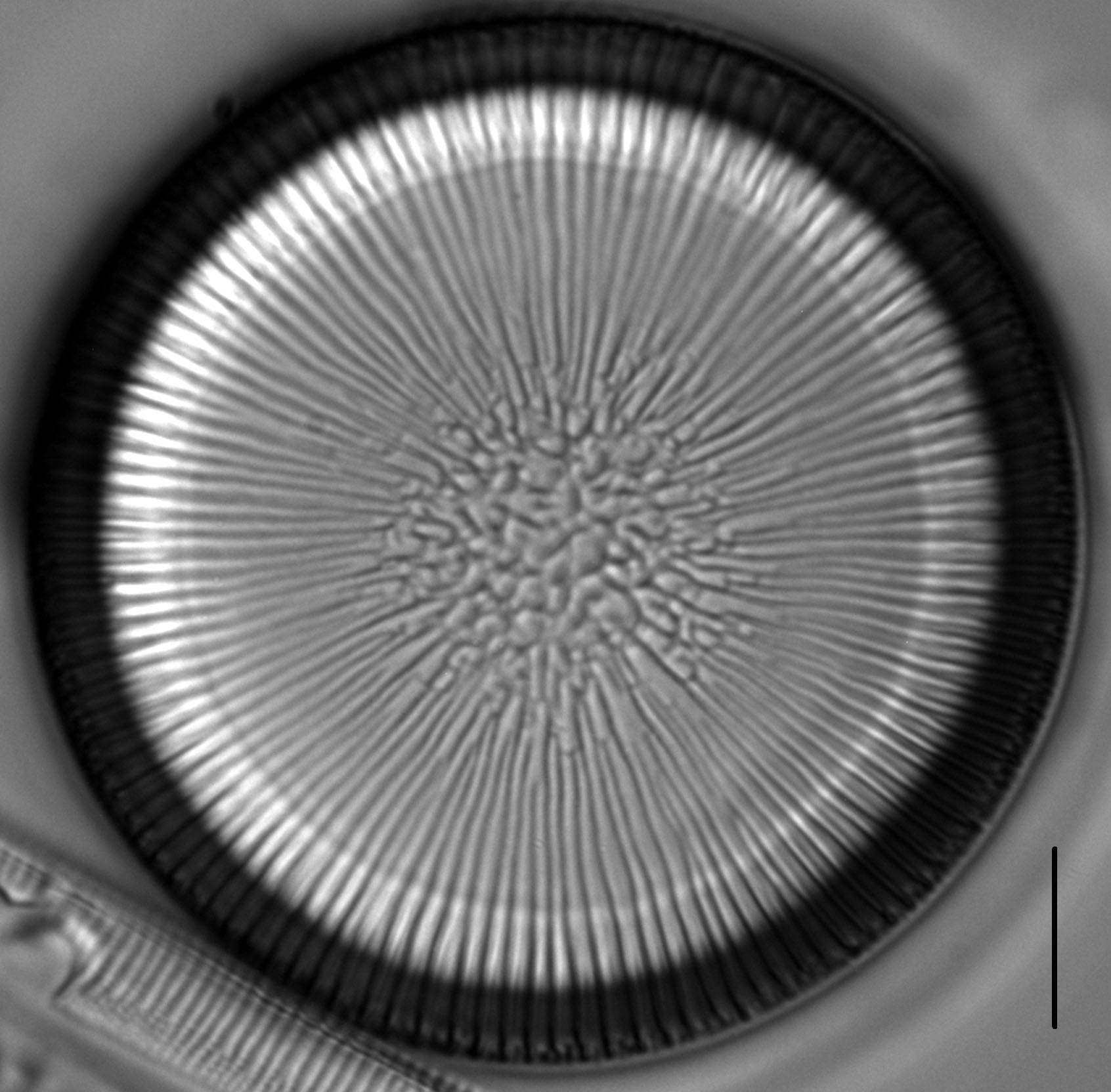
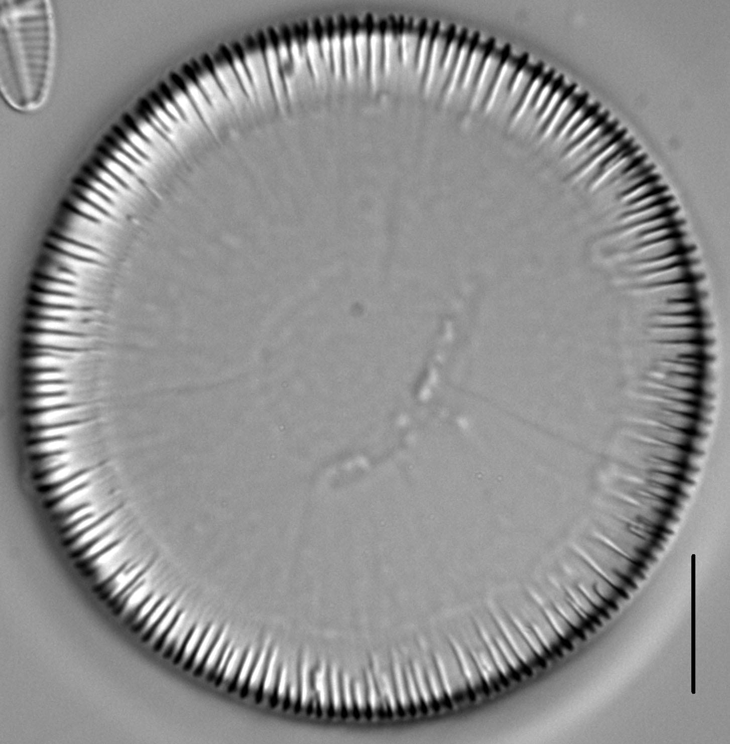
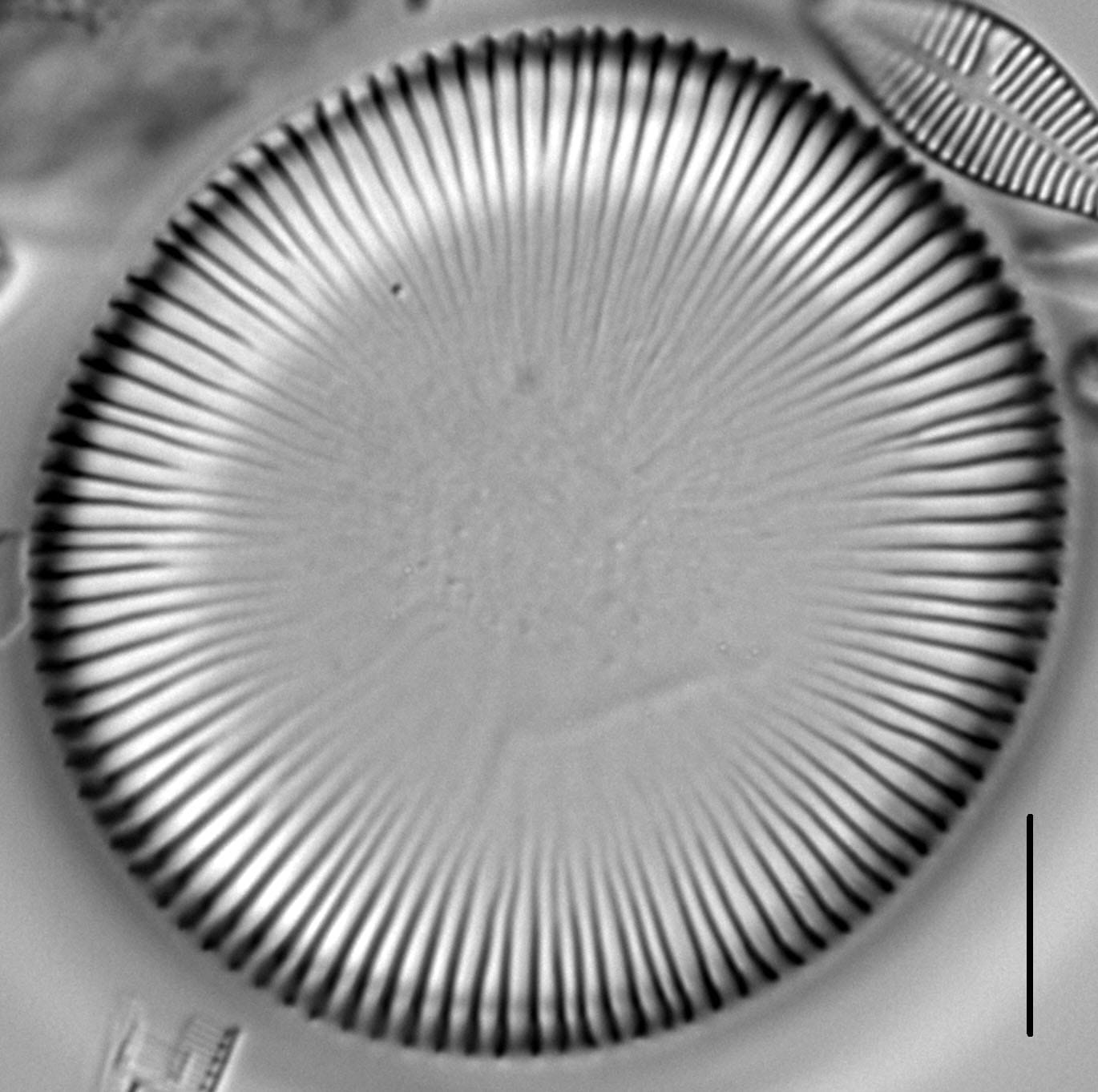
Drum-shaped frustules are heavily silicified and joined by valve faces in long filamentous colonies. Striae on the mantles are perpendicular to the valve faces. Areolae of adjacent striae are offset, producing a diagonal lattice pattern. Valves are of two types: Linking valves connect cells within a colony and separation valves occur at the ends of unbroken filaments. Both linking and separation valves have two complementary forms: a cameo form with ridges and an intaglio form with grooves. The interlocking ridges and grooves of linking valves extend from the valve margin to near the central region, where an irregular pattern of bumps and pits may also be present. The mantle edge on the open end of linking valves has a crenulate appearance and the connection between the valve and valvocopula looks like a zipper. In separation valves, the marginal ridges and grooves extend only a short distance in from the valve margin. Unique tubular processes are present on the mantle, which appear as simple pores that are visible in LM.
Ellerbeckia arenaria is one of only two freshwater species of Ellerbeckia recorded in the United States. The other is E. baileyi, which occurs only as a fossil in Oregon and Washington.
The population of E. arenaria described here was collected on 13 June 2012 at Giant Springs State Park on the Missouri River near Great Falls, Montana. Giant Springs is one of the largest freshwater springs in the world and discharges at a rate of 4.37 cubic meters per second. Water in the springs originates in the Madison limestone formation of the Little Belt Mountains, about 75 miles distant. At the point of discharge, water in the springs measures a constant 12.2 degrees C. The sample containing E. arenaria was collected from rocks and concrete that line the spring pool. On the day of collection, water temperature in the pool measured 14.6 degrees C, pH measured 7.50, and specific conductance measured 580 µS/cm. A common diatom associate in this sample was another robust, colony-forming centric: Melosira undulata.


Bahls, L. (2012). Ellerbeckia arenaria. In Diatoms of North America. Retrieved June 18, 2026, from https://diatoms.org/species/48715/ellerbeckia_arenaria
The 15 response plots show an environmental variable (x axis) against the relative abundance (y axis) of Ellerbeckia arenaria from all the stream reaches where it was present. Note that the relative abundance scale is the same on each plot. Explanation of each environmental variable and units are as follows:
ELEVATION = stream reach elevation (meters)
STRAHLER = distribution plot of the Strahler Stream Order
SLOPE = stream reach gradient (degrees)
W1_HALL = an index that is a measure of streamside (riparian) human activity that ranges from 0 - 10, with a value of 0 indicating of minimal disturbance to a value of 10 indicating severe disturbance.
PHSTVL = pH measured in a sealed syringe sample (pH units)
log_COND = log concentration of specific conductivity (µS/cm)
log_PTL = log concentration of total phosphorus (µg/L)
log_NO3 = log concentration of nitrate (µeq/L)
log_DOC = log concentration of dissolved organic carbon (mg/L)
log_SIO2 = log concentration of silicon (mg/L)
log_NA = log concentration of sodium (µeq/L)
log_HCO3 = log concentration of the bicarbonate ion (µeq/L)
EMBED = percent of the stream substrate that is embedded by sand and fine sediment
log_TURBIDITY = log of turbidity, a measure of cloudiness of water, in nephelometric turbidity units (NTU).
DISTOT = an index of total human disturbance in the watershed that ranges from 1 - 100, with a value of 0 indicating of minimal disturbance to a value of 100 indicating severe disturbance.