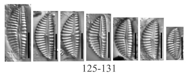
Credit: Loren Bahls
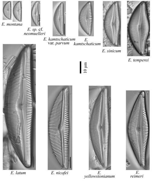
Taxa in the Encyonema reimeri group from the western United States.

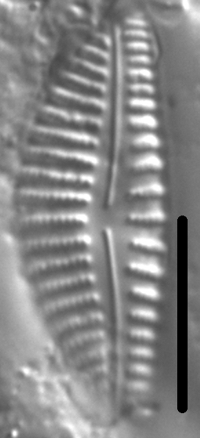
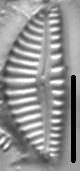
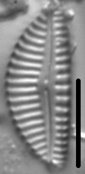
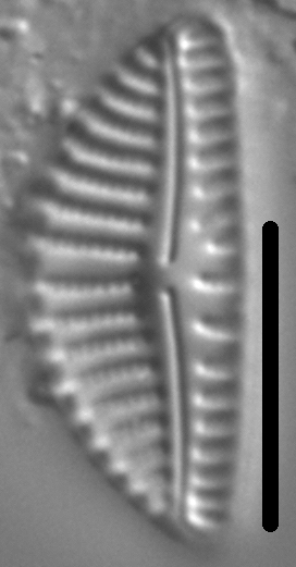
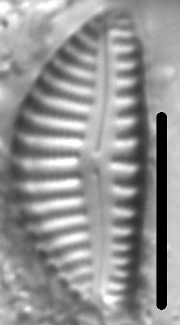
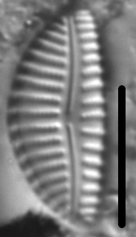
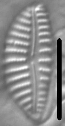
Valves are almost semicircular with a strongly arched dorsal margin and a weakly convex ventral margin. The axial area is narrow and a central area is absent. The raphe is filiform. External proximal raphe ends are weakly expanded and deflected dorsally. Terminal raphe fissures are deflected ventrally. Dorsal striae are radiate; ventral striae are parallel or weakly radiate. Areolae number 28-36 in 10 μm.
The type locality and the only record to date of E. montana is Wolf Creek, a prairie stream in eastern Montana. On the date of sampling, Wolf Creek had a specific conductance of 1181 μS/cm and a pH of 8.74. This is the smallest species in the E. reimeri group of taxa from the western United States.
Valves are almost semicircular with a strongly arched dorsal margin and a weakly convex ventral margin. Valve length 16-22 μm; valve width 6.8-8.5 μm. The axial area is narrow and a central area is absent. The raphe is filiform. External proximal raphe ends are weakly expanded and deflected dorsally. Terminal raphe fissures are deflected ventrally. Dorsal striae are radiate; ventral striae are parallel or weakly radiate. Striae number 11-12 in 10 μm. Areolae number 28-36 in 10 μm.
Bahls, L. (2018). Encyonema montana. In Diatoms of North America. Retrieved July 26, 2024, from https://diatoms.org/species/encyonema-montana
The 15 response plots show an environmental variable (x axis) against the relative abundance (y axis) of Encyonema montana from all the stream reaches where it was present. Note that the relative abundance scale is the same on each plot. Explanation of each environmental variable and units are as follows:
ELEVATION = stream reach elevation (meters)
STRAHLER = distribution plot of the Strahler Stream Order
SLOPE = stream reach gradient (degrees)
W1_HALL = an index that is a measure of streamside (riparian) human activity that ranges from 0 - 10, with a value of 0 indicating of minimal disturbance to a value of 10 indicating severe disturbance.
PHSTVL = pH measured in a sealed syringe sample (pH units)
log_COND = log concentration of specific conductivity (µS/cm)
log_PTL = log concentration of total phosphorus (µg/L)
log_NO3 = log concentration of nitrate (µeq/L)
log_DOC = log concentration of dissolved organic carbon (mg/L)
log_SIO2 = log concentration of silicon (mg/L)
log_NA = log concentration of sodium (µeq/L)
log_HCO3 = log concentration of the bicarbonate ion (µeq/L)
EMBED = percent of the stream substrate that is embedded by sand and fine sediment
log_TURBIDITY = log of turbidity, a measure of cloudiness of water, in nephelometric turbidity units (NTU).
DISTOT = an index of total human disturbance in the watershed that ranges from 1 - 100, with a value of 0 indicating of minimal disturbance to a value of 100 indicating severe disturbance.