
Credit: E. William Schweiger, National Park Service
Red Eagle Pond, Glacier National Park, Montana: home of Stauroneis gracilis.

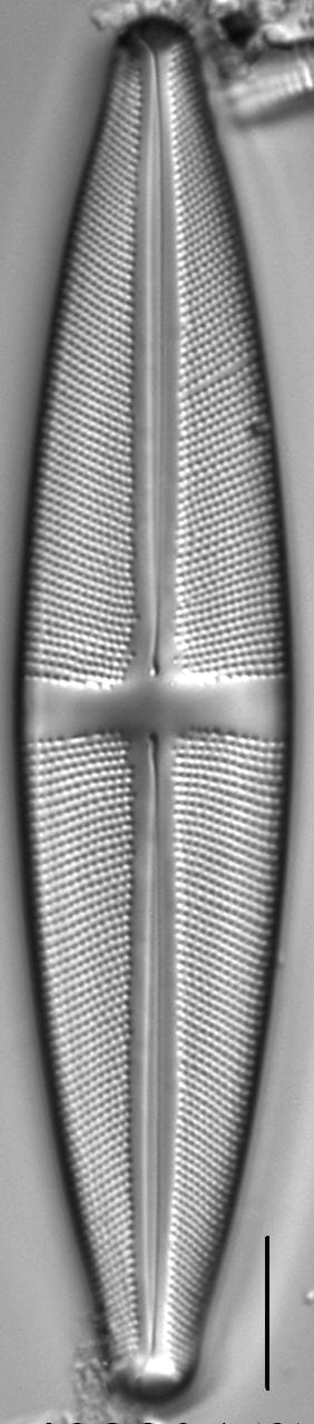
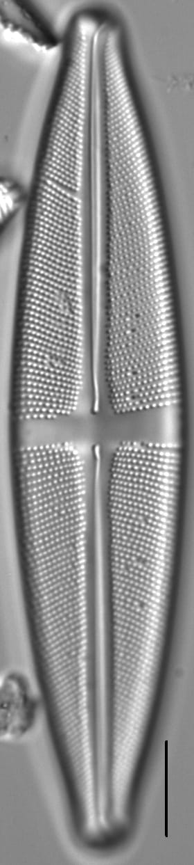
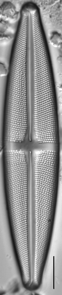
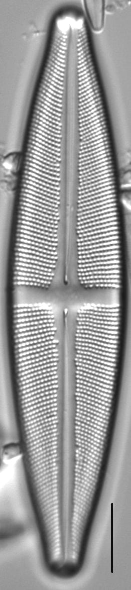
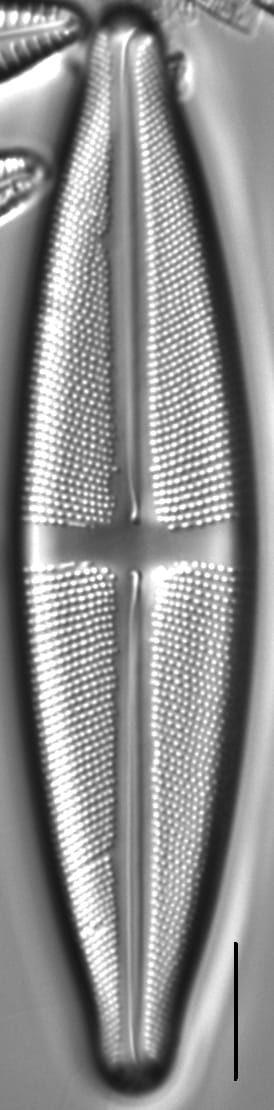
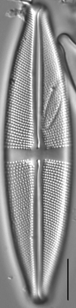
Valves are elliptic-lanceolate with subrostrate, broadly rounded apices. The axial area is linear to narrowly lanceolate and two to three times wider than the raphe. The stauros is rectangular, often widening slightly towards the valve margins. Short striae are absent from the central area. The raphe is lateral with curved and inflated proximal ends. Terminal raphe fissures are shaped like question marks and hooked toward the secondary side. Striae are radiate throughout. Areolae number 18-22 in 10 µm.
Stauroneis gracilis is widely distributed in lakes, ponds, and wetlands in the Northern Rockies. The pH of these waters ranges from 5.5 to 7.4 (mean pH = 6.7) and specific conductance ranges from 7 to 192 µS/cm (mean SC = 36 µS/cm). Van de Vijver et al. (2004) report this species as widely distributed in both the Arctic and Antarctic, where it is present in a large variety of habitats ranging from small, very shallow pools to large, deep lakes. In these waters the pH ranges from 6.0 to 8.3 and specific conductance ranges from 50 to 350 µS/cm.
Bahls, L. (2011). Stauroneis gracilis. In Diatoms of North America. Retrieved July 20, 2026, from https://diatoms.org/species/47403/stauroneis_gracilis
The 15 response plots show an environmental variable (x axis) against the relative abundance (y axis) of Stauroneis gracilis from all the stream reaches where it was present. Note that the relative abundance scale is the same on each plot. Explanation of each environmental variable and units are as follows:
ELEVATION = stream reach elevation (meters)
STRAHLER = distribution plot of the Strahler Stream Order
SLOPE = stream reach gradient (degrees)
W1_HALL = an index that is a measure of streamside (riparian) human activity that ranges from 0 - 10, with a value of 0 indicating of minimal disturbance to a value of 10 indicating severe disturbance.
PHSTVL = pH measured in a sealed syringe sample (pH units)
log_COND = log concentration of specific conductivity (µS/cm)
log_PTL = log concentration of total phosphorus (µg/L)
log_NO3 = log concentration of nitrate (µeq/L)
log_DOC = log concentration of dissolved organic carbon (mg/L)
log_SIO2 = log concentration of silicon (mg/L)
log_NA = log concentration of sodium (µeq/L)
log_HCO3 = log concentration of the bicarbonate ion (µeq/L)
EMBED = percent of the stream substrate that is embedded by sand and fine sediment
log_TURBIDITY = log of turbidity, a measure of cloudiness of water, in nephelometric turbidity units (NTU).
DISTOT = an index of total human disturbance in the watershed that ranges from 1 - 100, with a value of 0 indicating of minimal disturbance to a value of 100 indicating severe disturbance.