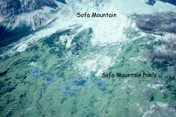
Credit: Barb Johnston, Parks Canada
Sofa Mountain Pools, Waterton Lakes National Park, Alberta: home of Staurophora tackei.
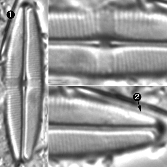
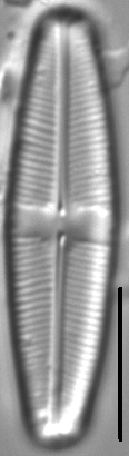
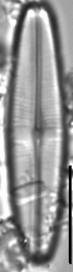
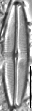
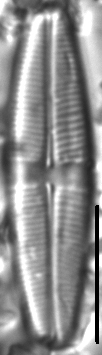
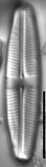
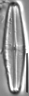
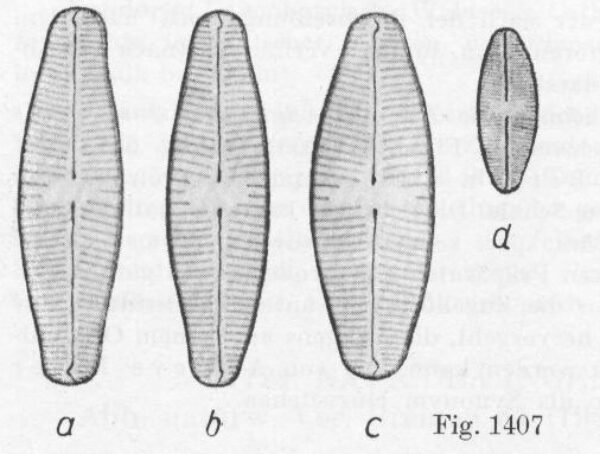
Valves are linear-lanceolate with convex sides and very broad, obtusely rounded apices. The axial area is very narrow and expands somewhat near the central area in deltoid fashion. The central area is a transverse rectangular fascia, somewhat diagonal in some specimens and in others expanding slightly towards the valve margins, often with short striae at the margins. The raphe is filiform. Proximal raphe ends are expanded and nearly straight. Terminal raphe fissures are strongly hooked, with hooks opening towards the secondary side of the valve. Striae are weakly radiate throughout or sometimes parallel near the middle of the valve. The spacing between striae is highly variable, both within and among specimens. Areolae in the striae are very fine and difficult to resolve in LM.
Staurophora tackei is a rare diatom in ponds and low-gradient streams of the Northwestern Great Plains and the Northern Rocky mountains east of the Continental Divide. There are only seven records of this species in the Montana Diatom Collection.
Bahls, L. (2012). Staurophora tackei. In Diatoms of North America. Retrieved April 26, 2024, from https://diatoms.org/species/staurophora_tackei
The 15 response plots show an environmental variable (x axis) against the relative abundance (y axis) of Staurophora tackei from all the stream reaches where it was present. Note that the relative abundance scale is the same on each plot. Explanation of each environmental variable and units are as follows:
ELEVATION = stream reach elevation (meters)
STRAHLER = distribution plot of the Strahler Stream Order
SLOPE = stream reach gradient (degrees)
W1_HALL = an index that is a measure of streamside (riparian) human activity that ranges from 0 - 10, with a value of 0 indicating of minimal disturbance to a value of 10 indicating severe disturbance.
PHSTVL = pH measured in a sealed syringe sample (pH units)
log_COND = log concentration of specific conductivity (µS/cm)
log_PTL = log concentration of total phosphorus (µg/L)
log_NO3 = log concentration of nitrate (µeq/L)
log_DOC = log concentration of dissolved organic carbon (mg/L)
log_SIO2 = log concentration of silicon (mg/L)
log_NA = log concentration of sodium (µeq/L)
log_HCO3 = log concentration of the bicarbonate ion (µeq/L)
EMBED = percent of the stream substrate that is embedded by sand and fine sediment
log_TURBIDITY = log of turbidity, a measure of cloudiness of water, in nephelometric turbidity units (NTU).
DISTOT = an index of total human disturbance in the watershed that ranges from 1 - 100, with a value of 0 indicating of minimal disturbance to a value of 100 indicating severe disturbance.