
Credit: Loren Bahls
Cameron Lake, Waterton-Glacier International Peace Park: home of Encyonema fogedii

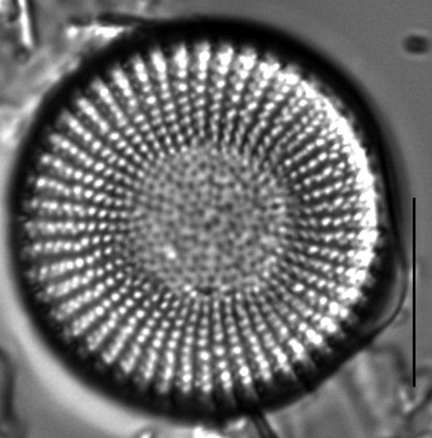
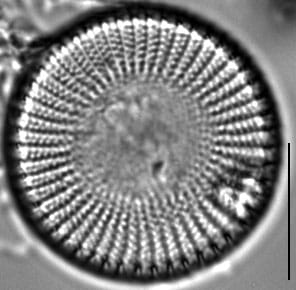
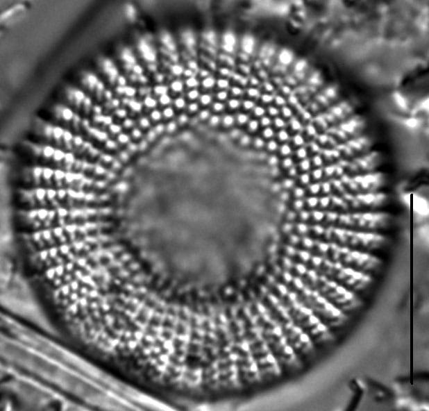
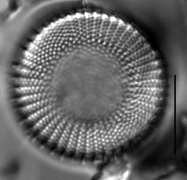
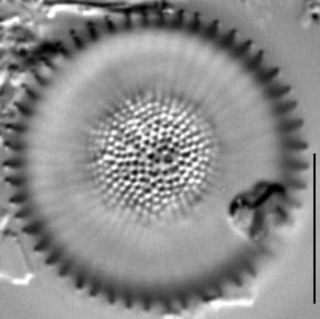
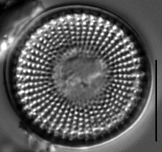
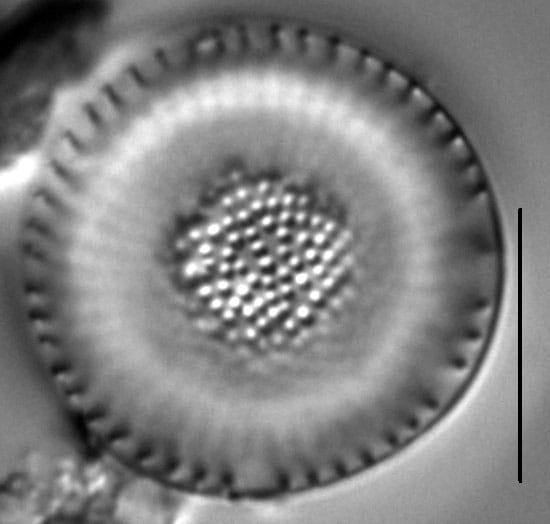

Valves cylindrical with strong concentric undulation. Central area either convex or concave with disorganized areolae. Fascicles number 12-14 in 10 µm. Striae uniseriate near the central area, becoming biseriate near the valve margin. Areolae are relatively coarse. Each interfascicle, or costa, has a spine positioned at the valve margin.
Scanning electron micrograph images and descriptions have been published by Håkansson (2002), Håkansson and Kling (1989), and Krammer and Lange-Bertalot (1991).
Stephanodiscus alpinus was described from Grundlsee in Austria (Hustedt in Huber-Pestalozzi 1942). Krammer and Lange-Bertalot (1991) report it as common in the eastern Alps and that it requires oligotrophic waters with low temperatures. Håkansson and Kling (1989) report S. alpinus from Canadian lakes and Stoermer and Ladewski (1976) report it from the Laurentian Great Lakes, where it prefers water temperatures less than 2 degrees C. The specimens shown here are from two alpine lakes and a stream in the Waterton-Glacier International Peace Park, Alberta and Montana. Here pH measured 7.2 to 8.5 and specific conductance measured 92 to 122 µS/cm.


Bahls, L. (2013). Stephanodiscus alpinus. In Diatoms of North America. Retrieved July 26, 2026, from https://diatoms.org/species/49583/stephanodiscus_alpinus1
The 15 response plots show an environmental variable (x axis) against the relative abundance (y axis) of Stephanodiscus alpinus from all the stream reaches where it was present. Note that the relative abundance scale is the same on each plot. Explanation of each environmental variable and units are as follows:
ELEVATION = stream reach elevation (meters)
STRAHLER = distribution plot of the Strahler Stream Order
SLOPE = stream reach gradient (degrees)
W1_HALL = an index that is a measure of streamside (riparian) human activity that ranges from 0 - 10, with a value of 0 indicating of minimal disturbance to a value of 10 indicating severe disturbance.
PHSTVL = pH measured in a sealed syringe sample (pH units)
log_COND = log concentration of specific conductivity (µS/cm)
log_PTL = log concentration of total phosphorus (µg/L)
log_NO3 = log concentration of nitrate (µeq/L)
log_DOC = log concentration of dissolved organic carbon (mg/L)
log_SIO2 = log concentration of silicon (mg/L)
log_NA = log concentration of sodium (µeq/L)
log_HCO3 = log concentration of the bicarbonate ion (µeq/L)
EMBED = percent of the stream substrate that is embedded by sand and fine sediment
log_TURBIDITY = log of turbidity, a measure of cloudiness of water, in nephelometric turbidity units (NTU).
DISTOT = an index of total human disturbance in the watershed that ranges from 1 - 100, with a value of 0 indicating of minimal disturbance to a value of 100 indicating severe disturbance.