
Credit: USGS BioData
Distribution of Stephanodiscus medius in continental U.S. rivers in the National Water Quality Assessment program. Retrieved 11 June 2015.

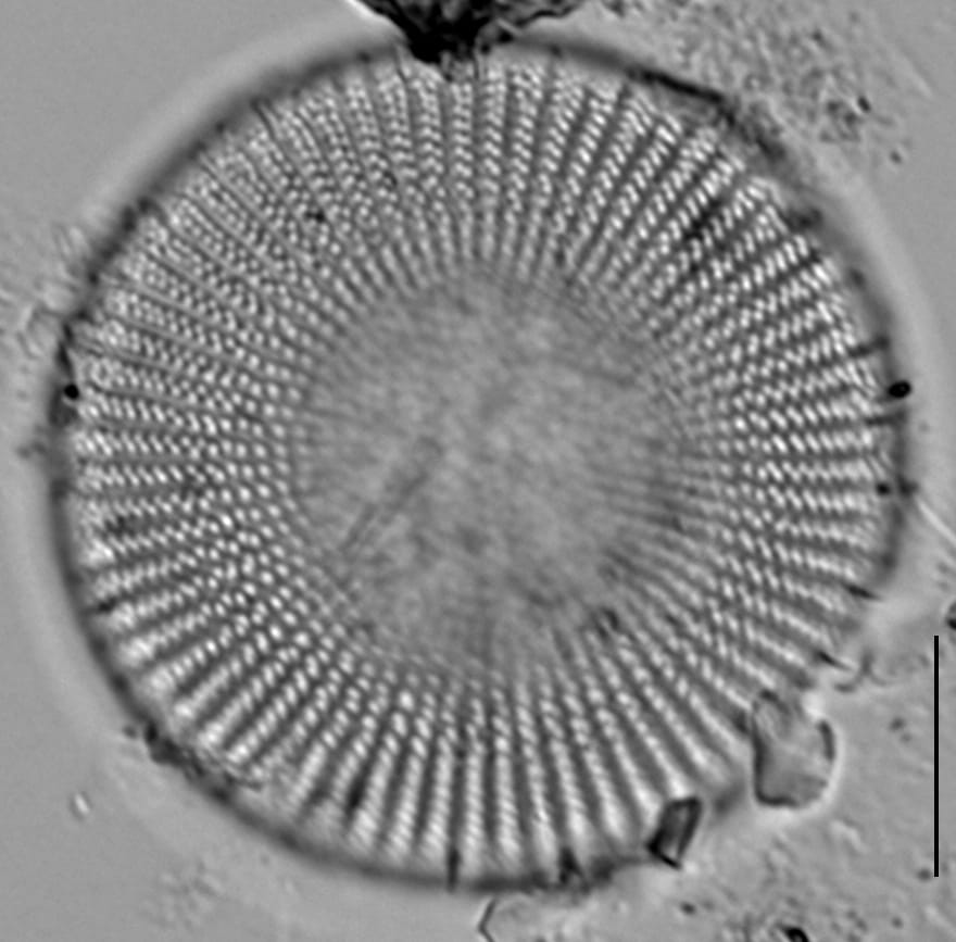
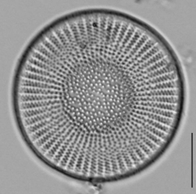
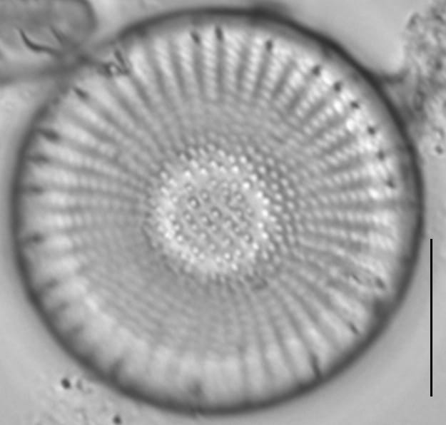
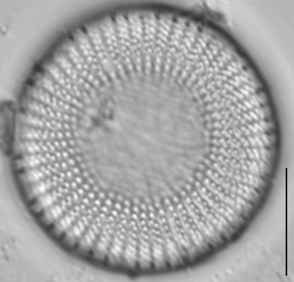
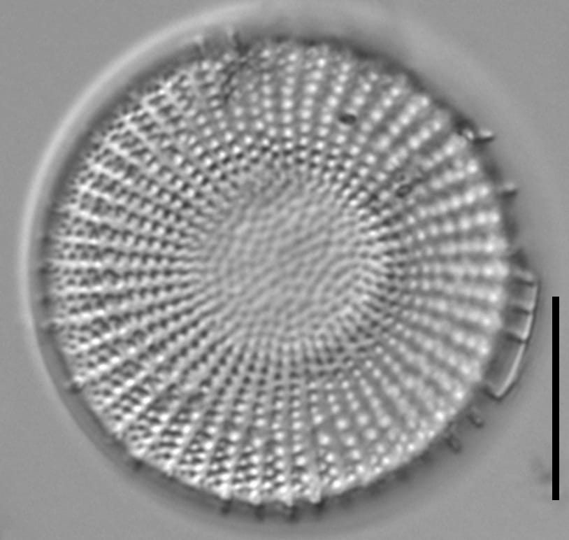
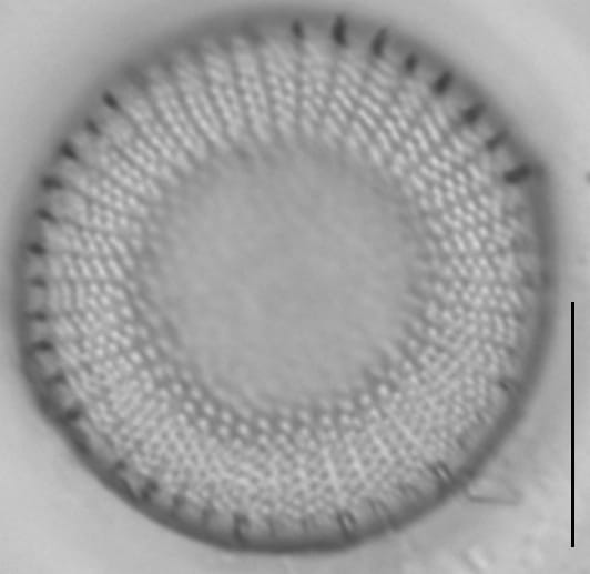
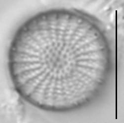
Valves are disc shaped. Valves are concentrically undulate resulting in convex (scutate) or concave (lacunate) valved. Spines are brittle and often broken. However, when spines are present they occur on the valve margins at each interfascicle (costae). Areolae are disorganized in the center of the valve face, becoming organized into uniseriate fascicles at mid-radius, and form bi- and tri-seriate fascicles near the margin. Fascicles have a density 6 to 10 in 10 µm. Fultoportulae are present below each spine, or in some specimens, every other spine.
Stephanodiscus medius is widely reported from the plankton of mesotrophic to eutrophic lakes and large rivers (Kirilova et al. 2010, Rzodkiewicz et al. 2017). The authors of this page encourage caution regarding ecological interpretations of this taxon as the identification can be easily confused with S. alpinus.

Valvae circulares undulatae, centro concavo vel convexo. Diameter 6-33.8 µm. Striae radiales areolis ad marginem bivel triseriatis, centrum versus uniseriatis vel striae irregulares. Nonnumquam annulus hyalinus circum puncta (unum ad tria, saepe plura) intima. Spatia inter fasciculos aliqundo irregularia. Spinae ad omnes (dum fractae non semper visibles). Sub spinis, sed non omnibus, fultoportulae adsunt.
The valve is circular, undulate, with a concave or convex centre. Diameter 6-33.8 µm. Radial striae of areolae in biseriate to triseriate fascicles from the margin, becoming uniseriate, sometimes disorganized towards the centre. Sometimes a hyaline ring is visible around the inner- most one to three (often more) puncta. The distance between the interfascicles is occasionally irregular. Spines occur at every interfascicle, but may be broken and are not always visible. Fultoportulae are present beneath the spines, but not beneath every spine.


Burge, D., Edlund, M. (2015). Stephanodiscus medius. In Diatoms of North America. Retrieved May 07, 2026, from https://diatoms.org/species/50450/stephanodiscus_medius
The 15 response plots show an environmental variable (x axis) against the relative abundance (y axis) of Stephanodiscus medius from all the stream reaches where it was present. Note that the relative abundance scale is the same on each plot. Explanation of each environmental variable and units are as follows:
ELEVATION = stream reach elevation (meters)
STRAHLER = distribution plot of the Strahler Stream Order
SLOPE = stream reach gradient (degrees)
W1_HALL = an index that is a measure of streamside (riparian) human activity that ranges from 0 - 10, with a value of 0 indicating of minimal disturbance to a value of 10 indicating severe disturbance.
PHSTVL = pH measured in a sealed syringe sample (pH units)
log_COND = log concentration of specific conductivity (µS/cm)
log_PTL = log concentration of total phosphorus (µg/L)
log_NO3 = log concentration of nitrate (µeq/L)
log_DOC = log concentration of dissolved organic carbon (mg/L)
log_SIO2 = log concentration of silicon (mg/L)
log_NA = log concentration of sodium (µeq/L)
log_HCO3 = log concentration of the bicarbonate ion (µeq/L)
EMBED = percent of the stream substrate that is embedded by sand and fine sediment
log_TURBIDITY = log of turbidity, a measure of cloudiness of water, in nephelometric turbidity units (NTU).
DISTOT = an index of total human disturbance in the watershed that ranges from 1 - 100, with a value of 0 indicating of minimal disturbance to a value of 100 indicating severe disturbance.