

Credit: Loren Bahls
Kintla Lake, Glacier National Park, Montana: home of Entomoneis ornata.
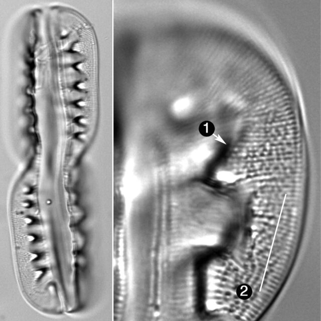
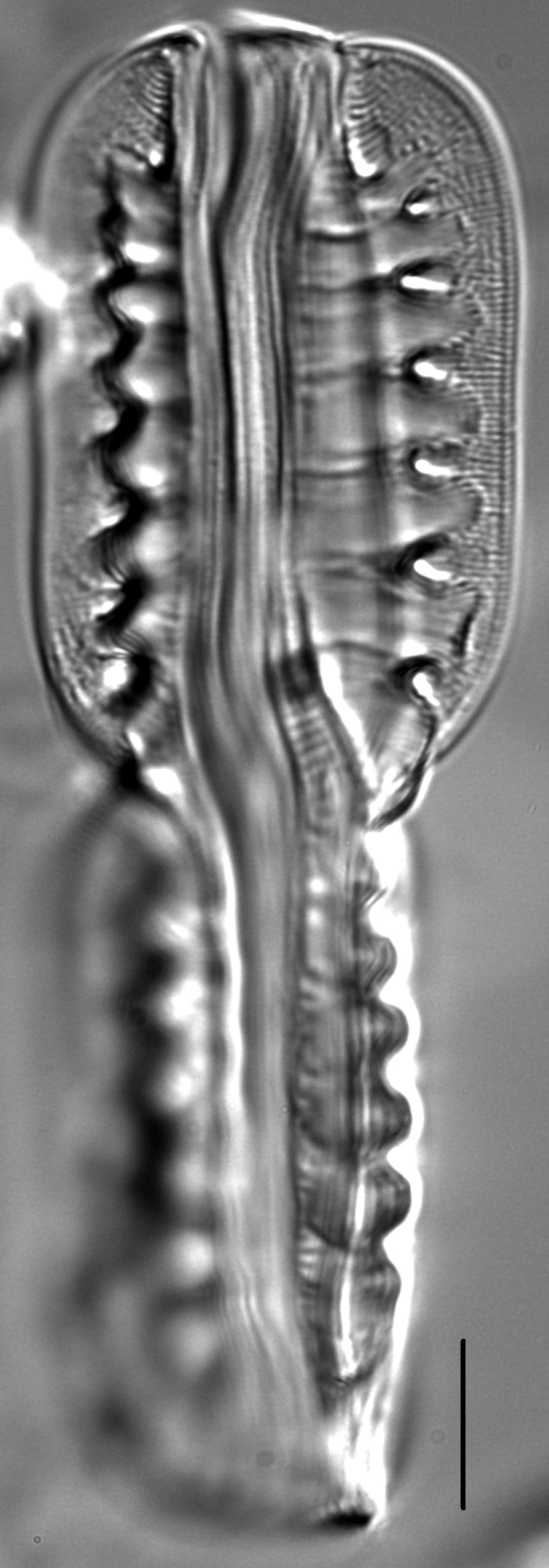
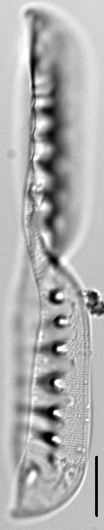
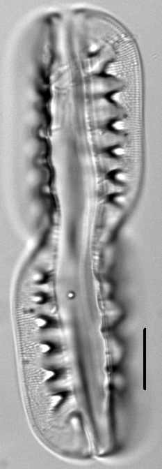
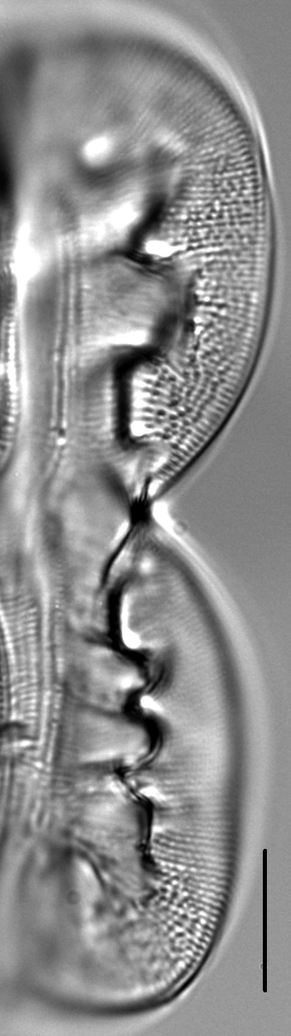
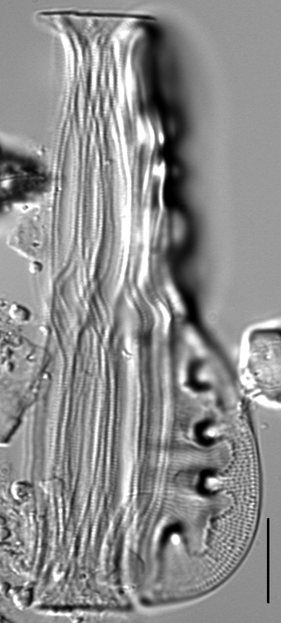
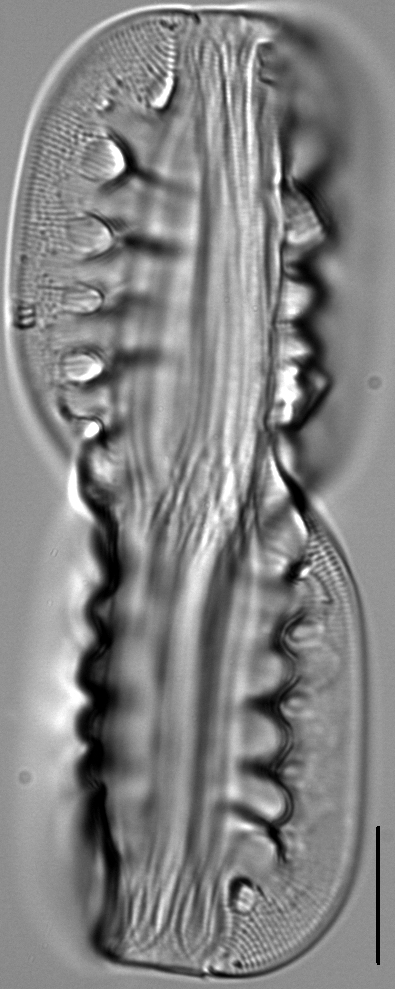
Frustules almost always come to rest in girdle view, a view which is dominated by highly arched bilobate keels. The keels are strongly torsioned so that only one lobe is in focus at one time. In complete frustules in girdle view, diagonally opposing lobes lie at approximately the same level of focus. Lobes are flattened in large specimens and more rounded in smaller specimens. Several girdle bands are present, each with a linear series of short transverse dashes that appear to cross at mid-valve. The junction line between the valve and the keel is marked by a series of prominent and irregularly shaped bulges or swellings. Striae on the valve face continue onto the keel. Areolae within a stria on the valve face are very fine and number 26-30 in 10 µm. Areolae within a stria on the keel are more prominent and number 14-20 in 10 µm.
In Montana, Entomoneis ornata has been found in 23 lakes, marshes, large rivers and small creeks, both east and west of the Continental Divide. These waters have an abundance-weighted mean pH of 8.1 and an abundance-weighted mean specific conductance of 2188 µS/cm, which is considerably lower than the conductivity preferred by other species of Entomoneis. But like E. alata, E. ornata prefers waters with elevated concentrations of sodium and sulfate. Common diatom associates of Entomoneis ornata include Gomphonema turgidum, Gomphonema coronatum, Neidium iridis, Placoneis explanata, Cavinula jaernefeltii, Stauroneis heinii, and Nitzschia obtusa. Patrick and Reimer (1975) report this species as widely distributed in in the United States in larger lakes and rivers, where it is an oligohalobe and "indifferent" to small changes in ionic content.
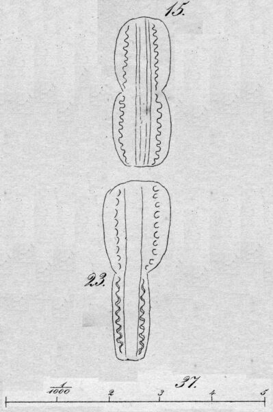
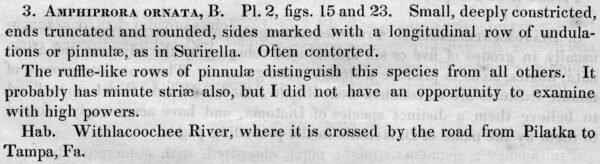
AMPHIPRORA ORNATA, B. Pl. 2, figs. 15 and 23. Small, deeply constricted, ends truncated and rounded, sides marked with a longitudinal row of undulations or pinnulæ, as in Surirella. Often contorted. The ruffle-like rows of pinnulæ distinguish this species from all others. It probably has minute striæ also, but I did not have an opportunity to examine with high powers. Hab. Withlacoochee River, where it is crossed by the road from Pilatka to Tampa, Fa.
Bahls, L. (2012). Entomoneis ornata. In Diatoms of North America. Retrieved October 23, 2024, from https://diatoms.org/species/entomoneis_ornata
The 15 response plots show an environmental variable (x axis) against the relative abundance (y axis) of Entomoneis ornata from all the stream reaches where it was present. Note that the relative abundance scale is the same on each plot. Explanation of each environmental variable and units are as follows:
ELEVATION = stream reach elevation (meters)
STRAHLER = distribution plot of the Strahler Stream Order
SLOPE = stream reach gradient (degrees)
W1_HALL = an index that is a measure of streamside (riparian) human activity that ranges from 0 - 10, with a value of 0 indicating of minimal disturbance to a value of 10 indicating severe disturbance.
PHSTVL = pH measured in a sealed syringe sample (pH units)
log_COND = log concentration of specific conductivity (µS/cm)
log_PTL = log concentration of total phosphorus (µg/L)
log_NO3 = log concentration of nitrate (µeq/L)
log_DOC = log concentration of dissolved organic carbon (mg/L)
log_SIO2 = log concentration of silicon (mg/L)
log_NA = log concentration of sodium (µeq/L)
log_HCO3 = log concentration of the bicarbonate ion (µeq/L)
EMBED = percent of the stream substrate that is embedded by sand and fine sediment
log_TURBIDITY = log of turbidity, a measure of cloudiness of water, in nephelometric turbidity units (NTU).
DISTOT = an index of total human disturbance in the watershed that ranges from 1 - 100, with a value of 0 indicating of minimal disturbance to a value of 100 indicating severe disturbance.