Actinocyclus normanii

-
Category
-
Diameter14-72 µm
-
SynonymsCoscinodiscus normanii W.Greg. ex Grev. 1859
-
Reported AsCoscinodiscus subsalsa (Stoermer and Yang 1969, pg. 33)
Coscinodiscus subtilis var. radiatus (Hohn 1952, p. 271, fig. 2)
Actinocyclus normanii f. subsalsa (Hustedt 1957)
-
ContributorMargaret Christie - Jun 2014
-
ReviewerMark Edlund - Jun 2014
Identification


Description
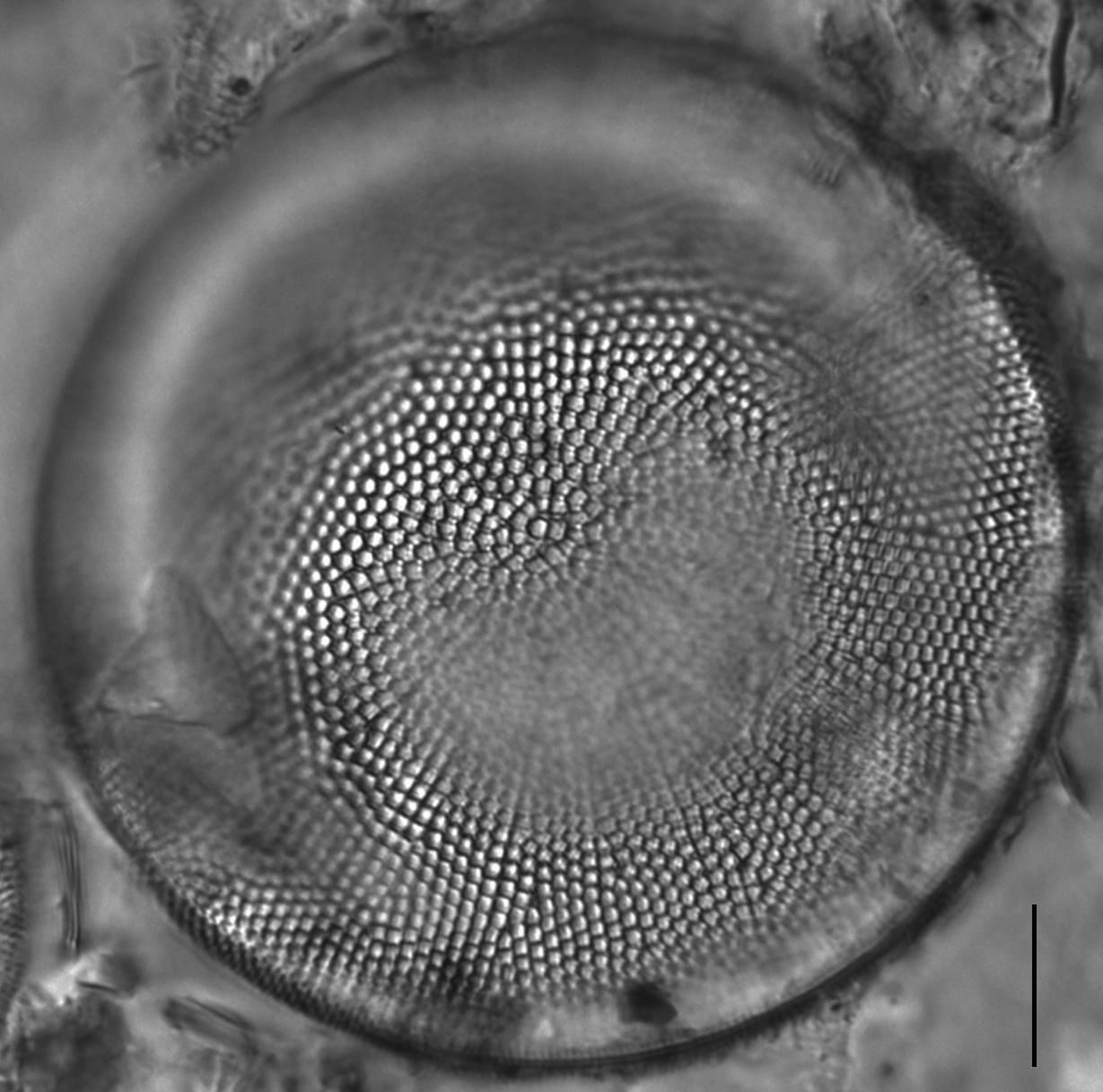
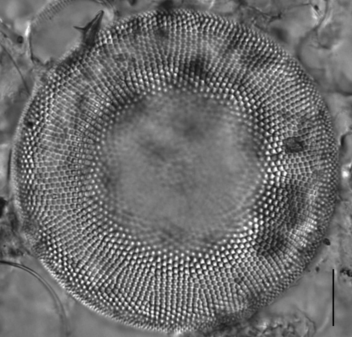
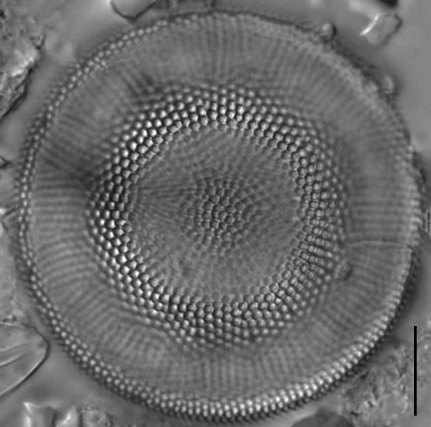
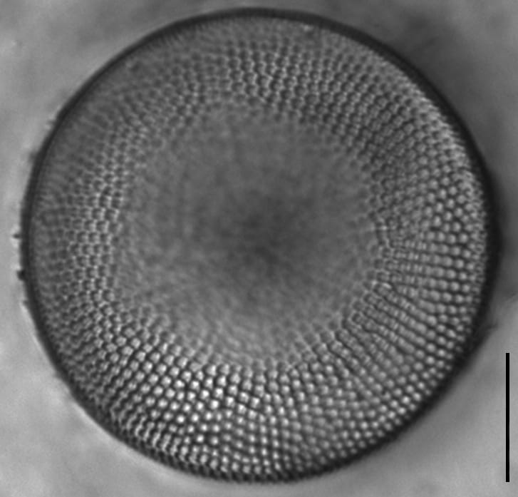
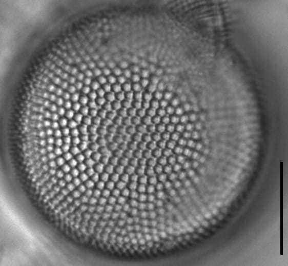
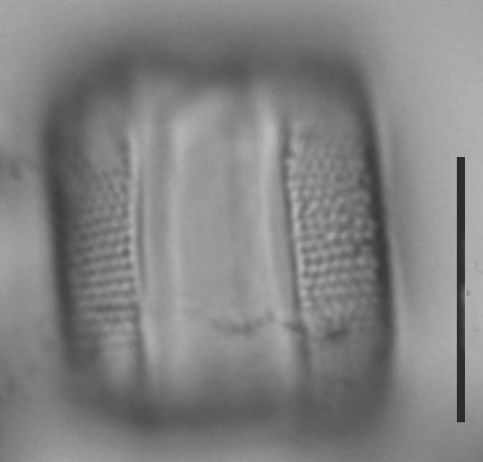
Valves are disc-shaped, flat to weakly concentrically undulate, with short mantles. Areolae are coarse and polygonal in shape, numbering 8-12 in 10 µm. Areolae often appear to radiate in pseudosectored, or fasciculate groups, of striae from the valve center. Several rimoportulae are located along the valve margin and are generally visible in LM. Rimoportulae are evenly spaced and number 4-8 per valve. A pseudonodule is located at the valve / mantle interface, but is often not visible due to its position.
In SEM images, the hexagonal to polygonal areolae and are occluded by flat external cribra. Externally, the opening of the rimoportula and of the pseudonodule are evident. Internally, the rimoportulae have long stalks, external openings are simple.
Some workers recognize the smaller form, A. normanii f. subsalsa (Juhl.-Dannf.) Hustedt from freshwater habitats (Hustedt 1957, Hasle 1977, Stoermer 1993). This form is recognized as differing from the nominate form in size and autecology (Hasle, 1977), with A. normanii f. subsalsa being 16-44 µm in diameter versus 30-110 µm for the nominate form, and the forma subsalsa occurring in fresh, inland waters (Hustedt 1927-1966, Hasle 1977, Stoermer et al. 1993). Although Hasle (1977) was not able to identify morphological discontinuities between the two forms, she and others (Belcher and Swale 1977) recognize that differentiating the two forms (or at least documenting the size distribution within collections) could provide ecological information.
Autecology
Actinocyclus normanii was found throughout a sediment core from a marsh near the Christina River, Delaware. The Christina River is part of a a tidal tributary to the Delaware River and includes freshwater and marine diatom species. According to Witkowski et al. (2000), A. normanii is widespread and common in coastal, brackish, planktonic habitats.
This taxon is also documented from waters of Saginaw Bay, Michigan. According to Kiss et al. (1990), this species reflects anthropogenic nutrient enrichment and increases in conductance. Additionally, A. normanii may be considered an invasive species in many sites subject to nutrient enrichment (Kiss et al. 1990). In the Great Lakes, the appearance of A. normanii f. subsalsa along with Stephanodiscus binderanus occurs with human alteration of water bodies (Spaulding et al. 2010).
The variety A. normanii f. subsalsa is reported to differ from the nominate form in in size and autecology (Hasle 1977), but the distinction may not be a real as the nominate variety becomes smaller than published values for the size range (Edlund, personal communication, 2014).
-
Size Range, µm3
-
Motility
-
Attachment
-
Habitat
-
Colony
-
BCG
-
Waterbody
-
Distribution
- Learn more about this
Original Description
- Coscinodiscus Normanii, Greg. MSS. Areolation forming numerous fasciculi of radiating lines or rows of areolæ, each fasciculus composed of about six rows ; areolæ equal, except at the margin, where they become suddenly smaller and faint ; margin smooth ; diameter of disc ·0016” to ·0036” ; areolæ about 24 in ·001”. (Fig. 3.) Marine. In the stomach of Ascidians, Hull. George Norman, Esq.
-
BasionymCoscinodiscus normanii
-
AuthorGregory ex Grev. 1859
-
Length Range40.6-91.4 µm
Original Images


Citations & Links
Citations
Links
-
Index Nominum Algarum
-
North American Diatom Ecological DatabaseNADED ID: 86002
Cite This Page
Christie, M. (2014). Actinocyclus normanii. In Diatoms of North America. Retrieved July 19, 2026, from https://diatoms.org/species/47886/actinocyclus_normanii
Responses
The 15 response plots show an environmental variable (x axis) against the relative abundance (y axis) of Actinocyclus normanii from all the stream reaches where it was present. Note that the relative abundance scale is the same on each plot. Explanation of each environmental variable and units are as follows:
ELEVATION = stream reach elevation (meters)
STRAHLER = distribution plot of the Strahler Stream Order
SLOPE = stream reach gradient (degrees)
W1_HALL = an index that is a measure of streamside (riparian) human activity that ranges from 0 - 10, with a value of 0 indicating of minimal disturbance to a value of 10 indicating severe disturbance.
PHSTVL = pH measured in a sealed syringe sample (pH units)
log_COND = log concentration of specific conductivity (µS/cm)
log_PTL = log concentration of total phosphorus (µg/L)
log_NO3 = log concentration of nitrate (µeq/L)
log_DOC = log concentration of dissolved organic carbon (mg/L)
log_SIO2 = log concentration of silicon (mg/L)
log_NA = log concentration of sodium (µeq/L)
log_HCO3 = log concentration of the bicarbonate ion (µeq/L)
EMBED = percent of the stream substrate that is embedded by sand and fine sediment
log_TURBIDITY = log of turbidity, a measure of cloudiness of water, in nephelometric turbidity units (NTU).
DISTOT = an index of total human disturbance in the watershed that ranges from 1 - 100, with a value of 0 indicating of minimal disturbance to a value of 100 indicating severe disturbance.
Actinocyclus normanii
- Areolae radiate in pseudosectors
- Areolae similar in size across valve
- Rimoportulae marginal
Valves concentrically undulate, with radiate areolae. Areolae are 8-12 in 10 µm and maintain constant size throughout the valve. Rimoportulae (4-8) are located equally spaced along valve margins. The pseudonodule is not visible due to its position on the valve / mantle interface.