
Distribution of D. asterocostata (Alverson et al. 2021).


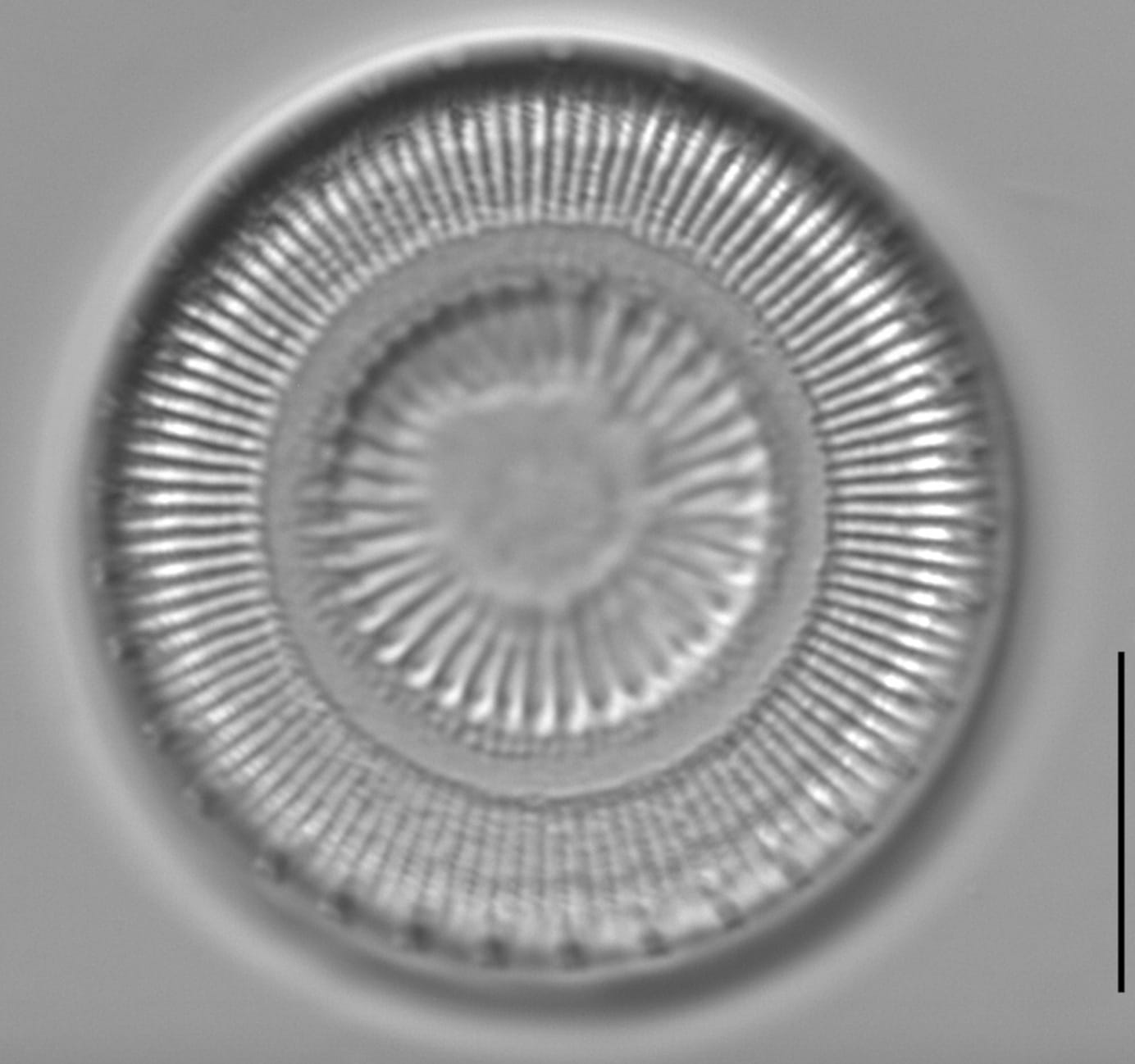
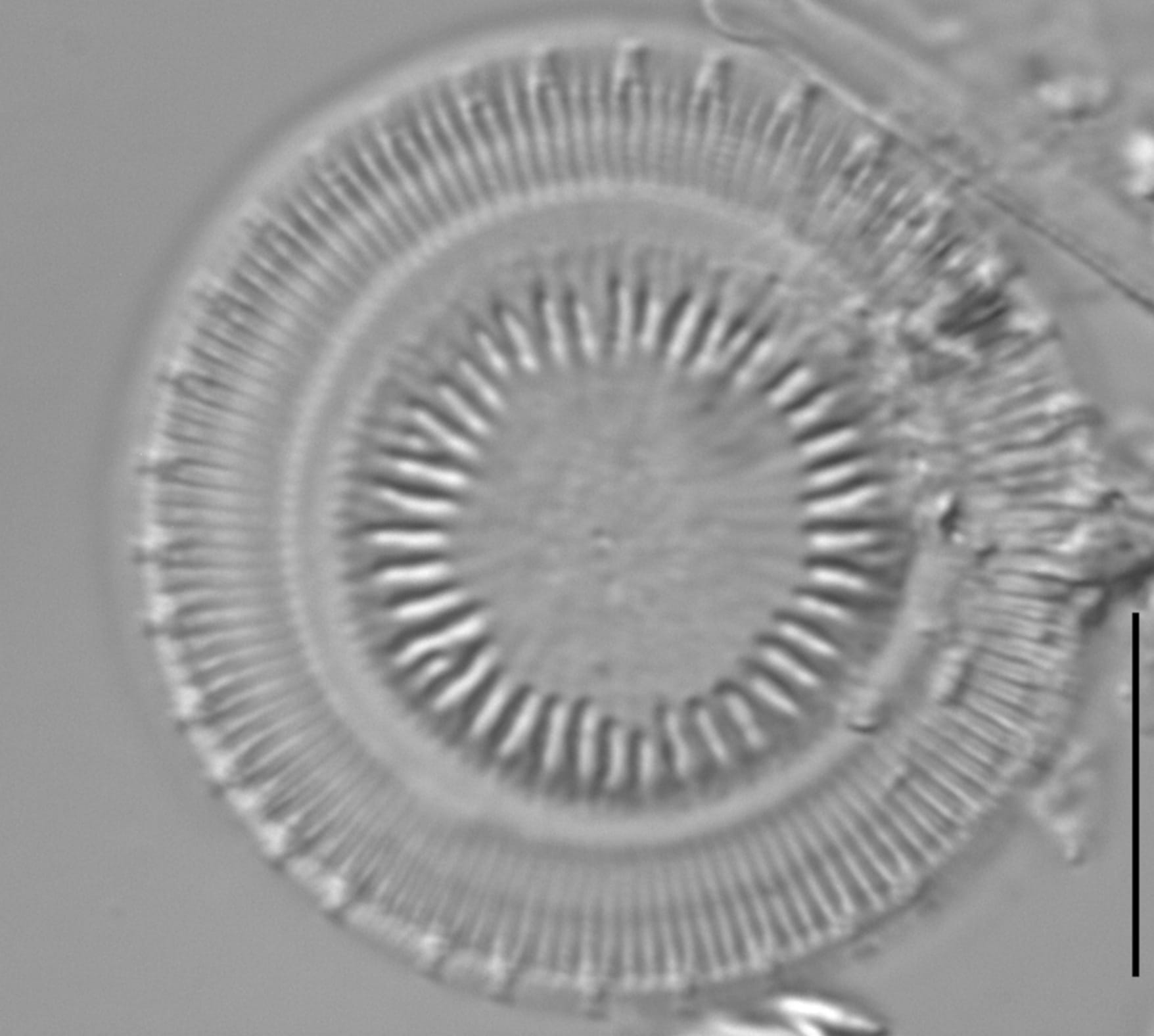
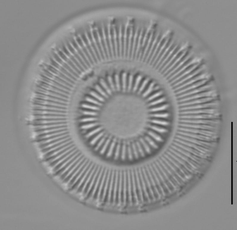
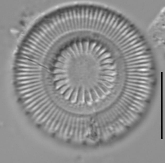
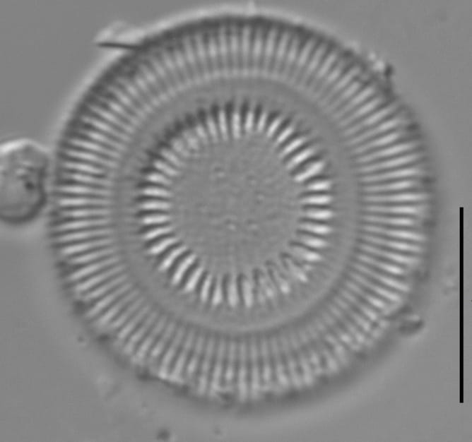
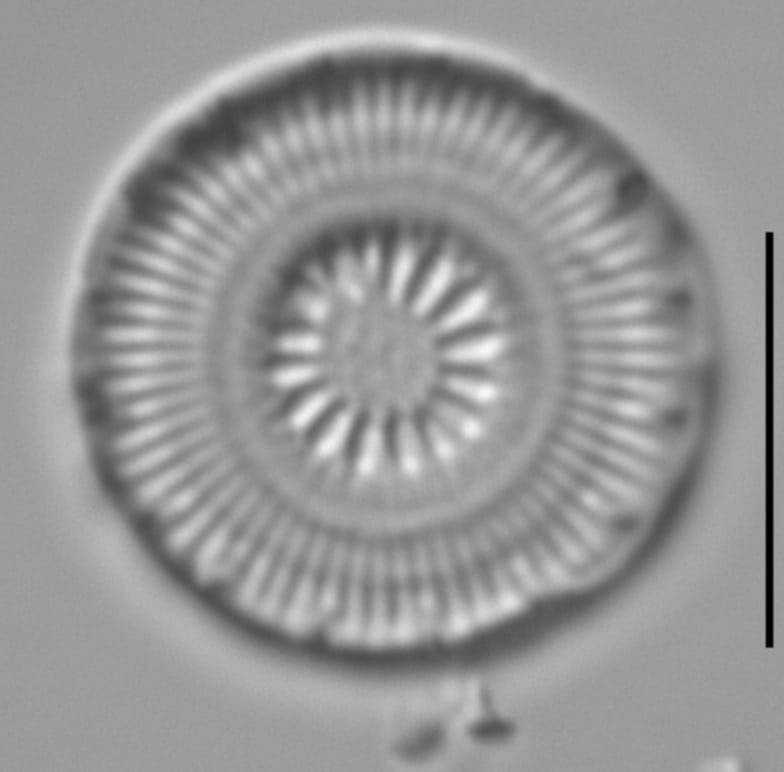
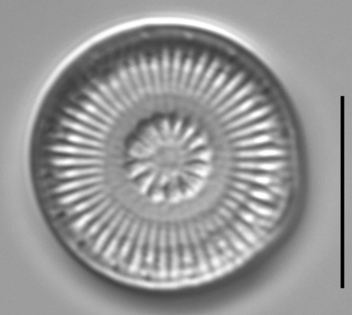
Valves are circular in outline. The valve face is strongly concentrically undulate. The valve margin is marked by a ring of fultoportulae with long, external spine-like central tubes. The marginal fultoportulae have a spacing of 1 every 2-4 striae. A single, prominent rimoportula is present on the valve margin, positioned between two fultoportulae. The external opening of the rimoportula is a simple pore.
The valve central area is either elevated, or depressed. Valves are separated, roughly, into three distinct concentric focal planes. On a valves with a raised center, the margin is found in the lower-most focal plane of the valve surface, consisting of radially oriented rows of coarse striae and the base of the central tube of the fultoportula.
In the light microscope, marginal striae are divided by a distinct shadow line located roughly midway through the length of a stria. The shadow line represents the image of internal chambers. The distal tips of the fultoportulae and a central ring of coarse "stelligeroid" striae constitute the uppermost focal plane.
Discostella asterocostata is found predominantly in reservoirs and large rivers of the central and eastern United States (Alverson et al. 2021). Documented occurrences include Lake Dardanelle , Robert S. Kerr Reservoir, Beaver Lake, Grand Lake O' The Cherokees, Dobbs Memorial Park, Beal Woods State Park Lake, Lake Fayetteville, Wabash River, Maple Avenue Park Pond, and other sites (Alverson et al. 2021).
The EPA National Lakes Assessment survey documented this taxon in surface sediments of Lake Zoar and Gray's Pond in Connecticut.
Frustua solitaria discoidea, axe pervalvari brevi, in aspectu cinguli rectangulari, angulis obliquis, striis cingulorum parallelis. Valva circularis diametro 24.2–33.2 um, cum concentrice undulata; zona marginalis leviter convexa, costis marginalibus 12–13 per 10 um, marginibus externis lineari-seriatim perforatis, in margine valvae fultoportulis 4–6 per 10 um, rimoportula 1; annulus concavus inter costas marginales et zonam centralem latitudine 2.5 um; zona centralis convexa, costis centralibus radiatis 7–9 per 10 um; pars centralis zonae centralis leviter concava, in contralio valvae disperse minute porata.
Alverson, A., Stone, J., Manoylov, K. (2015). Discostella asterocostata. In Diatoms of North America. Retrieved July 15, 2026, from https://diatoms.org/species/50702/discostella_asterocostata
The 15 response plots show an environmental variable (x axis) against the relative abundance (y axis) of Discostella asterocostata from all the stream reaches where it was present. Note that the relative abundance scale is the same on each plot. Explanation of each environmental variable and units are as follows:
ELEVATION = stream reach elevation (meters)
STRAHLER = distribution plot of the Strahler Stream Order
SLOPE = stream reach gradient (degrees)
W1_HALL = an index that is a measure of streamside (riparian) human activity that ranges from 0 - 10, with a value of 0 indicating of minimal disturbance to a value of 10 indicating severe disturbance.
PHSTVL = pH measured in a sealed syringe sample (pH units)
log_COND = log concentration of specific conductivity (µS/cm)
log_PTL = log concentration of total phosphorus (µg/L)
log_NO3 = log concentration of nitrate (µeq/L)
log_DOC = log concentration of dissolved organic carbon (mg/L)
log_SIO2 = log concentration of silicon (mg/L)
log_NA = log concentration of sodium (µeq/L)
log_HCO3 = log concentration of the bicarbonate ion (µeq/L)
EMBED = percent of the stream substrate that is embedded by sand and fine sediment
log_TURBIDITY = log of turbidity, a measure of cloudiness of water, in nephelometric turbidity units (NTU).
DISTOT = an index of total human disturbance in the watershed that ranges from 1 - 100, with a value of 0 indicating of minimal disturbance to a value of 100 indicating severe disturbance.