
Credit: Loren Bahls
Tufted colony of Synedra famelica in a sample (Montana Diatom Collection No. 344301) collected from Corral Creek in Big Horn County, Montana.

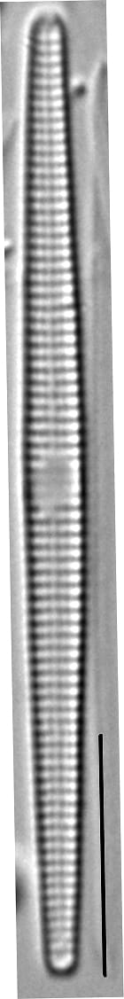
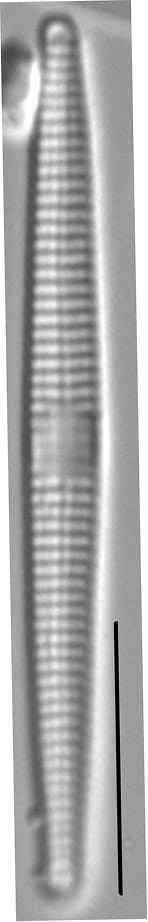
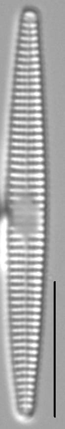
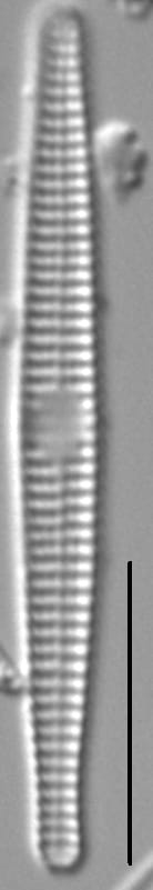
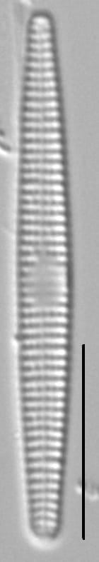
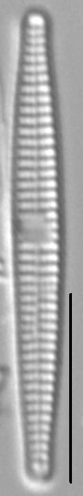
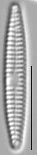
Valves are narrow and linear, not swollen in the middle, with gradually tapered and rounded apices. Axial area is straight and very narrow. Central area is ovoid, often offset to one side of the valve and with ghost striae. Short striae are typically found at one or both sides of the central area. Striae are parallel throughout. Areolae are coarse and easily resolved in LM.
Synedra famelica forms tufted colonies with frustules joined at one end by mucilage pads (see photo below). This species is widespread and locally abundant in streams and wetlands on the Northwestern Great Plains (Montana, North Dakota, Wyoming). Here it prefers nutrient-rich, sodium-sulfate waters with elevated conductivity (see table below).


Bahls, L. (2012). Synedra famelica. In Diatoms of North America. Retrieved July 03, 2026, from https://diatoms.org/species/48692/synedra_famelica
The 15 response plots show an environmental variable (x axis) against the relative abundance (y axis) of Synedra famelica from all the stream reaches where it was present. Note that the relative abundance scale is the same on each plot. Explanation of each environmental variable and units are as follows:
ELEVATION = stream reach elevation (meters)
STRAHLER = distribution plot of the Strahler Stream Order
SLOPE = stream reach gradient (degrees)
W1_HALL = an index that is a measure of streamside (riparian) human activity that ranges from 0 - 10, with a value of 0 indicating of minimal disturbance to a value of 10 indicating severe disturbance.
PHSTVL = pH measured in a sealed syringe sample (pH units)
log_COND = log concentration of specific conductivity (µS/cm)
log_PTL = log concentration of total phosphorus (µg/L)
log_NO3 = log concentration of nitrate (µeq/L)
log_DOC = log concentration of dissolved organic carbon (mg/L)
log_SIO2 = log concentration of silicon (mg/L)
log_NA = log concentration of sodium (µeq/L)
log_HCO3 = log concentration of the bicarbonate ion (µeq/L)
EMBED = percent of the stream substrate that is embedded by sand and fine sediment
log_TURBIDITY = log of turbidity, a measure of cloudiness of water, in nephelometric turbidity units (NTU).
DISTOT = an index of total human disturbance in the watershed that ranges from 1 - 100, with a value of 0 indicating of minimal disturbance to a value of 100 indicating severe disturbance.