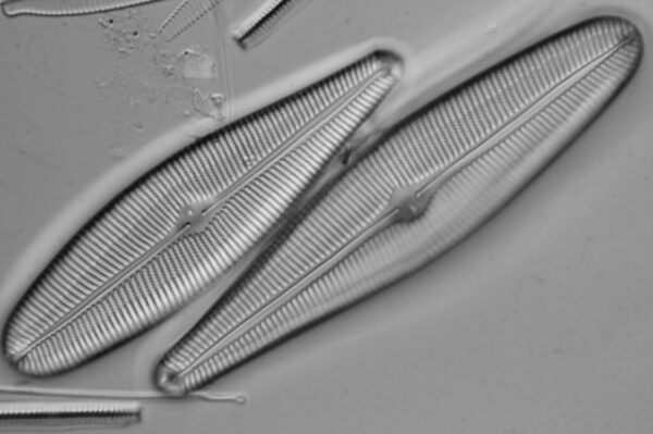
Credit: Teo Nakov
Voucher image of G. herculeana collected from South Boulder Creek, Colorado (Nakov et al. 2014).
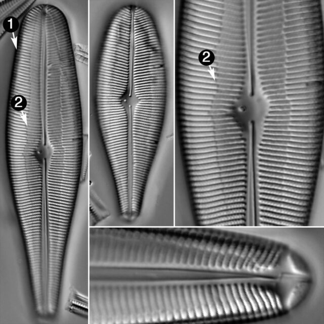
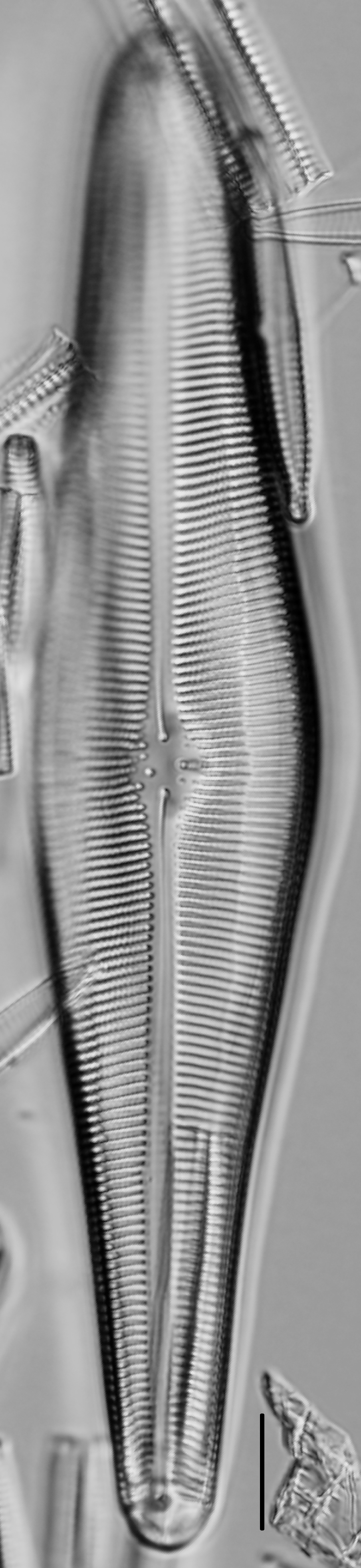
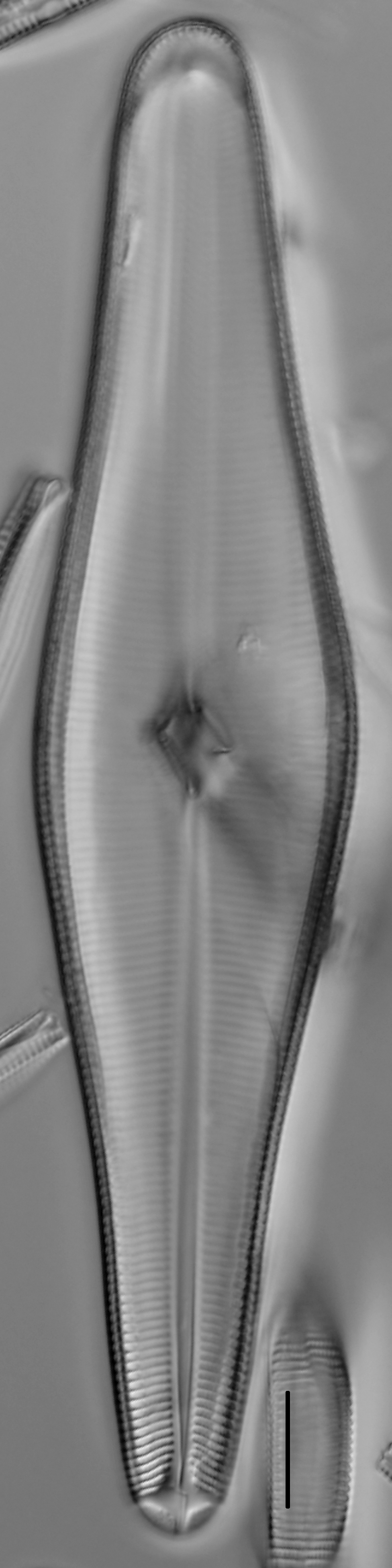
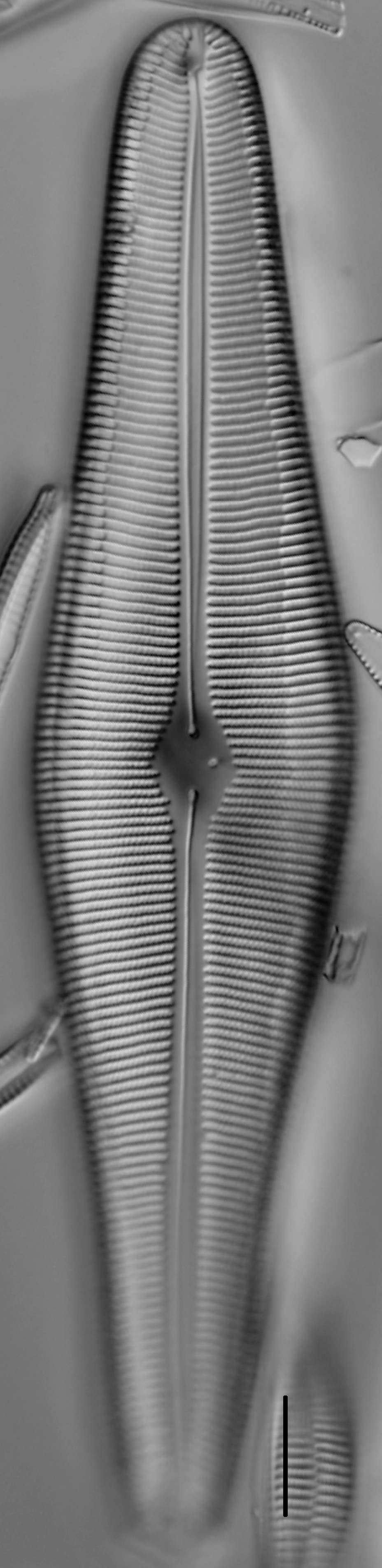
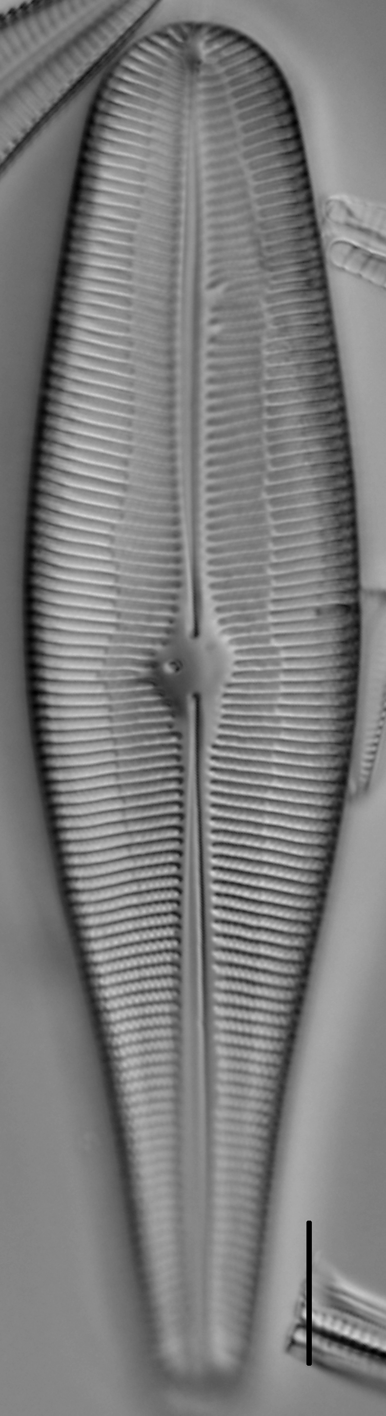
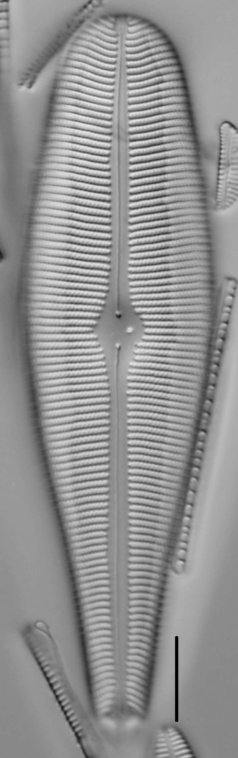
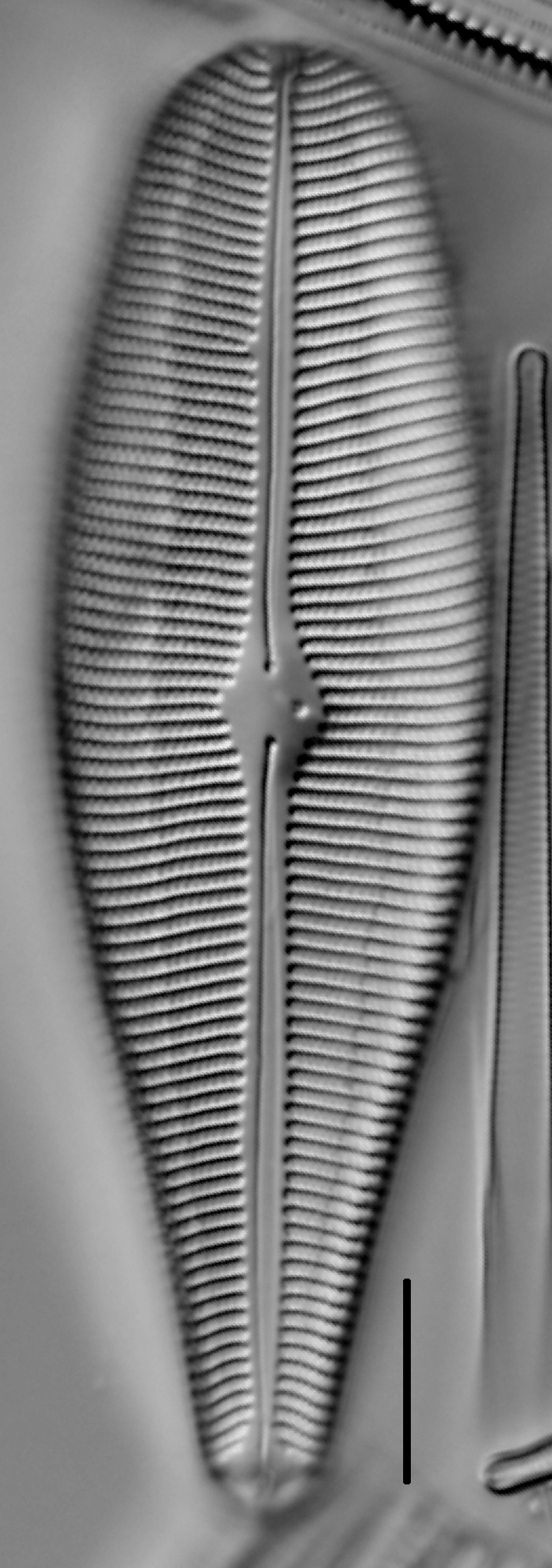
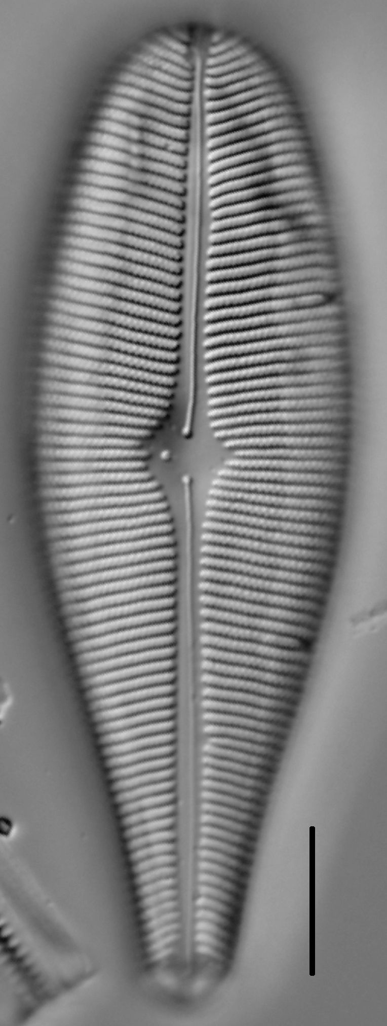
Valves are robust, strongly lanceolate-clavate, with a broadly rounded headpole and narrow, rounded footpole. The axial area is narrow, straight, and at midvalve forms a relatively small, irregularly rounded central area that bears a single stigma.The raphe lateral, weakly undulate, with small external proximal ends. Striae are composed of double rows of areolae, arranged alternately. From the headpole to the central nodule the striae are radiate; from the central nodule to the footpole striae are radiate, become parallel, and near the footpole striae become strongly radiate. The longitudinal lines of G. herculeana at the middle portion of the valve are positioned approximately one-half the way between the axial area and margin. The apical pore fields are distinctly bi-lobed.
Initial valves are 140-165 µm long and 26-34 µm wide.
Distribution: This species, though commonly recorded across North America, is restricted to the upper Laurentian Great Lakes and some localities in the Pacific Northwest.
The specimens shown here were collected from Lake Superior, Marquette County, Michigan.
Kociolek, P., Stoermer, G. (2011). Gomphoneis herculeana. In Diatoms of North America. Retrieved July 26, 2024, from https://diatoms.org/species/gomphoneis_herculeana
The 15 response plots show an environmental variable (x axis) against the relative abundance (y axis) of Gomphoneis herculeana from all the stream reaches where it was present. Note that the relative abundance scale is the same on each plot. Explanation of each environmental variable and units are as follows:
ELEVATION = stream reach elevation (meters)
STRAHLER = distribution plot of the Strahler Stream Order
SLOPE = stream reach gradient (degrees)
W1_HALL = an index that is a measure of streamside (riparian) human activity that ranges from 0 - 10, with a value of 0 indicating of minimal disturbance to a value of 10 indicating severe disturbance.
PHSTVL = pH measured in a sealed syringe sample (pH units)
log_COND = log concentration of specific conductivity (µS/cm)
log_PTL = log concentration of total phosphorus (µg/L)
log_NO3 = log concentration of nitrate (µeq/L)
log_DOC = log concentration of dissolved organic carbon (mg/L)
log_SIO2 = log concentration of silicon (mg/L)
log_NA = log concentration of sodium (µeq/L)
log_HCO3 = log concentration of the bicarbonate ion (µeq/L)
EMBED = percent of the stream substrate that is embedded by sand and fine sediment
log_TURBIDITY = log of turbidity, a measure of cloudiness of water, in nephelometric turbidity units (NTU).
DISTOT = an index of total human disturbance in the watershed that ranges from 1 - 100, with a value of 0 indicating of minimal disturbance to a value of 100 indicating severe disturbance.