Credit: Loren Bahls
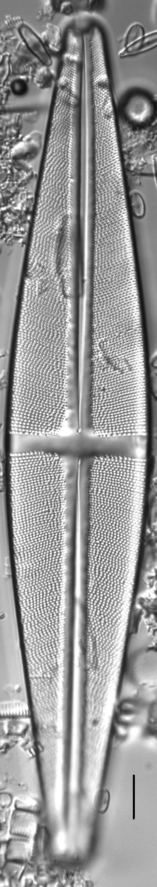
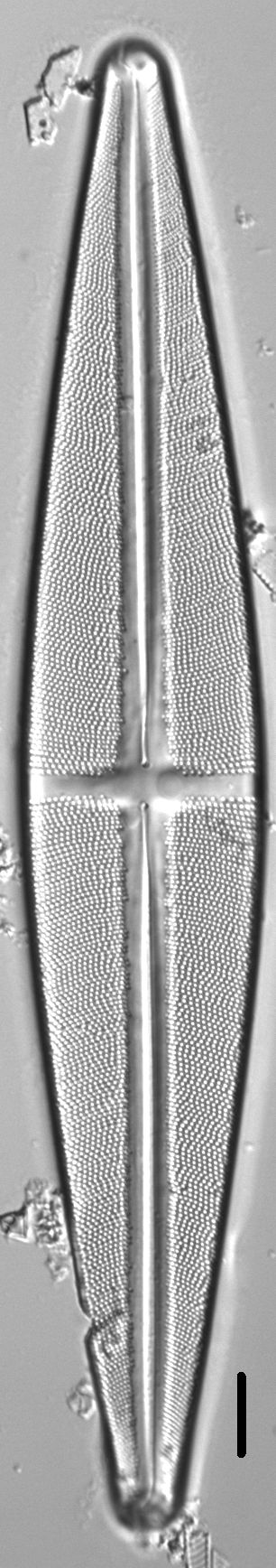
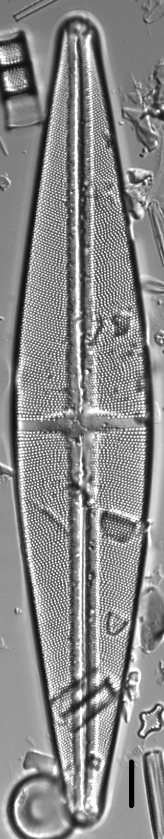
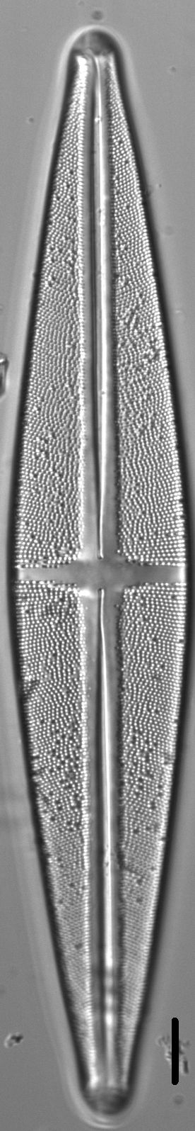
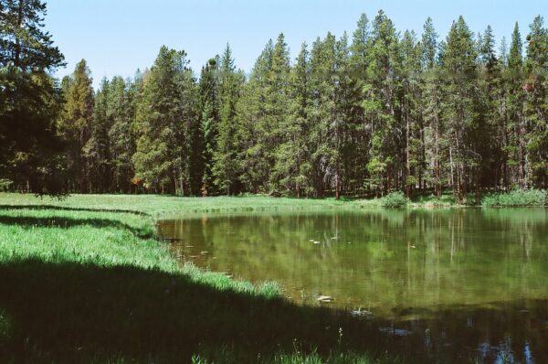
Skinner Pond #2, Beaverhead County, Montana: Home of Stauroneis phoenicenteron.
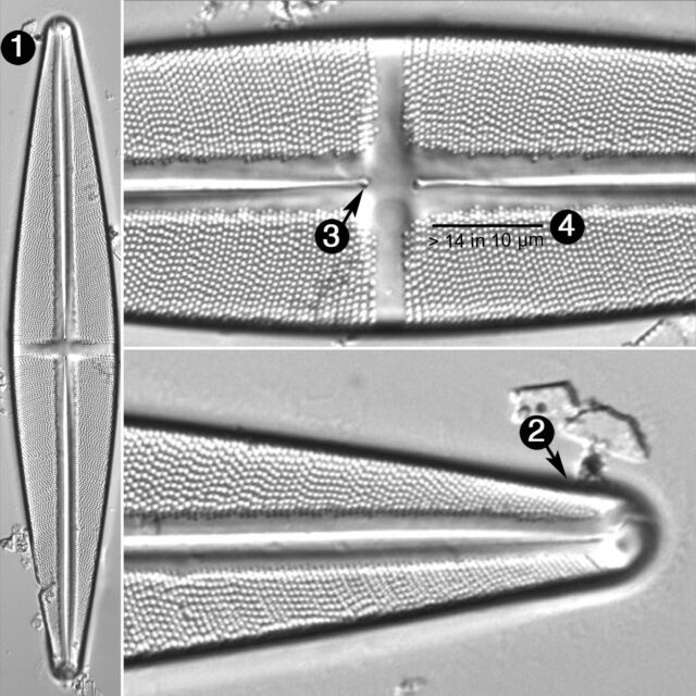
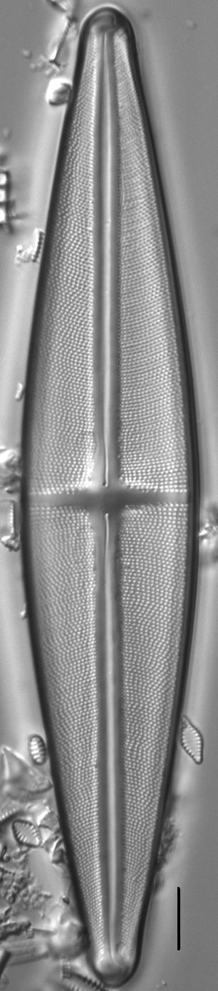
Valves are lanceolate with broadly rounded, non-protracted apices. The axial area is narrow, widening slightly near the central area. The stauros is rectangular, narrowing slightly toward the valve margins. Shortened striae may be present in the central area. The raphe is lateral with straight and somewhat inflated proximal ends. Striae are radiate throughout. Areolae number 13-17 in 10 µm.
Note that Patrick and Reimer (1966, plate 29, fig. 2) mistakenly illustrate the species Stauroneis baileyi, instead of S. phoenicenteron, in their volume.
In the Northern Rockies Stauroneis phoenicenteron is widely distributed in the benthos of lakes and ponds with circumneutral pH (mean pH = 7.1) and low specific conductance (mean SC = 34 µS/cm).
Bahls, L. (2011). Stauroneis phoenicenteron. In Diatoms of North America. Retrieved April 26, 2024, from https://diatoms.org/species/stauroneis_phoenicenteron
The 15 response plots show an environmental variable (x axis) against the relative abundance (y axis) of Stauroneis phoenicenteron from all the stream reaches where it was present. Note that the relative abundance scale is the same on each plot. Explanation of each environmental variable and units are as follows:
ELEVATION = stream reach elevation (meters)
STRAHLER = distribution plot of the Strahler Stream Order
SLOPE = stream reach gradient (degrees)
W1_HALL = an index that is a measure of streamside (riparian) human activity that ranges from 0 - 10, with a value of 0 indicating of minimal disturbance to a value of 10 indicating severe disturbance.
PHSTVL = pH measured in a sealed syringe sample (pH units)
log_COND = log concentration of specific conductivity (µS/cm)
log_PTL = log concentration of total phosphorus (µg/L)
log_NO3 = log concentration of nitrate (µeq/L)
log_DOC = log concentration of dissolved organic carbon (mg/L)
log_SIO2 = log concentration of silicon (mg/L)
log_NA = log concentration of sodium (µeq/L)
log_HCO3 = log concentration of the bicarbonate ion (µeq/L)
EMBED = percent of the stream substrate that is embedded by sand and fine sediment
log_TURBIDITY = log of turbidity, a measure of cloudiness of water, in nephelometric turbidity units (NTU).
DISTOT = an index of total human disturbance in the watershed that ranges from 1 - 100, with a value of 0 indicating of minimal disturbance to a value of 100 indicating severe disturbance.